Forår 2017 i København – besøg torve, kanaler, Inderhavnen med cykel- og gang broer, Papirøen Christianholm med street food restauranter og Christianshavn.
Text and photos Erik K Abrahamsen, 3. maj 2017
Part 1: Copenhagen city
Part 2: Christianshavn
Part 3 : Copenhagen Inner Harbour and Nyhavn
Click on photos and use your zoom control and you see the in full screen size and text on right side of photo disappear.
Its spring 2017 in Copenhagen.
The old city with squares, parks and canals are full of people walking, playing, eating on café and outdoor restaurants enjoying the sun, warm weather and the beautiful flowers and tree all over.
Residents and tourists of all ages make fun and enjoying all activities in this beautiful city so close to the sea Øresund.
I visit the city 3. may 2017 and here are my impressions.
Follow me through the old city on a 2-3 hours walk from Nørreport Station in north to Christianshavn Metro station in south and then passing the new walk and bike slide bridge “Inderhavnsbroen” from Christianshavn (Greenland Square) to Nyhavn.
Map of Copenhagen City, Inner Harbour and Christianshavn:
Click on photos and use your zoom control and you see the in full screen size.

Part 1: Copenhagen City:
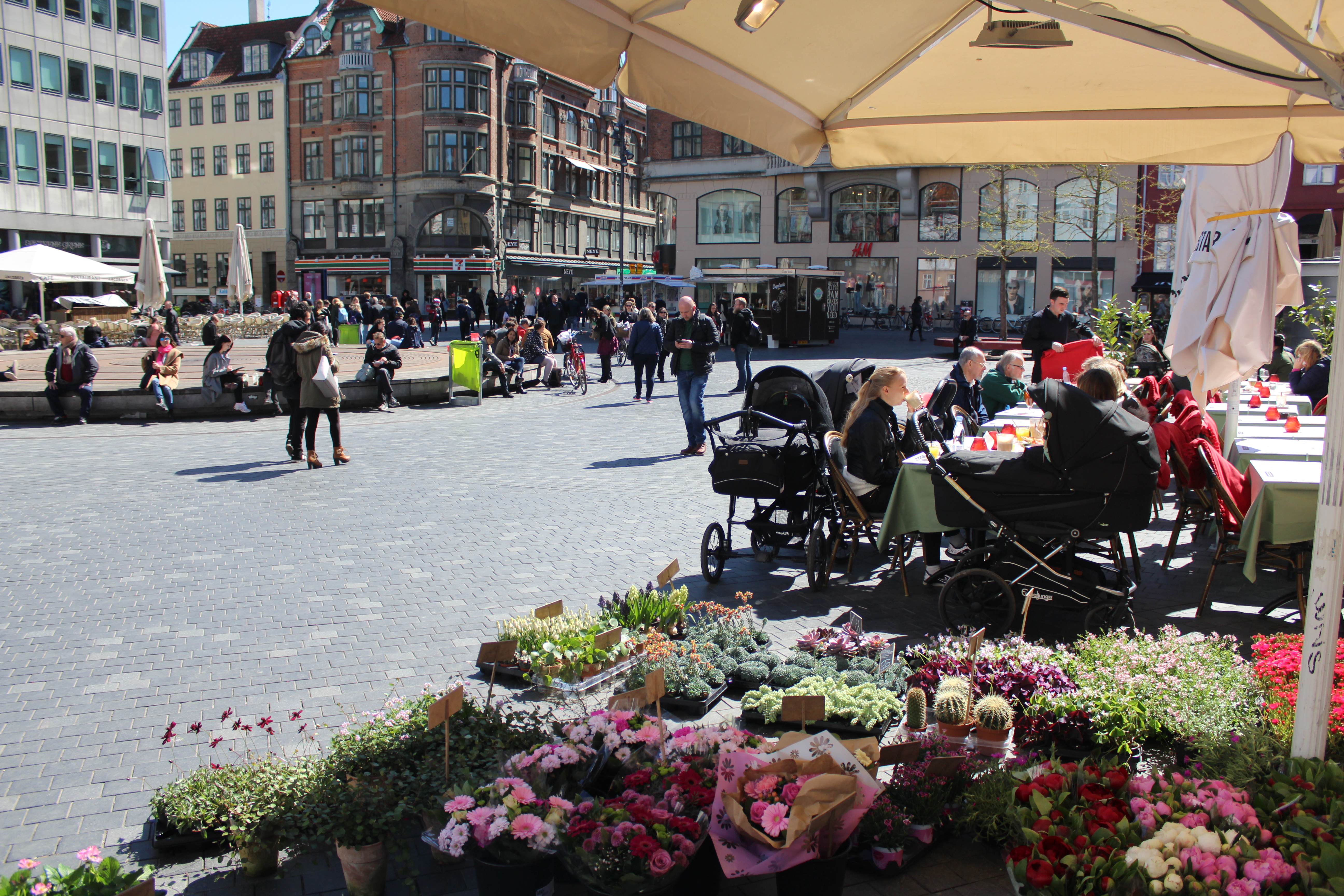
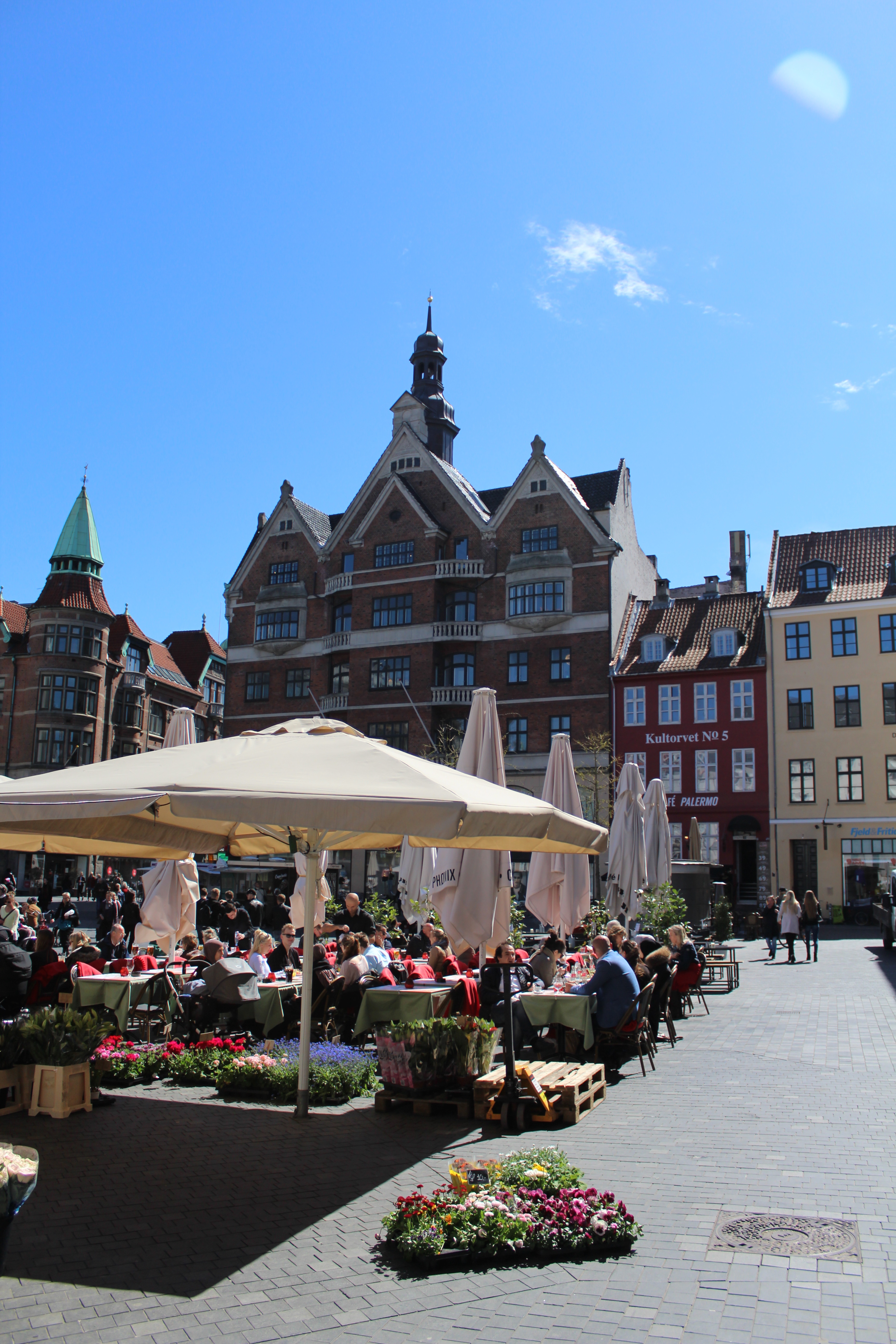
Kultorvet with outdoor restaurants:
Click on photos and use your zoom control and you see the in full screen size.
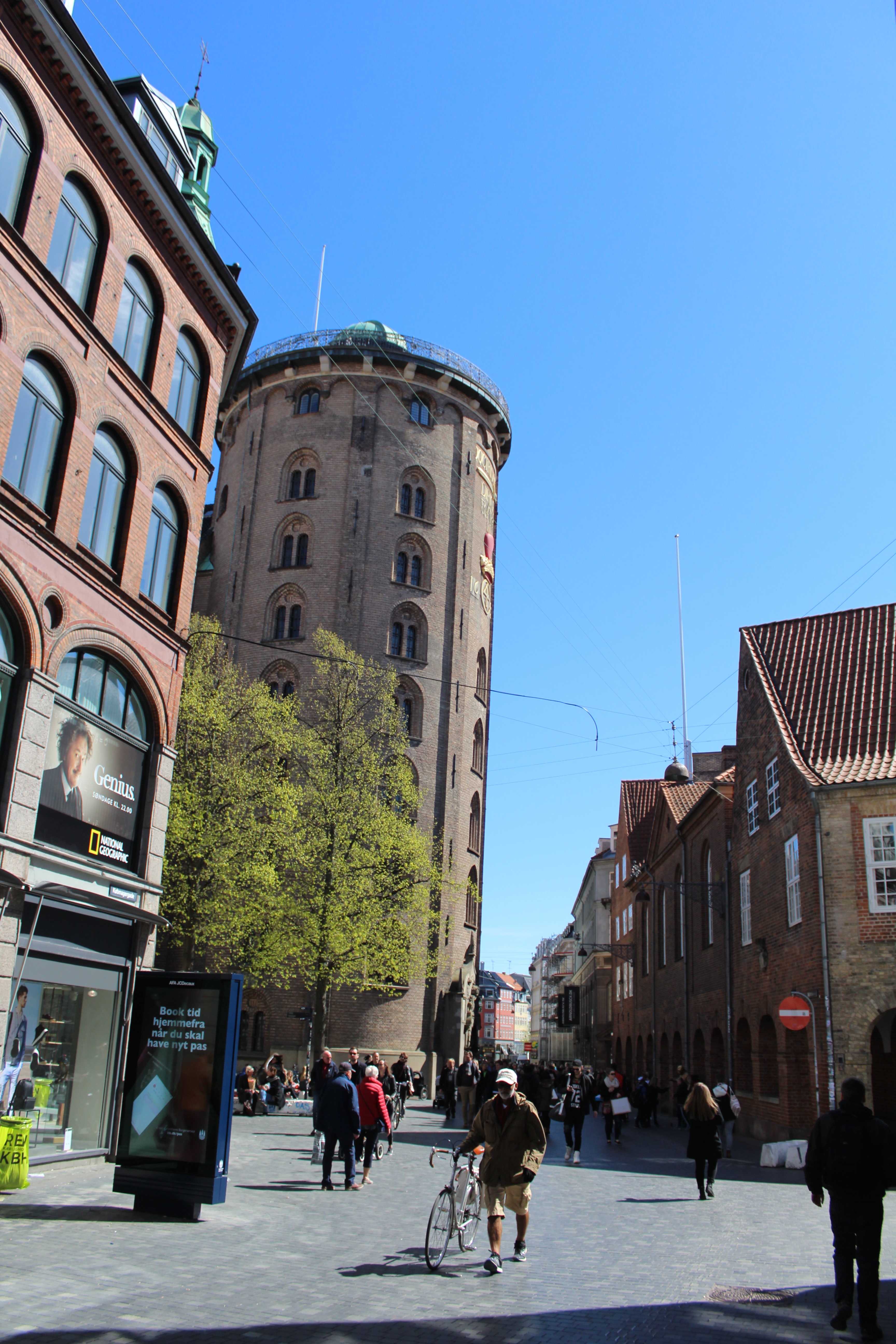
Købmagergade – main shopping street:
Rundetårn, Round Tower built as a observatory 1637-42, 36 m high and western part of Trinitatis Church built 1637-56 by King Christian 4, king of Denmark and Norway 1588-1648:
Click on photos and use your zoom control and you see the in full screen size.
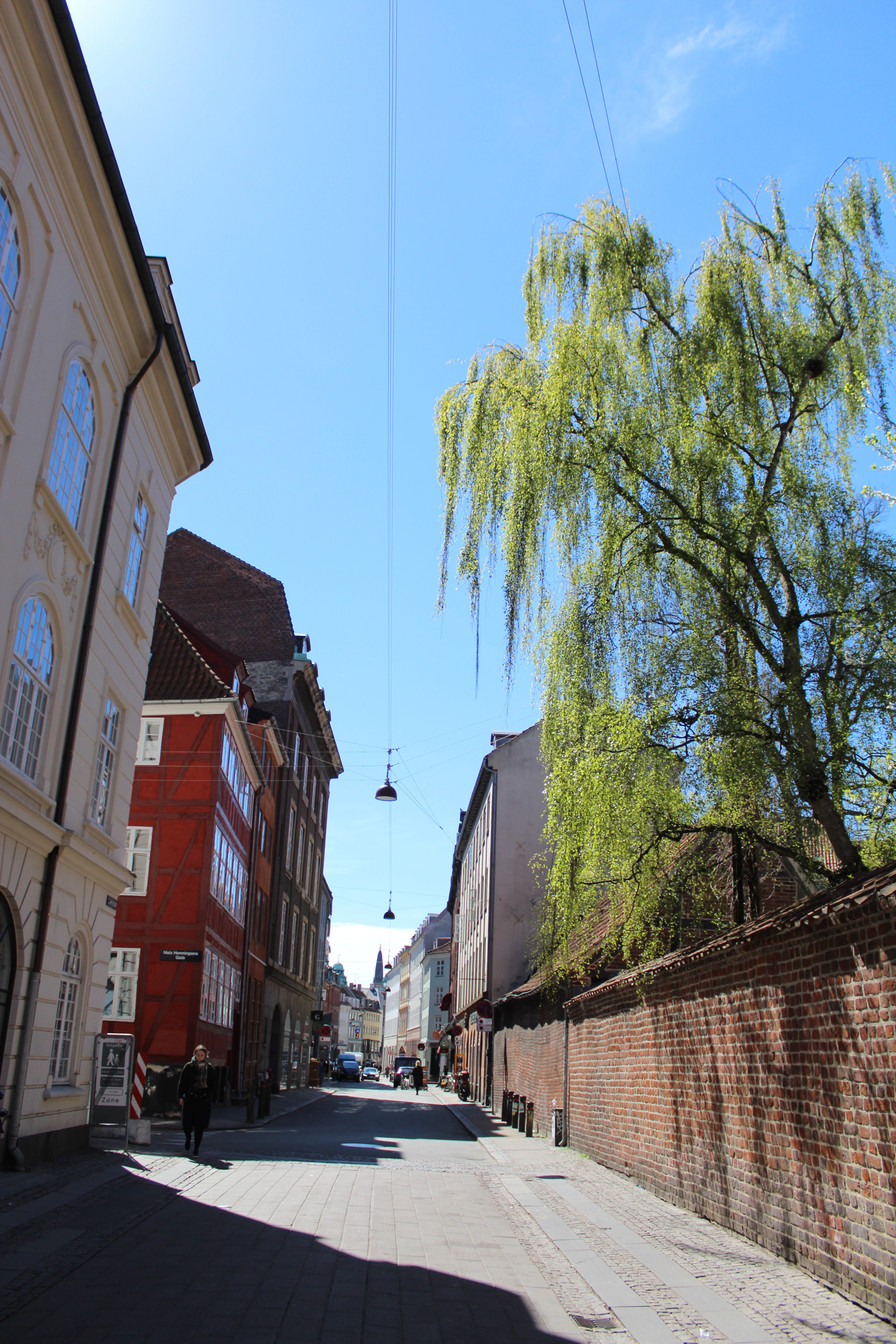
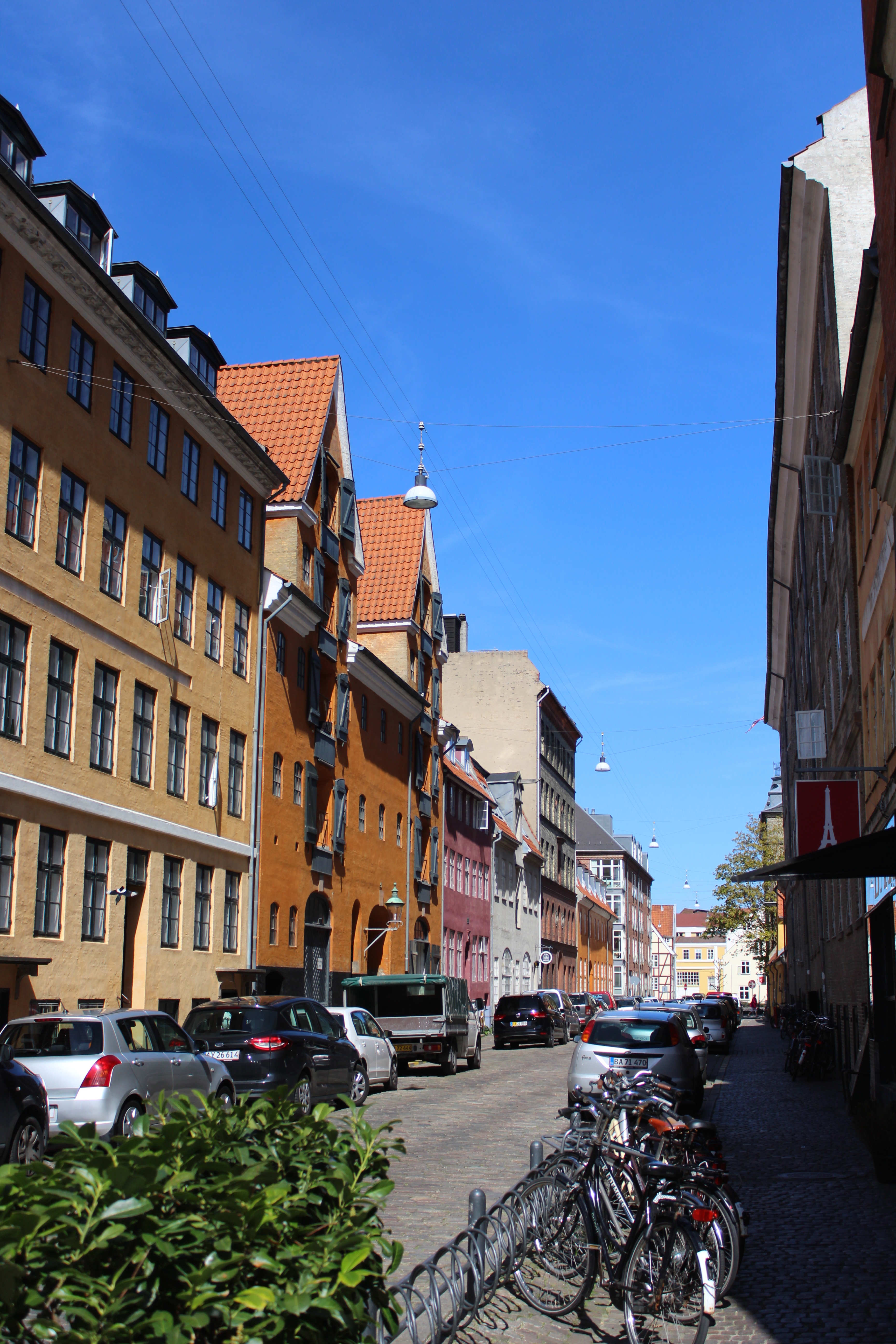
Skindergade – old city withs half-timbered house:
Click on photos and use your zoom control and you see the in full screen size.
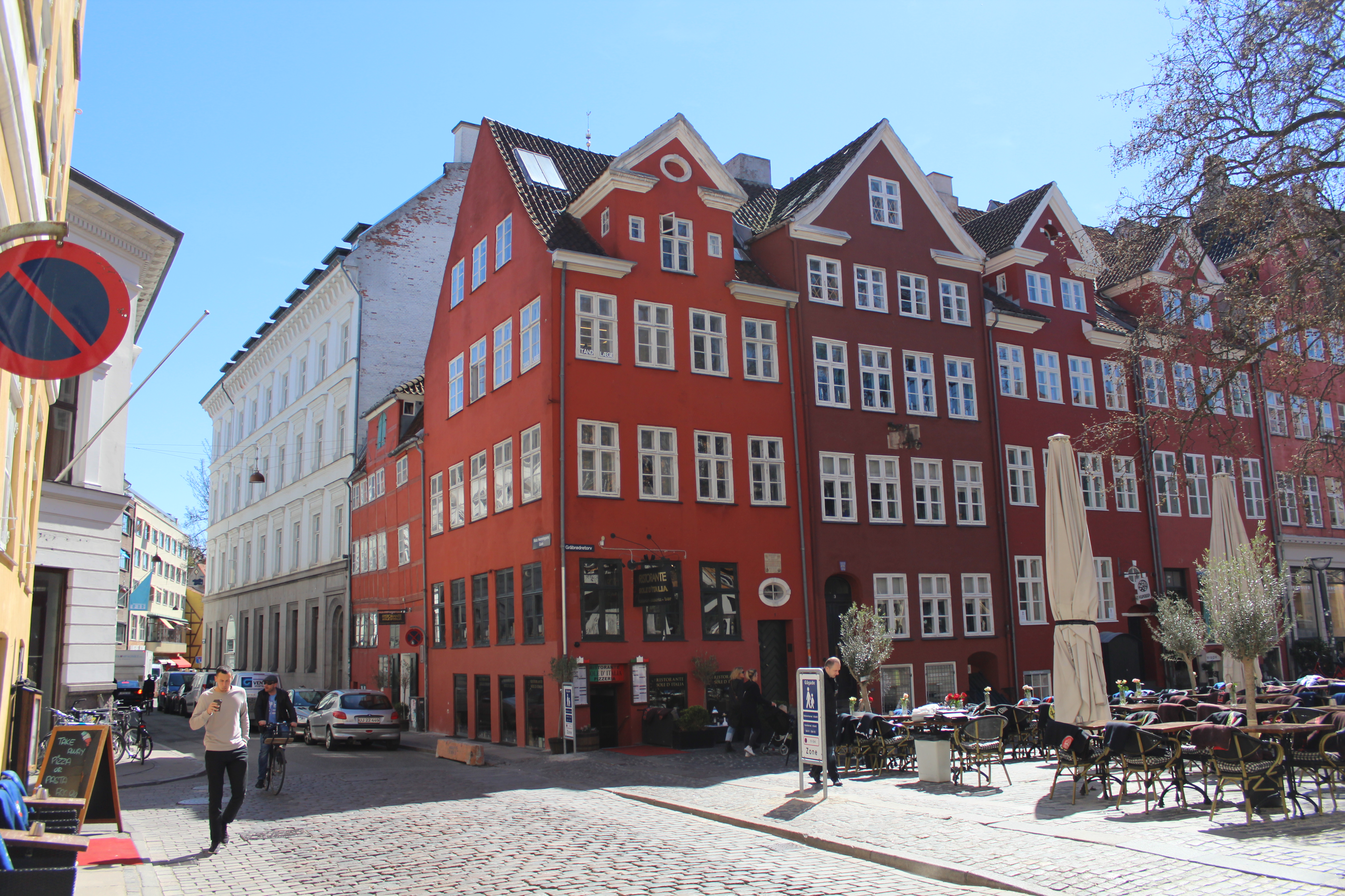
Grøbrødre Torv with outdoor restaurants.
Franciskan monks built 1238 a monastery on Gråbrødre Square and was together with Church of The Holy Spirit (Helligåndskirken) and hospital “Helligåndshuset” built around 1400 the center for their christians spiritual-, social- and educational activities until The Lutheran Reformation 1530-36.
View to “Ildebrandshusene “- 5 red houses built 1730 after the big fire 20.-23. october 1728 which destroyed 1670 houses in inner Copenhagen:
Click on photos and use your zoom control and you see the in full screen size.
Amager Torv – Amager Square, since 1400 a marketplace of food: vegetables, fish and meat – today a relaxing place with outdoor restaurantc:
Fountain “Storkespringvandet” constructed 1894 in center of the square:
Click on photos and use your zoom control and you see the in full screen size.
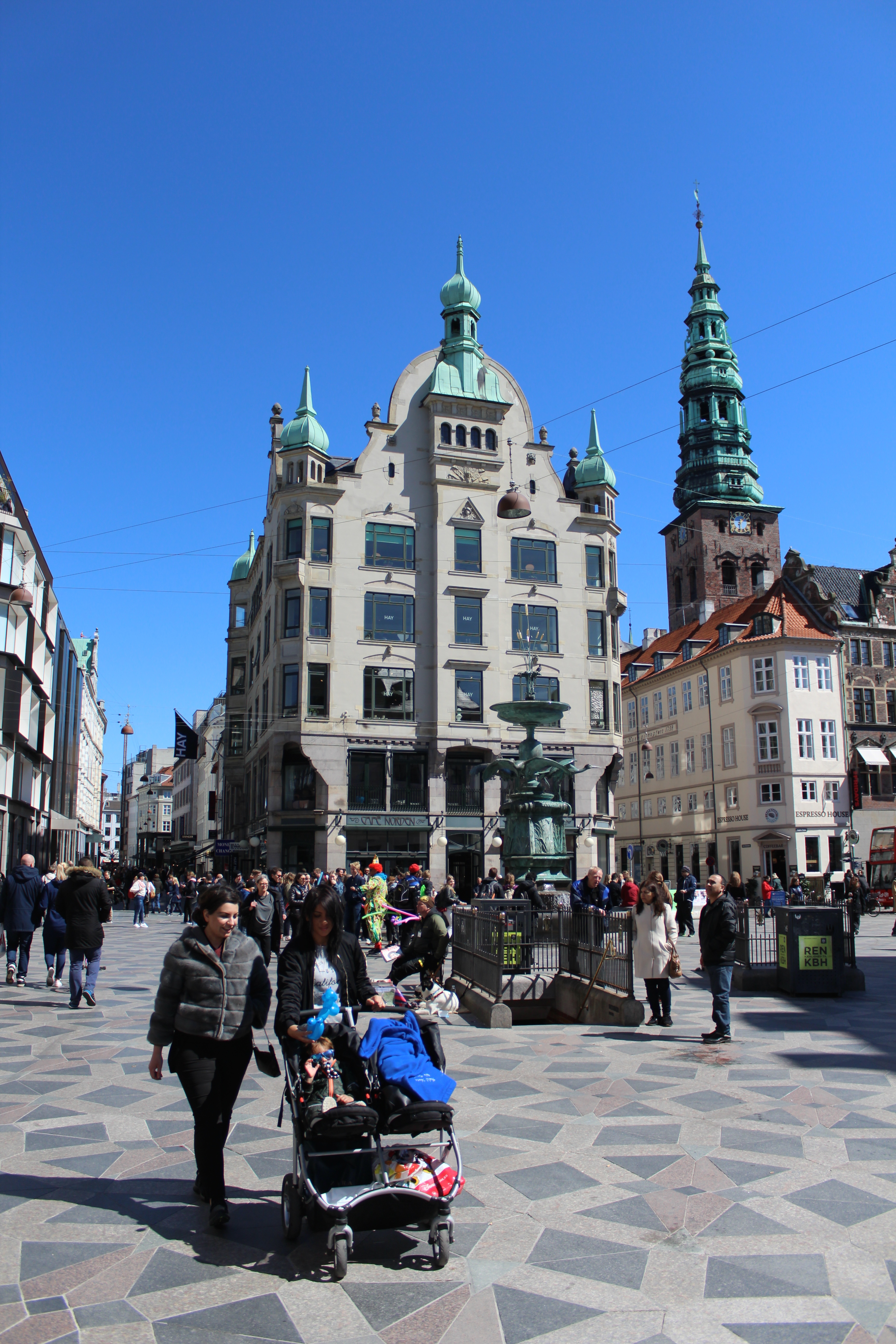
Fun and joy spring 2017:
Fountain “Storkespringvandet” at Amager Torv:
Click on photos and use your zoom control and you see the in full screen size.

View to Third Christianborg Castle built 1906-19 as the third castle on the small island Slotsholmen:
First Christiansborg Castle built 1730-46 – burned 1794.
Second Christiansborg Castle and Church (Slotskirken) built 1803-28 – burned 1884.
In 1167 bishop Absalon built a fortress Absalon Borg on island Slotsholmen. It was completely destroyed by The Hanseates in 1386.
The first Copenhagen Castle was built on island Slotsholmen around 1400 and expanded the next 300 years until 1730 when
King Christian 6 (King of Denmark and Norway 1730-46) wanted and built a new castle: The second Christiansborg (1733-94).
Click on photos and use your zoom control and you see the in full screen size.

Canal “Slotsholmens Kanal” surrounding Slotsholmen.
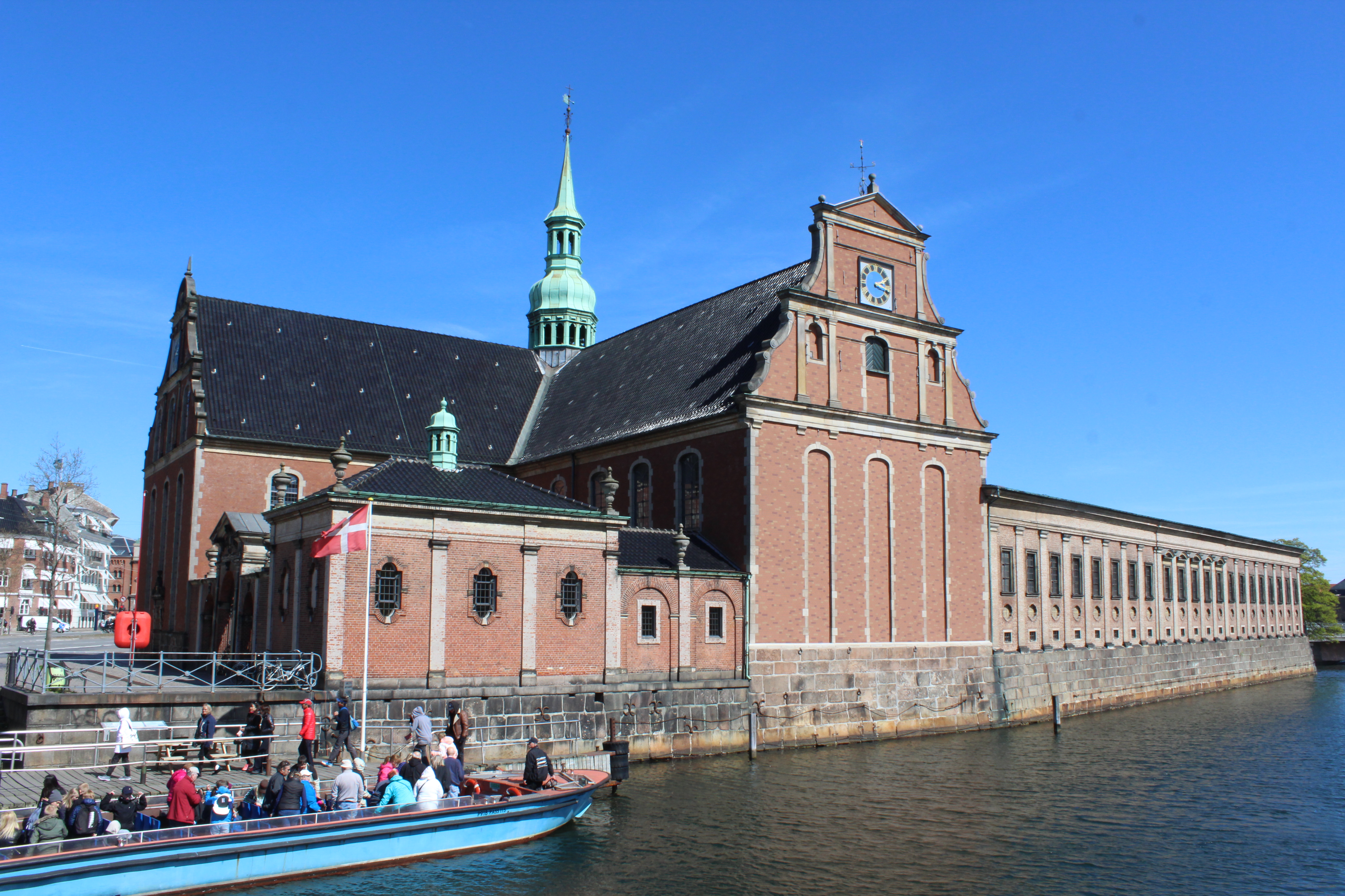
Vue to Holmen Church – a former weapon smity of Danish Navy built 1562 and renewed 1619-23 as a church by King Christian 4:
Click on photos and use your zoom control and you see the in full screen size.
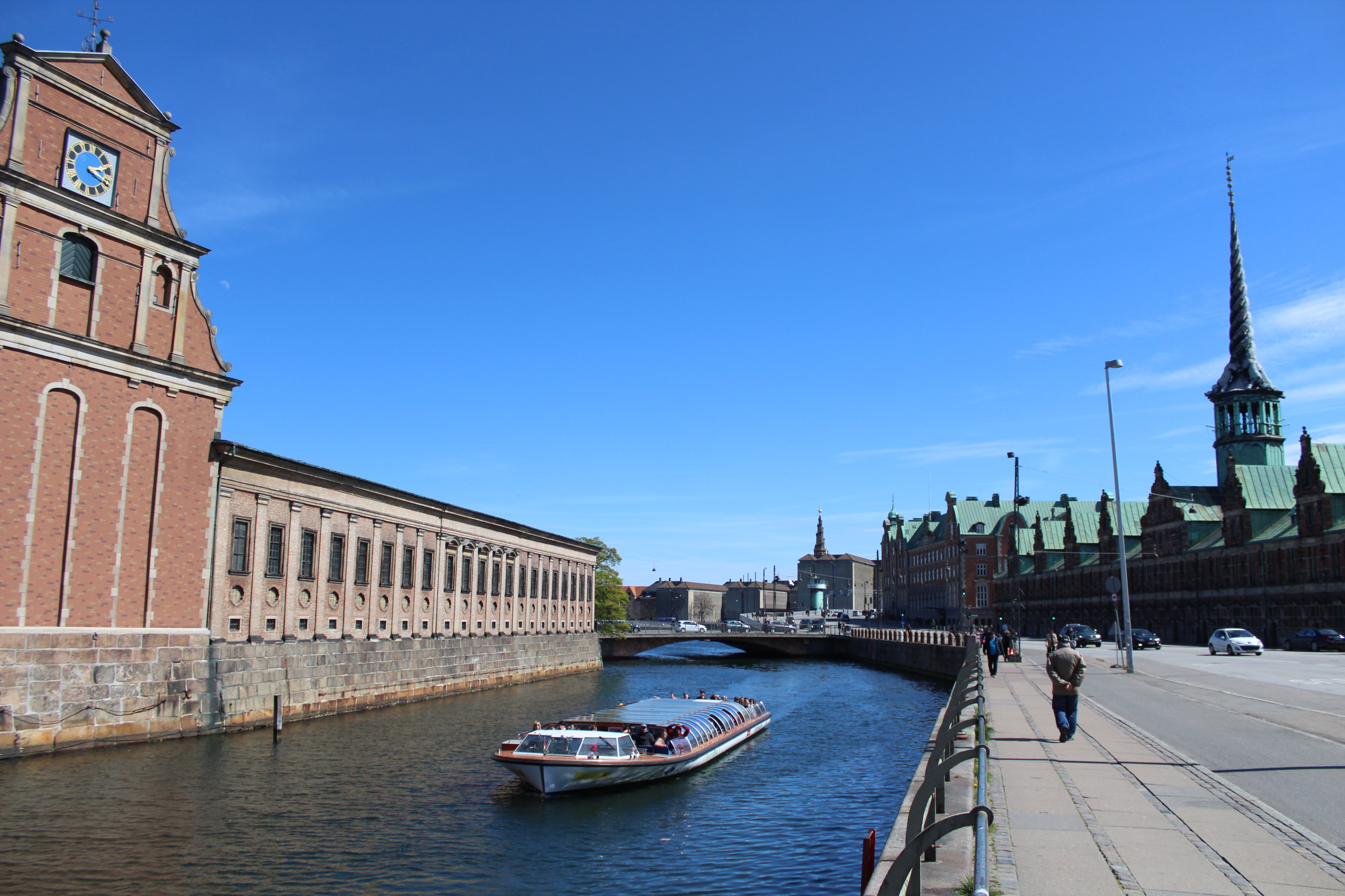
View to Slotsholmen Canal and Børsen at right – The bourse built by King Christian 4 in 1619-25:
Click on photos and use your zoom control and you see the in full screen size.
Copenhagen Inner Harbour:
– view from bridge “Knippelsbro” in direction east to new walk- and bike slide bridge “Inderhavnsbroen”, Copenhagen Opera and Paper Island (Papirøen) with street food restaurants.
At left Christianshavn with The Ministery of Foreign Affaires and Eigtved Store House built 1748-50.
Click on photos and use your zoom control and you see the in full screen size.

Copenhagen Inner Harbour:
– view from bridge “Knippelsbro” in direction east to new walk- and bike slide bridge “Inderhavnsbroen”, Copenhagen Opera and Paper Island (Papirøen) with street food restaurants.
Click on photos and use your zoom control and you see the in full screen size.
Part 2: Christianshavn:
Map of Copenhagen City, Copenhagen Inner Harbour and Christianshavn:
Click on photos and use your zoom control and you see the in full screen size.

Christianshavn Square and Christianhavn Canal:
Christianshavn was built around 1620 as a fortress and a city against swedish invasion from island Amager south of Copenhagen.
The Christianshavn Fortress was constructed by inspiration from Nederland with canals in lines and with a big central square – all constructions surrounded by bastions and moats.
Close to the harbour and the canals rich merchant companies built store houses and private and commercial residences:
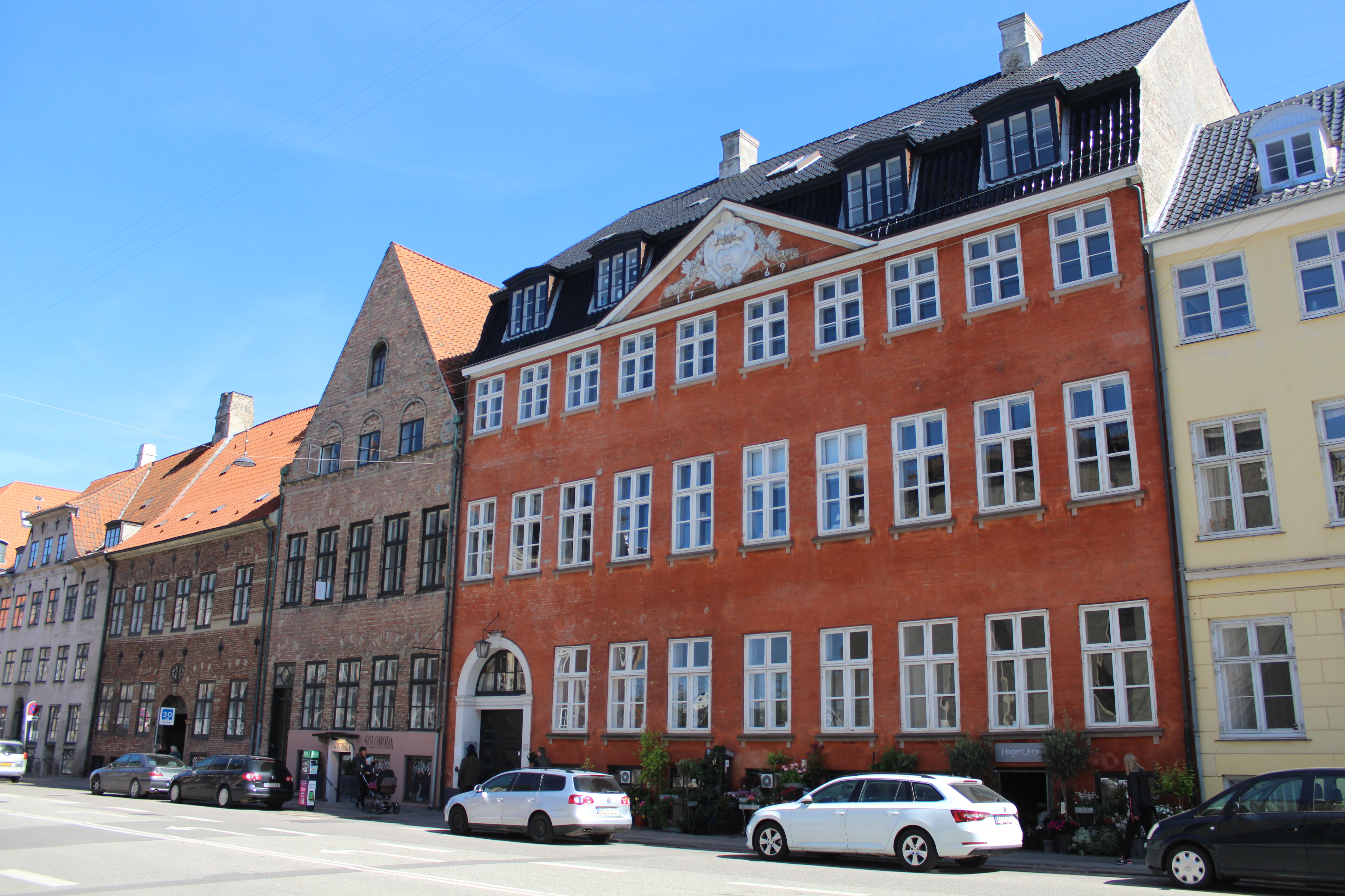
Strandgade 26-32 – all houses original built around 1620-25 – in 1700 all houses were rebuilt:
Nr. 26 “Behagen Gård” – the red house built 1769,
Nr. 28 “Sivert Grubbes Gård”,
Nr. 30 and nr. 32: “Mikkel Vibes Gård” rebuilt 1710.
Click on photos and use your zoom control and you see the in full screen size.
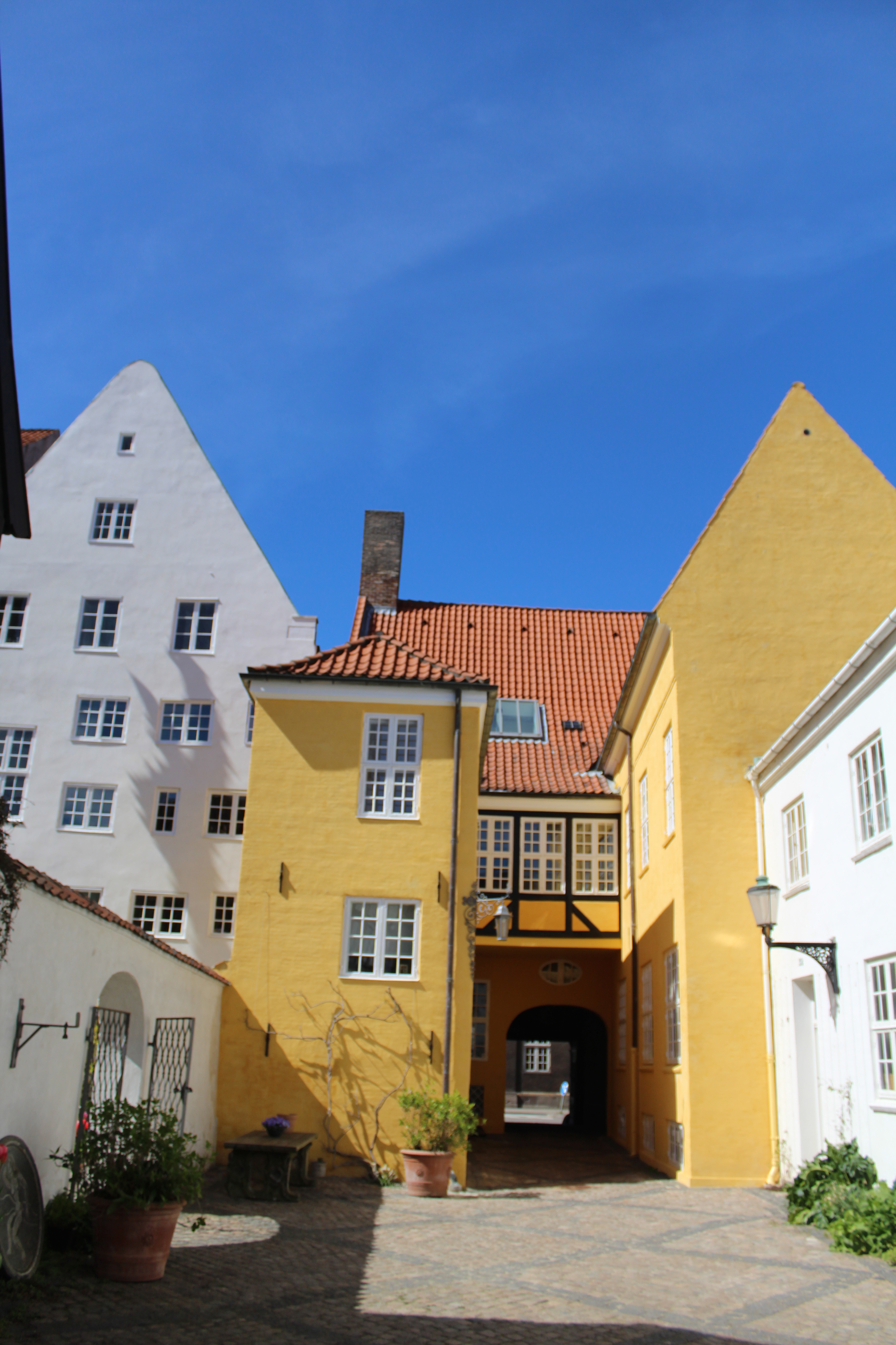
Visit into backyard of house Strandgade 30: “Mikkel Vibes Gård”:
Click on photos and use your zoom control and you see the in full screen size.

Visit into backyard of house Strandgade 30: “Mikkel Vibes Gård”:
Click on photos and use your zoom control and you see the in full screen size.

Visit into backyard of house Strandgade 30: “Mikkel Vibes Gård”:
At left backhouse and garden of residence Strandgade nr. 28 “Sivert Grubbes Gård” original built 1620-30 and reconstructed around 1760-70.
Click on photos and use your zoom control and you see the in full screen size.
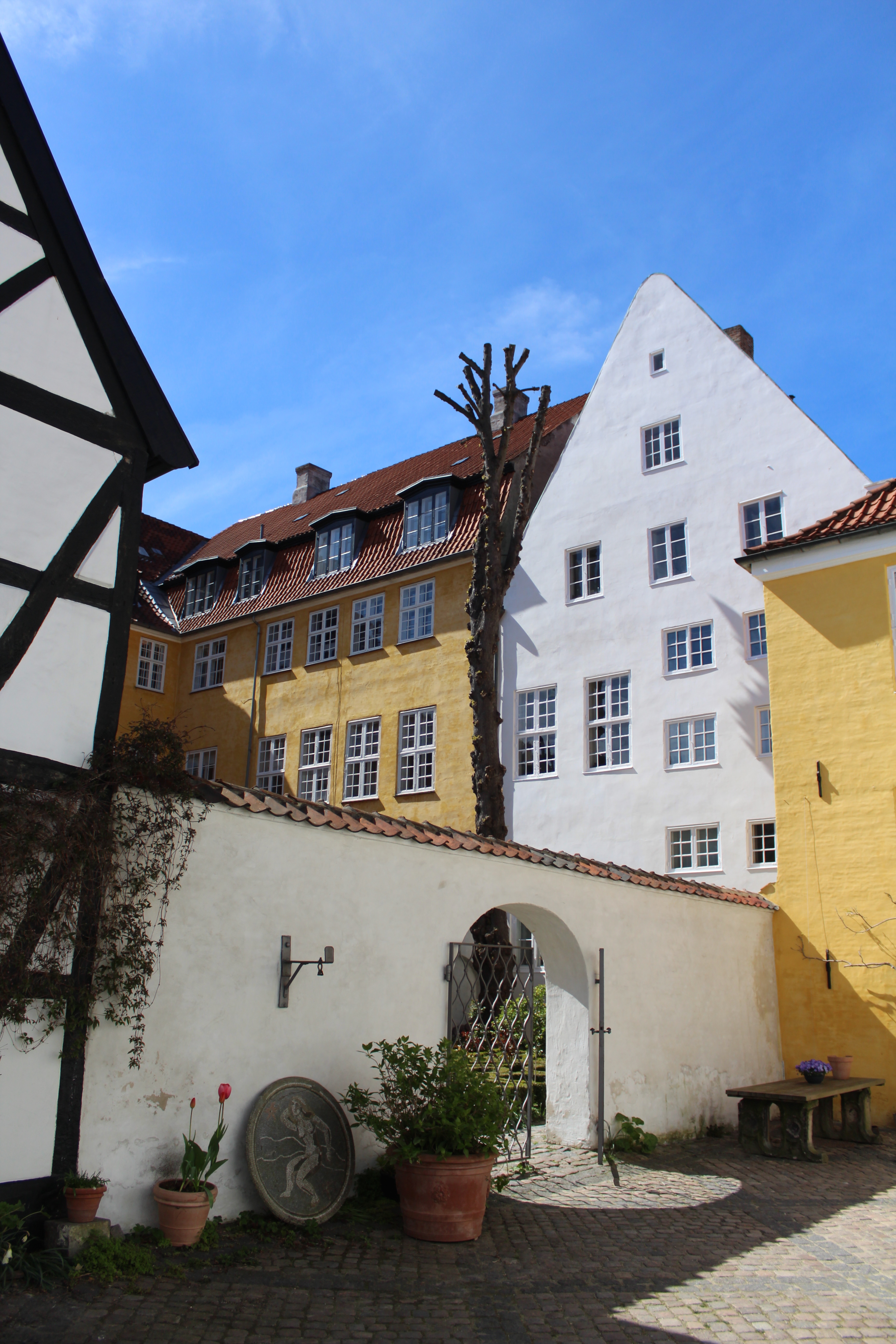
View to backside of Strandgade nr. 28 “Sivert Grubbes Gård” and its garden and to backside of Strandgade nr. 26 “Behagen Gård”:
Click on photos and use your zoom control and you see the in full screen size.
Sct Anæå gade – Sct. Annae Street:
View to “Our Savior Church” built 1782-96 by Lambert van Haven (1630-95) with 4 m high statue of “Christ the Conqueror” and spire constructed 1751 by Laurids de Thurah (1706-59):
Click on photos and use your zoom control and you see the in full screen size.

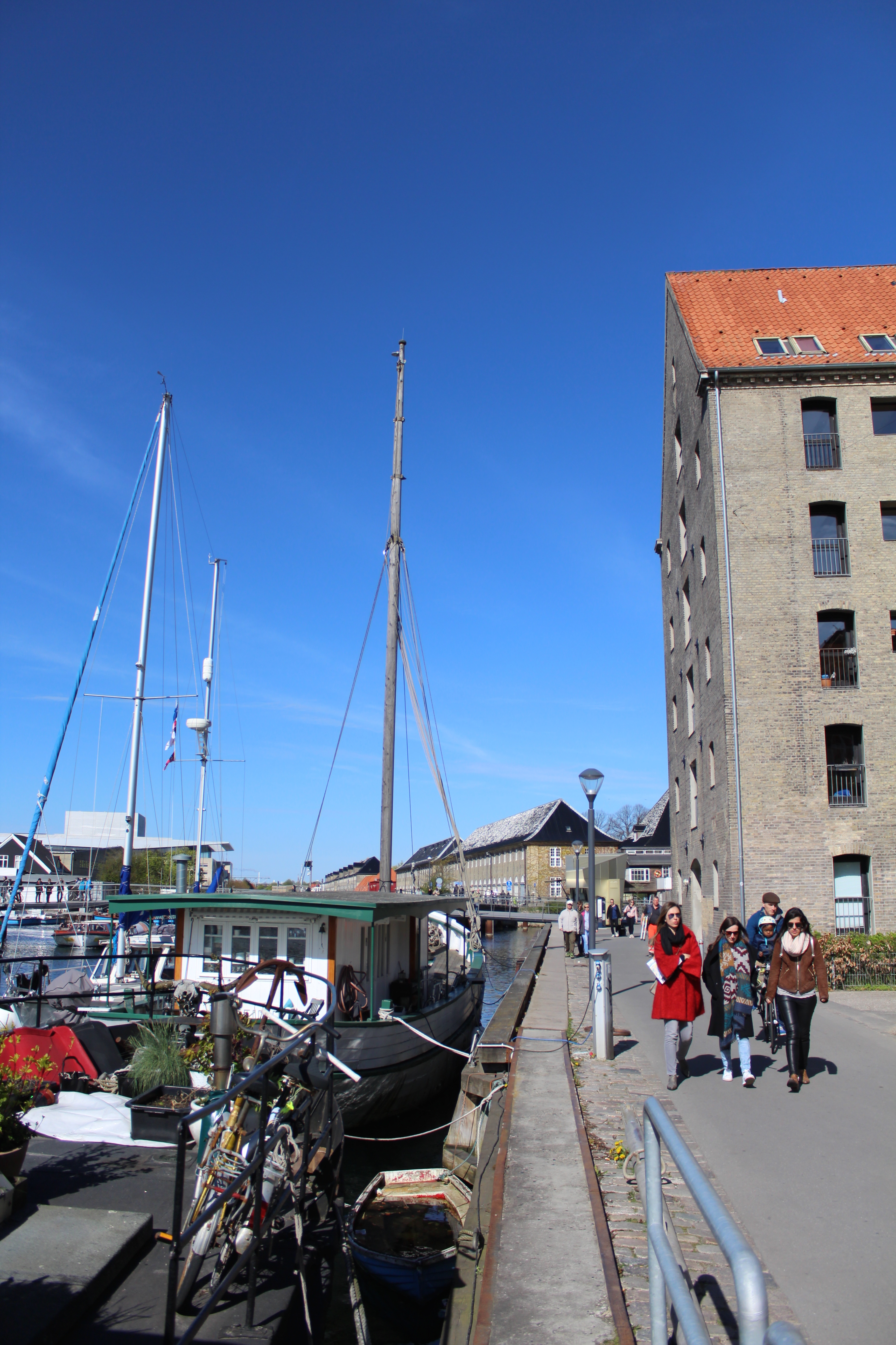
Wilders Gade with store houses built around 1700-50:
Click on photos and use your zoom control and you see the in full screen size.
Sct. Annae Bridge – Sct. Anna Bridge at Christians Canal:
Click on photos and use your zoom control and you see the in full screen size.
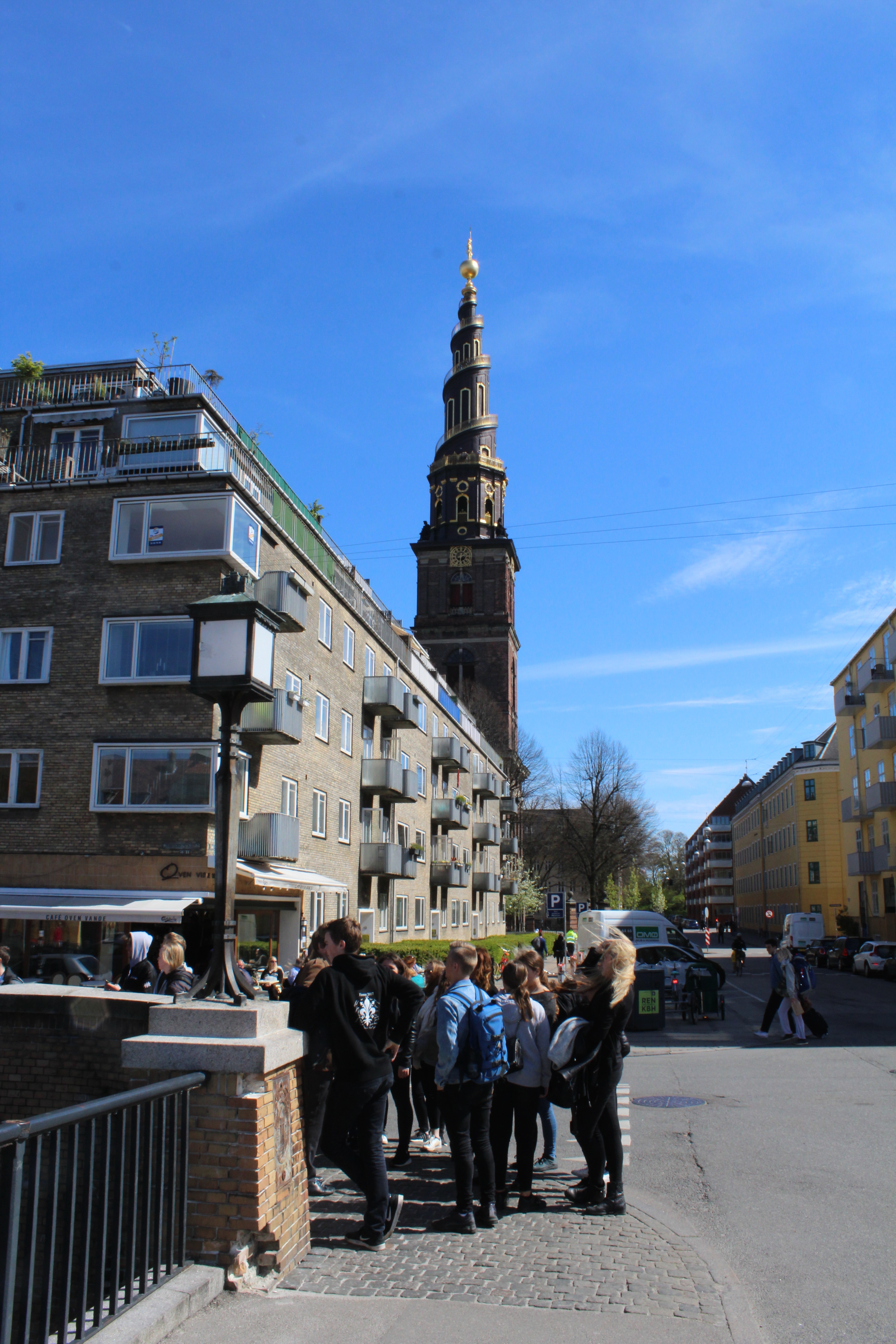
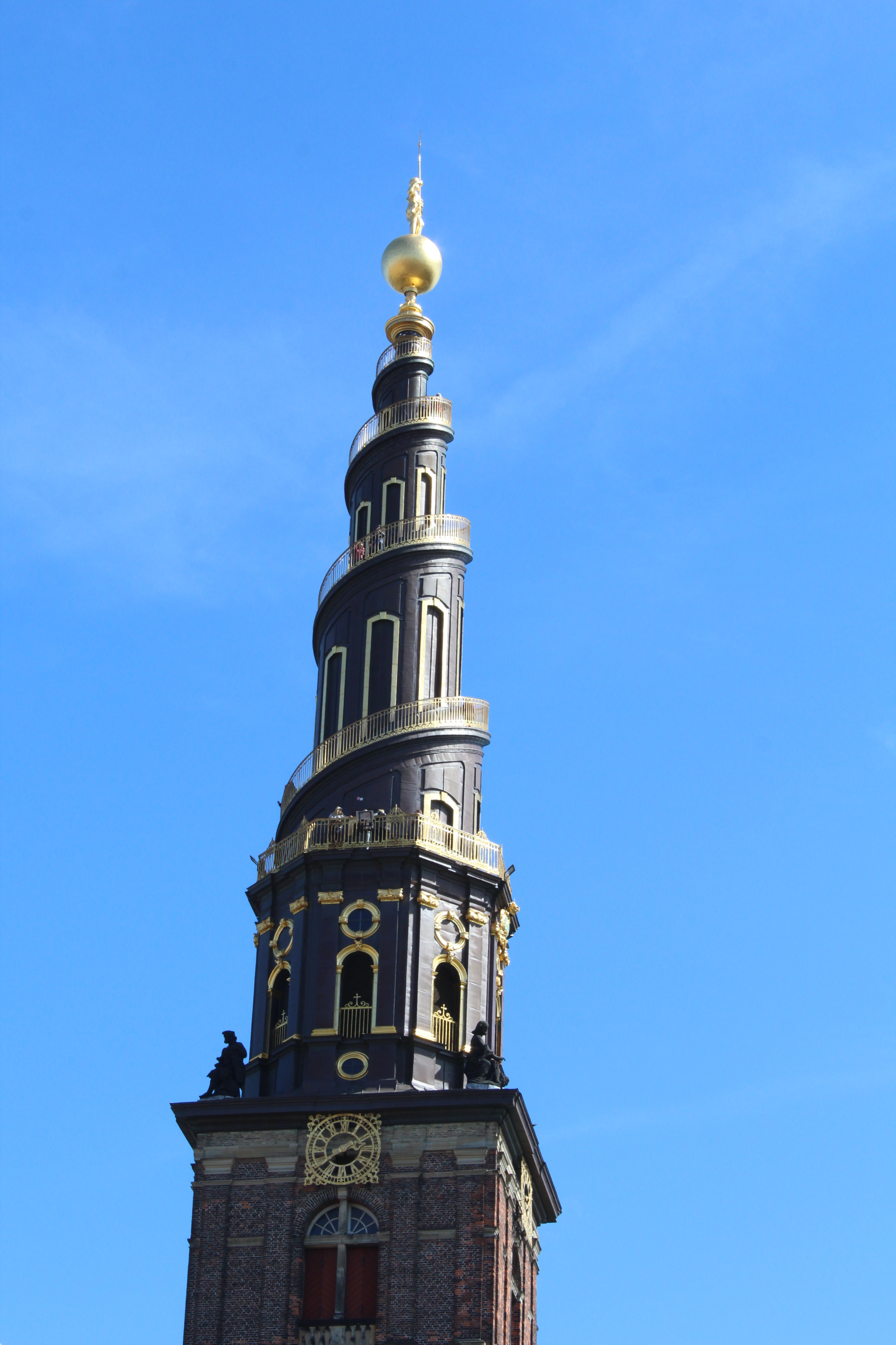
Our Savior Church – Vor Frelsers Kirke built 1682-96 and Spire with 4 meter high statue “Christ as Conqueror” by Laurids de Thurah (1706-59):
Click on photos and use your zoom control and you see the in full screen size.
View from Sct. Annæ Bridge to Christianshavn Canal in direction west to Torvegade Bridge and Christianshavn Square:
Click on photos and use your zoom control and you see the in full screen size.

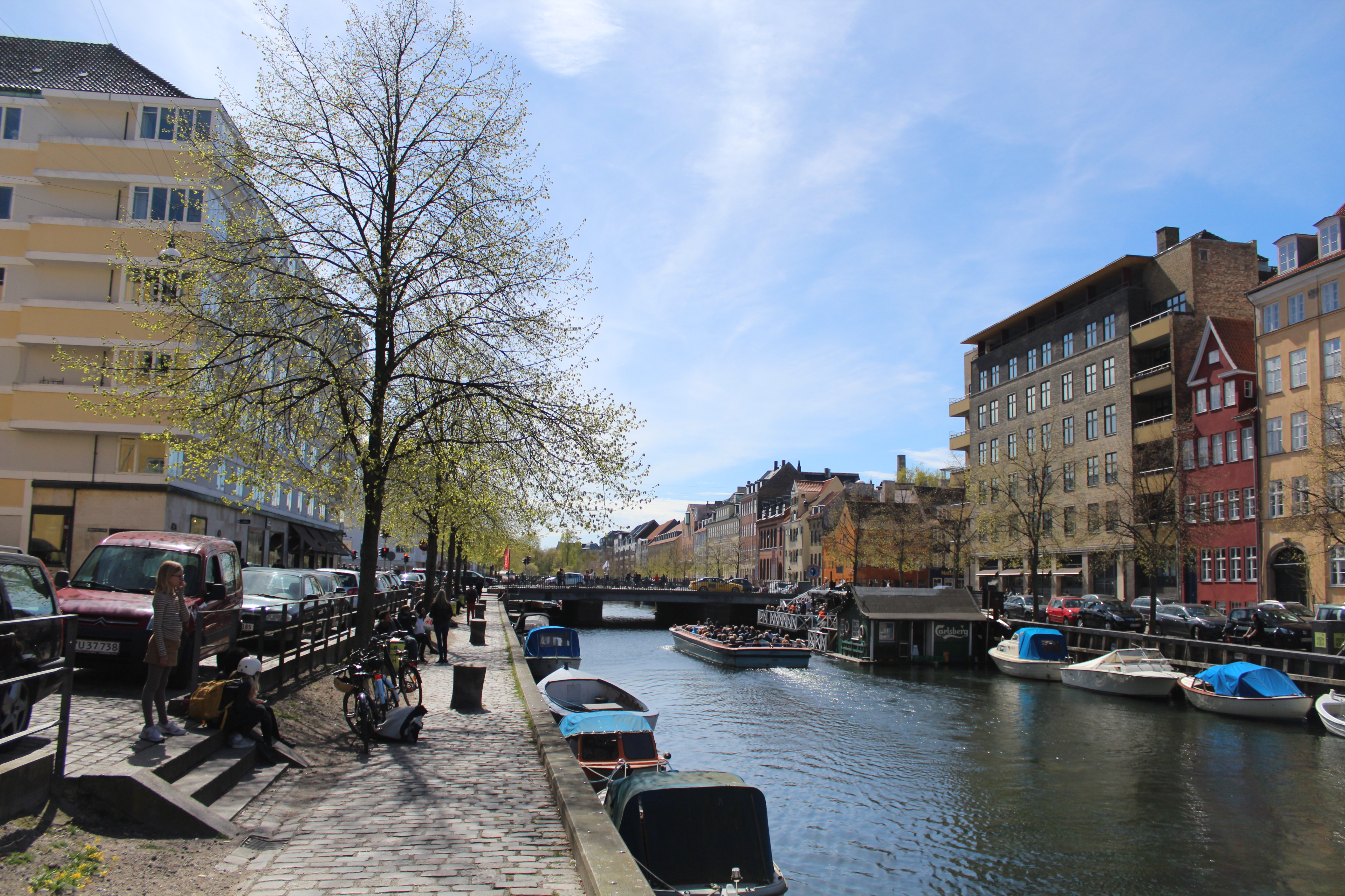
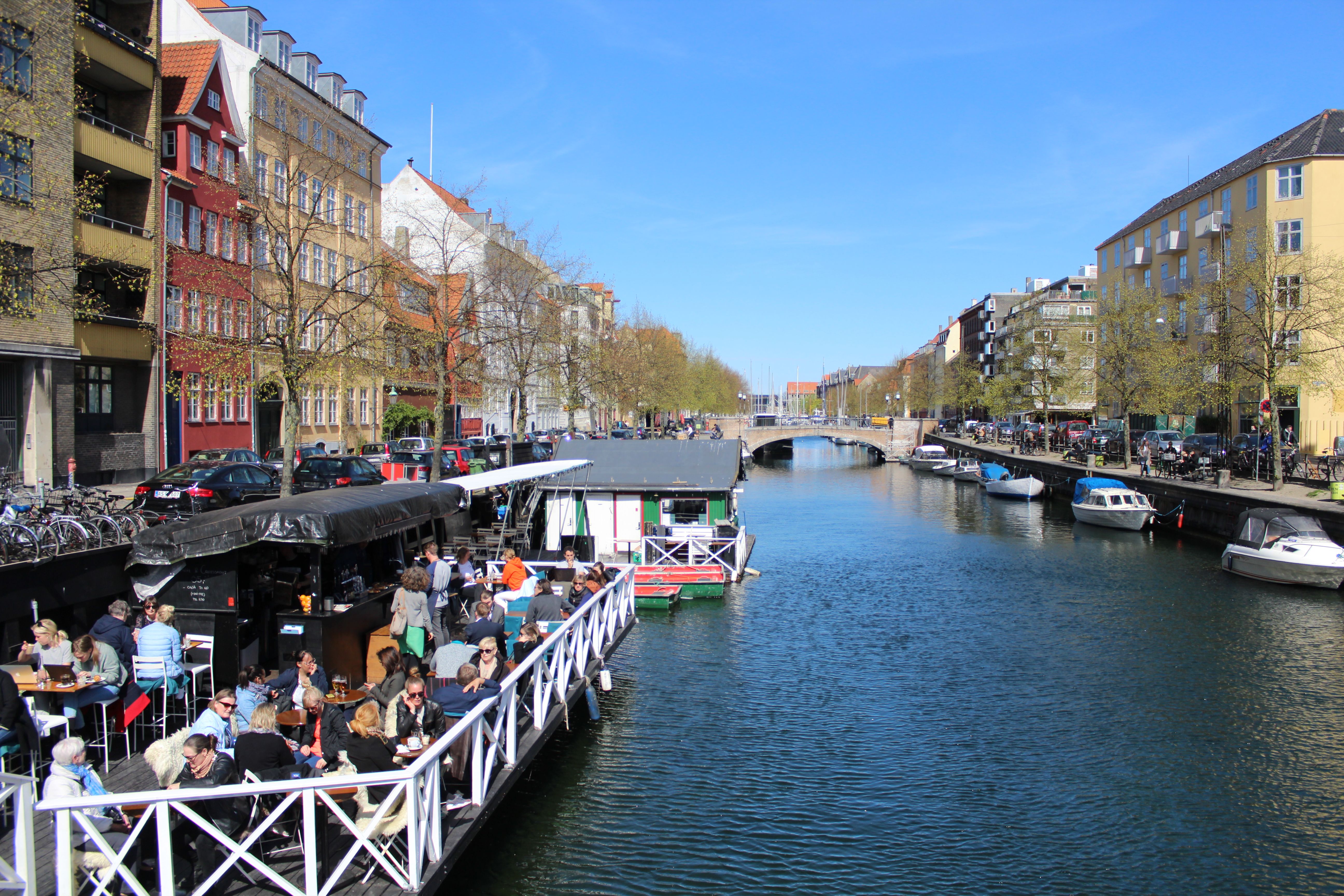
Christianshavn Canal:
Click on photos and use your zoom control and you see the in full screen size.
Open air restaurant on Christianshavn Canal – view in direction east to Sct Annae Bridge:
Click on photos and use your zoom control and you see the in full screen size.
Lovely atmosphere of fun, joy and poetry at Christianshavn Canal spring 2017:
Click on photos and use your zoom control and you see the in full screen size.
Lovely atmosphere of fun, joy and poetry at Christianshavn Canal spring 2017:
Click on photos and use your zoom control and you see the in full screen size.
Lovely atmosphere of fun, joy and poetry at Christianshavn Canal spring 2017:
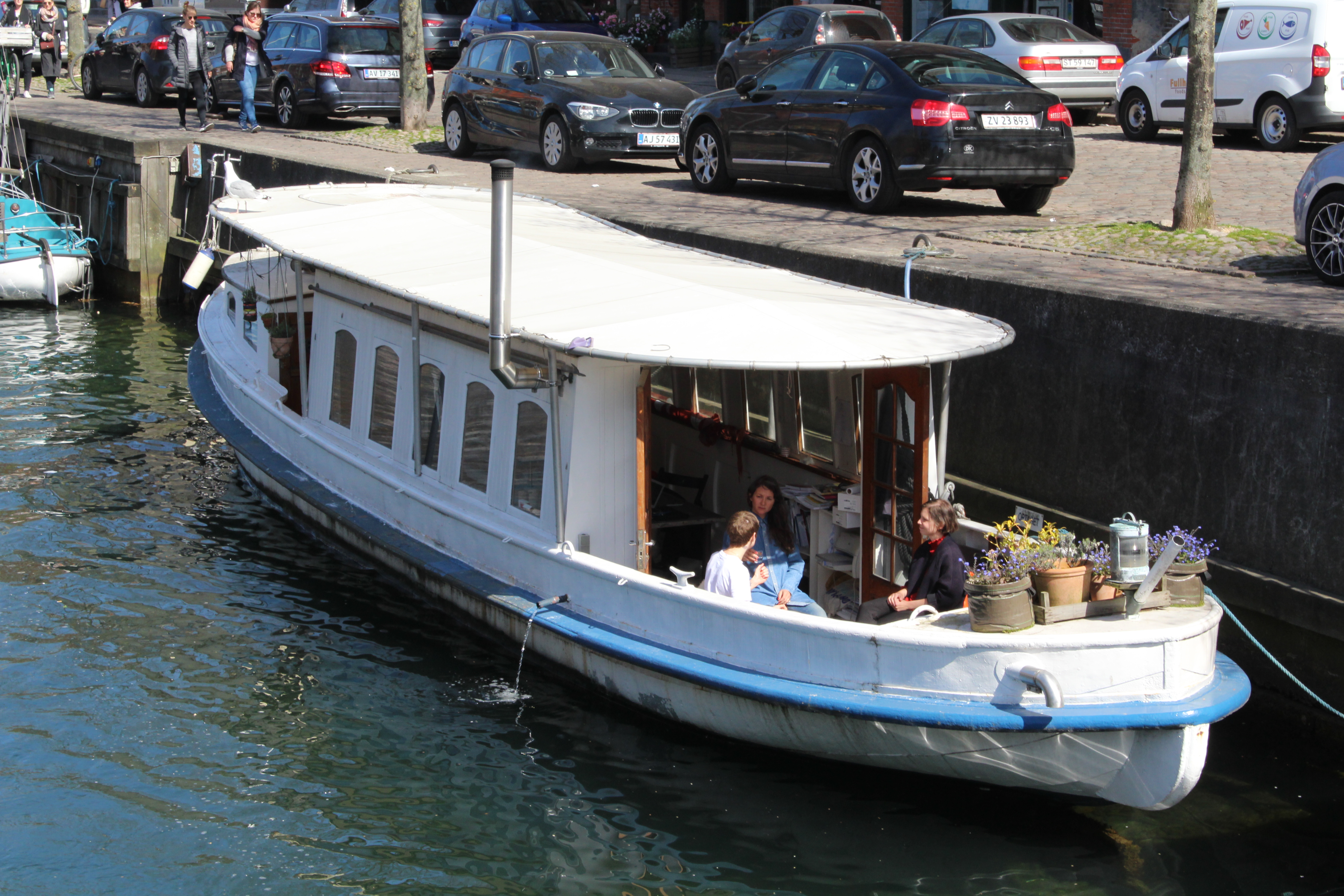
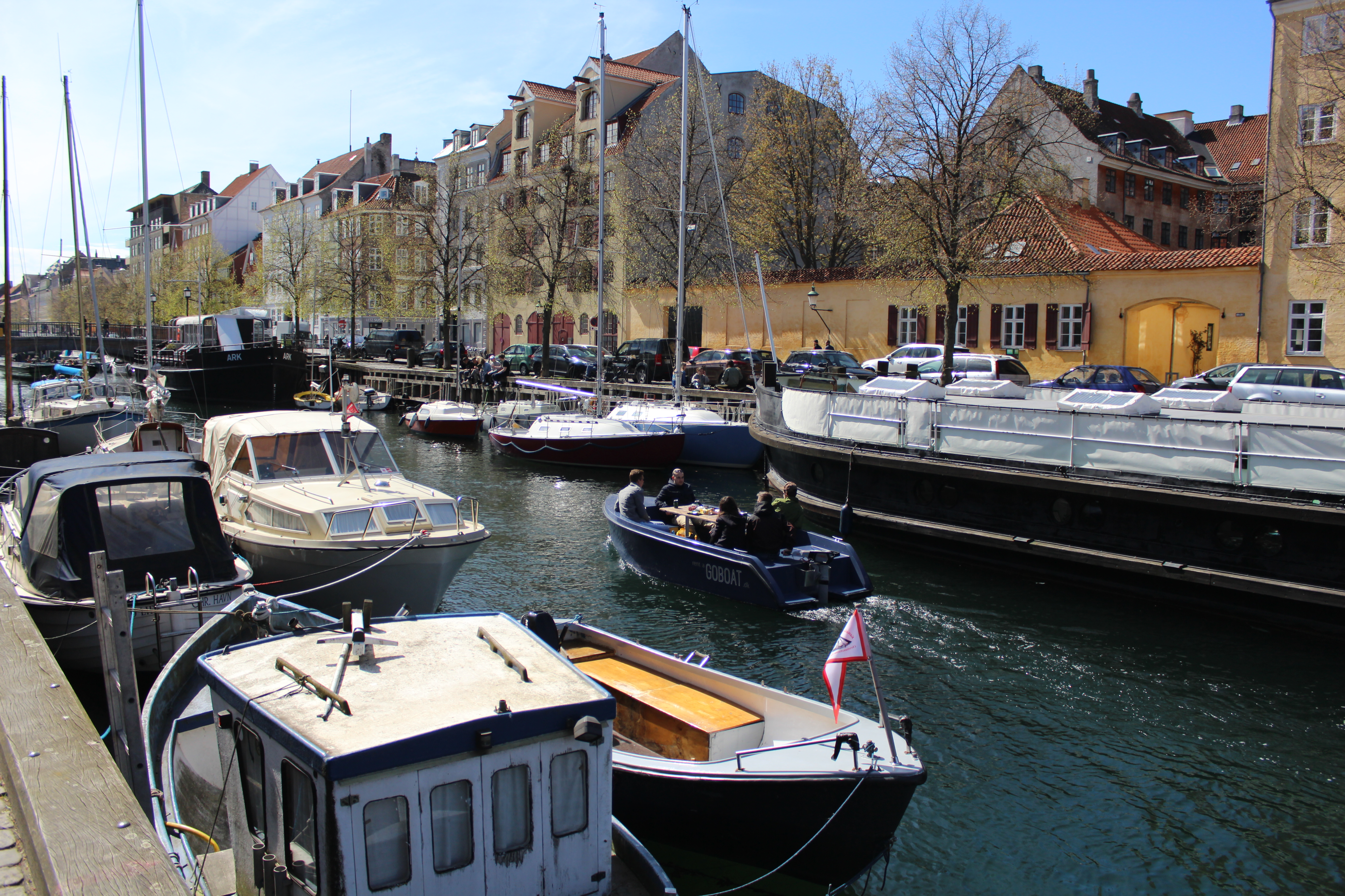
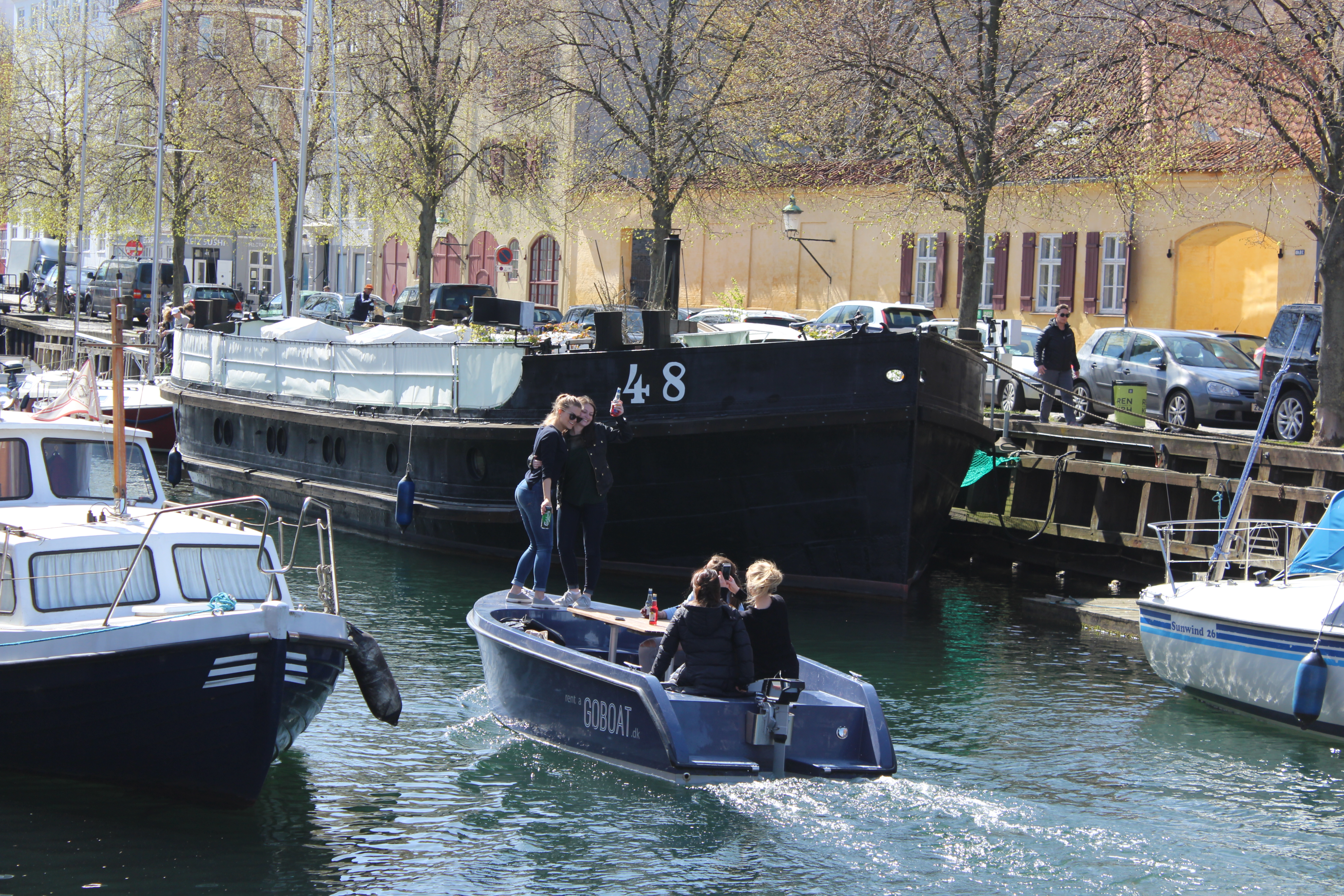
Danish “HYGGE” on Christianshavn Canal with friends in a rented GOBOAT:
Click on photos and use your zoom control and you see the in full screen size.
Lovely atmosphere of fun, joy and poetry at Christianshavn Canal spring 2017:
Click on photos and use your zoom control and you see the in full screen size.

Lovely atmosphere of fun, joy and poetry at Christianshavn Canal spring 2017:
Danish “HYGGE” on Christianshavn Canal with friends in a rented GOBOAT:
Click on photos and use your zoom control and you see the in full screen size.

Lovely atmosphere of fun, joy and poetry at Christianshavn Canal spring 2017:
Danish “HYGGE” on Christianshavn Canal with friends in a rented GOBOAT:
Click on photos and use your zoom control and you see the in full screen size.
Lovely atmosphere of fun, joy and poetry at Christianshavn Canal spring 2017:
Click on photos and use your zoom control and you see the in full screen size.

Lovely atmosphere of fun, joy and poetry at Christianshavn Canal spring 2017:
Click on photos and use your zoom control and you see the in full screen size.

Lovely atmosphere of fun, joy and poetry at Christianshavn Canal spring 2017:
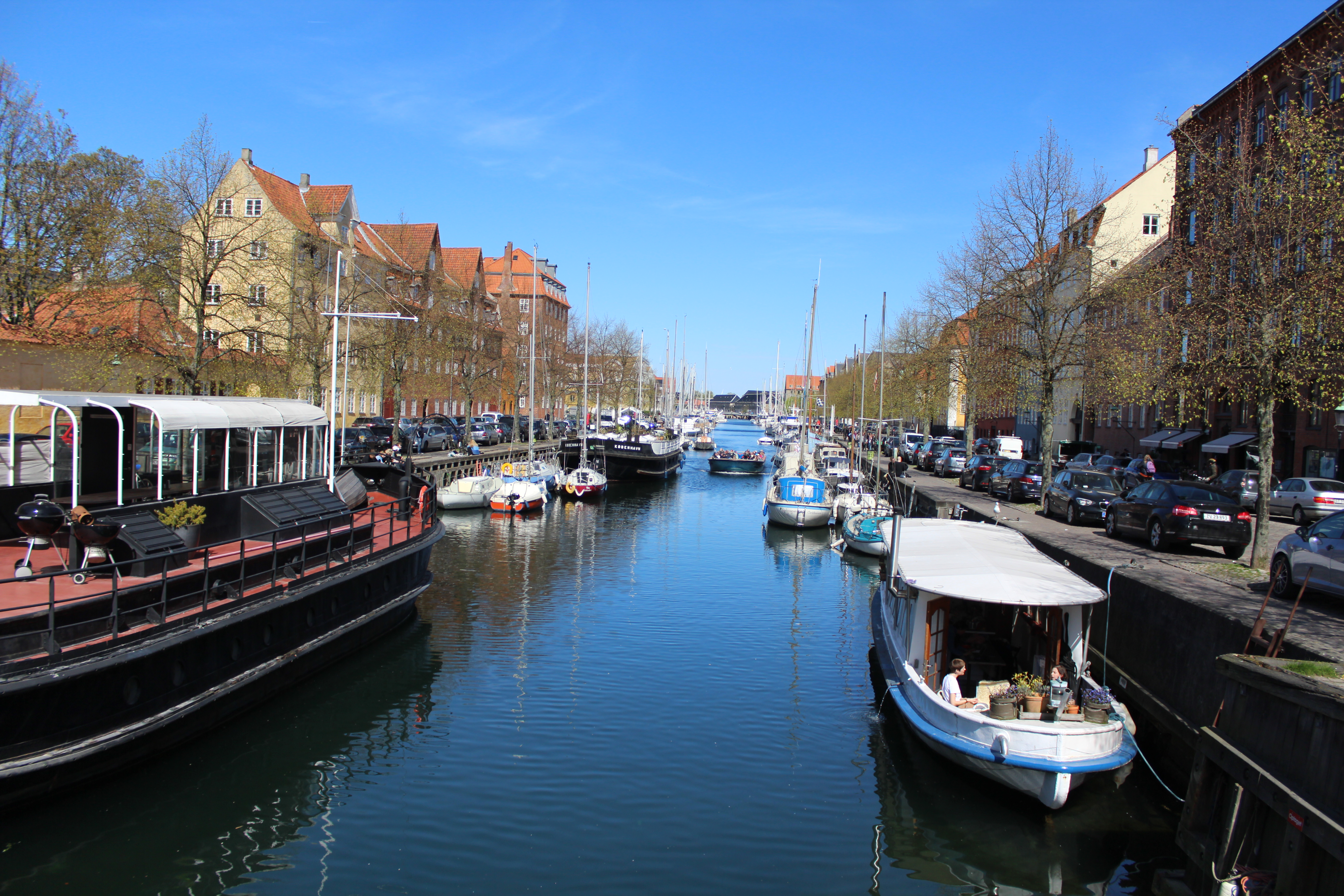
View to Trangraven Canal in the background and walk-and bike bridge “Trangraven” which connects Christianshavn with island “Paper Island,” Papirøen (Christiansholm) with street food restaurants and Arsenaløen:
Click on photos and use your zoom control and you see the in full screen size.
Part 3: Copenhagen Inner Harbour and Nyhavn:
New bike- and walk bridge “Trangraven Bridge” connecting Christianshavn and Papirøen , Paper Island) with street food restaurants and Arsenaløen:
Click on photos and use your zoom control and you see the in full screen size.

Christiansholm, Paper Island (Papirøen) is a part of Holmen.
Holmen has 5 artificial islands created by “manpower” since 1680: Arsenaløen, Frederiksholm, Christiansholm, Dokøen and Nyholm.
Holmen was the center for Danish Navy with all its installations from 1680-1989: Naval Station Holmen.
Today island Nyholm is base of Marine Station Copenhagen with museum navy ships open to the public.
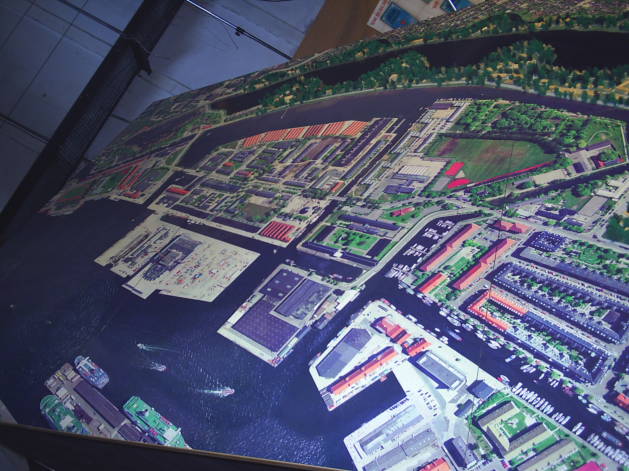
Model of Copenhagen Inner Harbour, Holmen and Christianshavn:
Click on photos and use your zoom control and you see the in full screen size.
Since 1996 many of the naval buildings are rebuilt to School of Architecture, School of Music, Film School and School of Theatre.
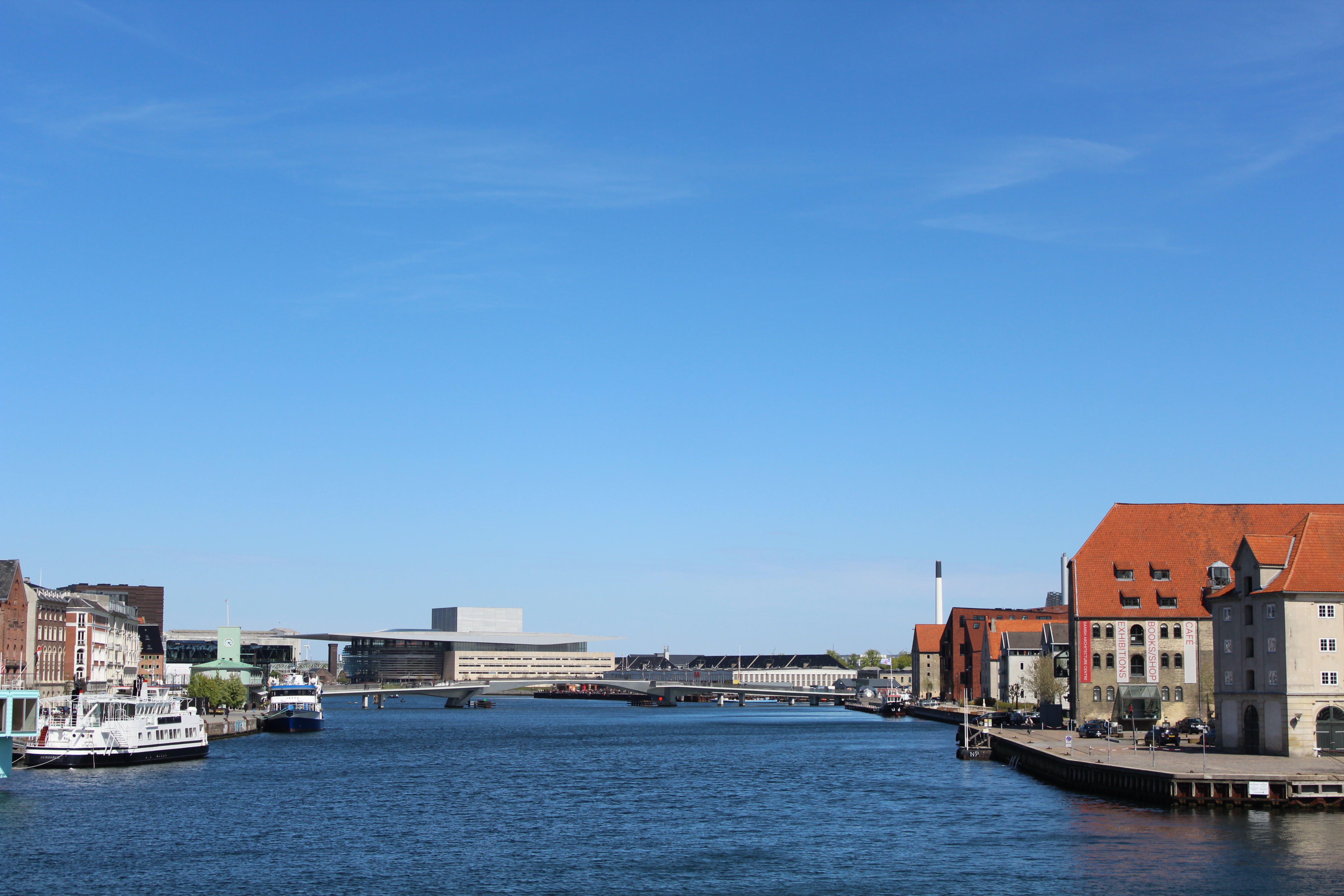
View from Paper Island, Christiansholm (Papirøen) in direction west to new walk and bike slide bridge “Inderhavnsbroen” connecting Christianshavn at Greenland Place with Nyhavn:
Click on photos and use your zoom control and you see the in full screen size.

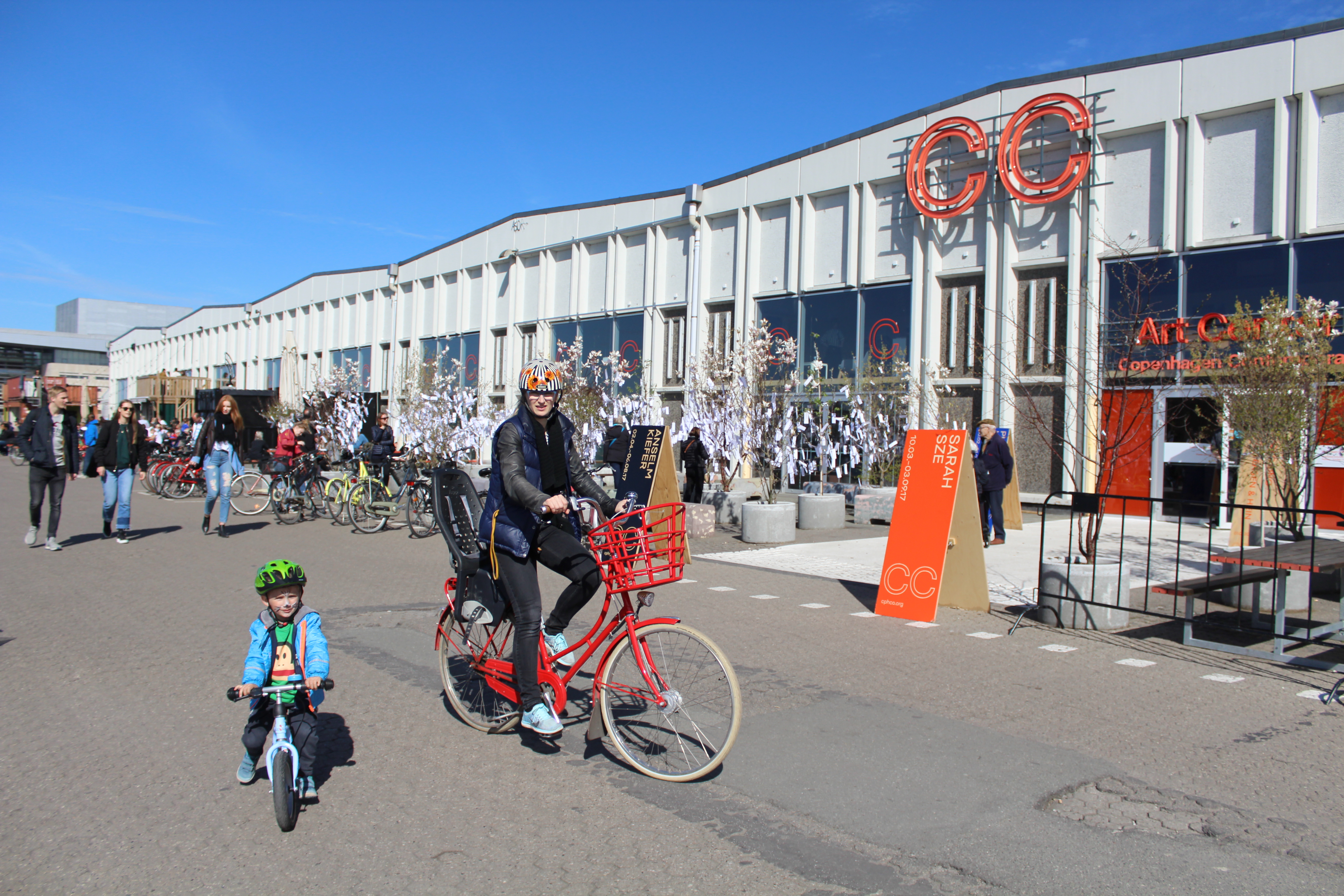
On Paper Island (Papirøen) you will find:
Copenhagen Contemporary, International Art Center and Street food restaurants:
Click on photos and use your zoom control and you see the in full screen size.
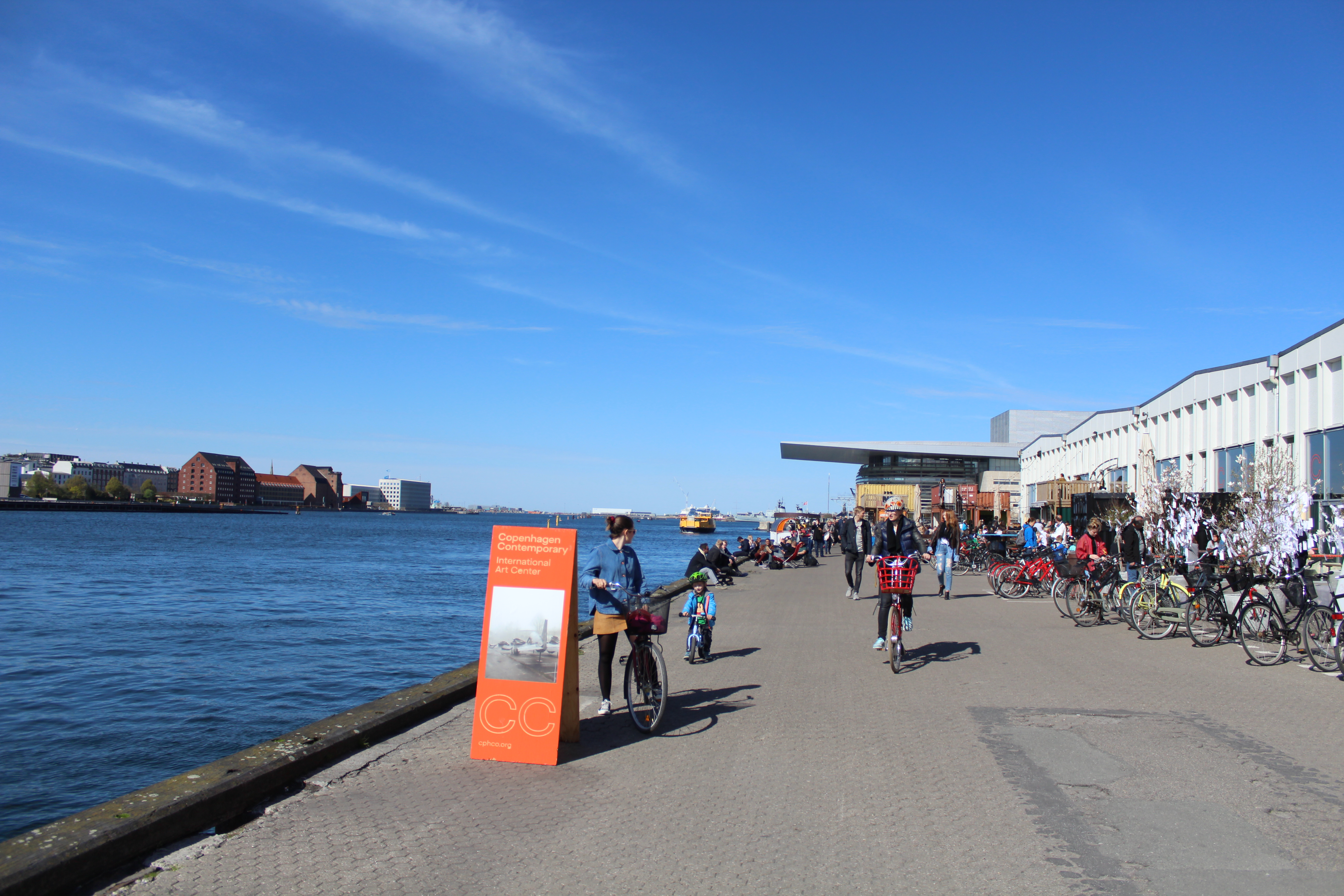
Copenhagen Contemporary, International Art Center and Street food restaurants:
Click on photos and use your zoom control and you see the in full screen size.
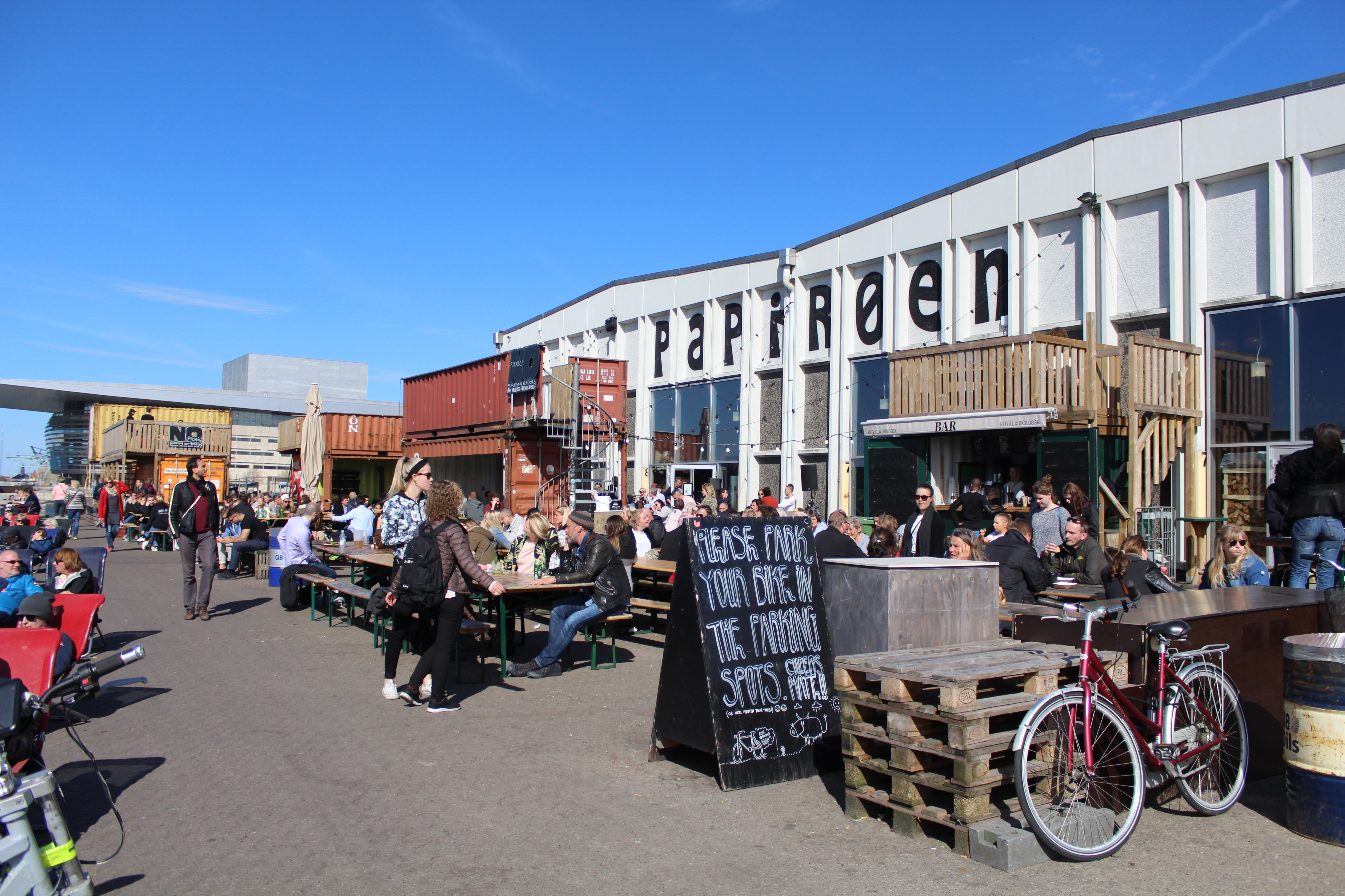
Paper Island – Papirøen, Holmen.
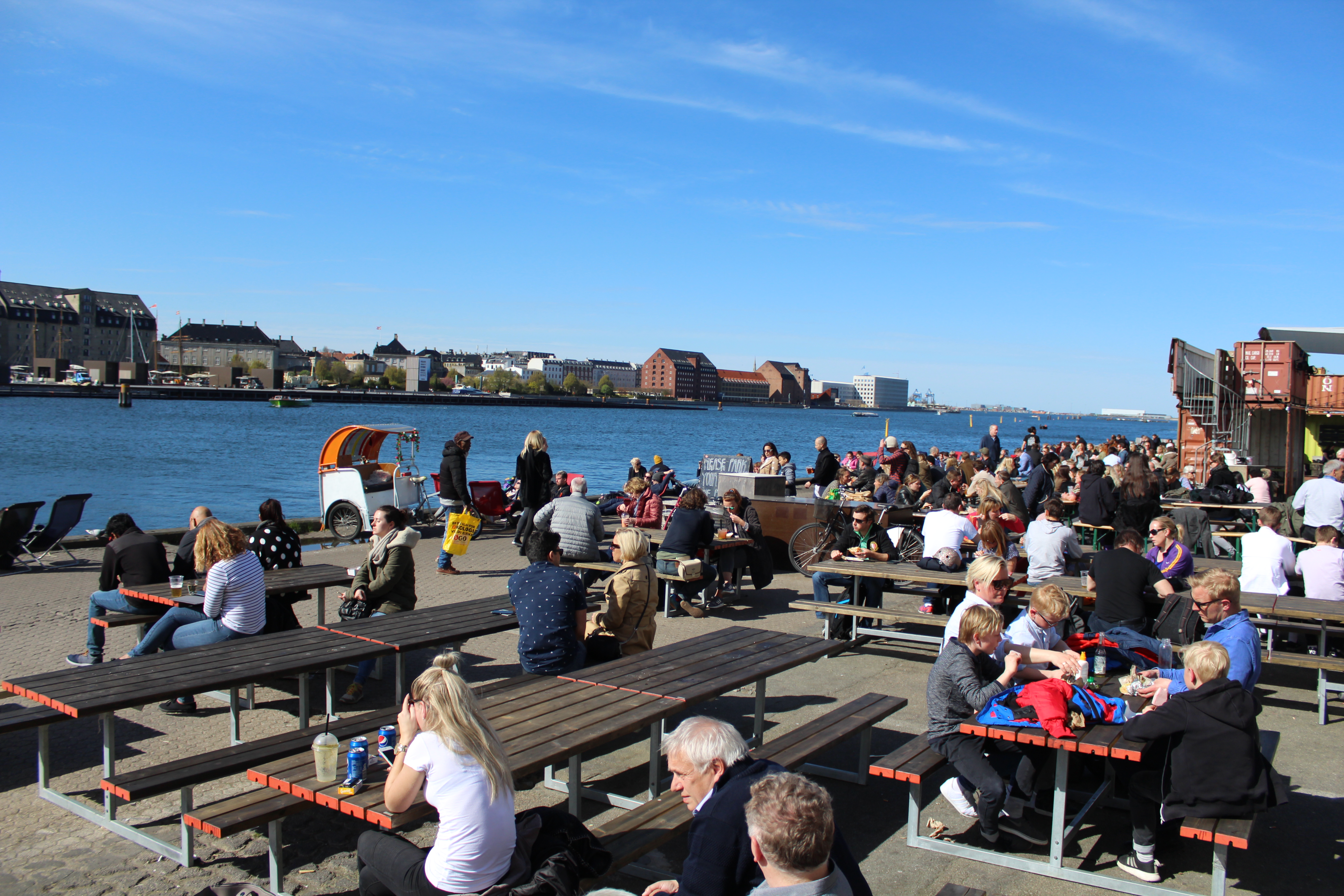
Relaxed “Cosy” atmosphere at bulwarks in Copenhagen Inner Harbour:
Click on photos and use your zoom control and you see the in full screen size.

Paper Island – Papirøen, Holmen.
Street food restaurants PAPIRØEN:
Click on photos and use your zoom control and you see the in full screen size.
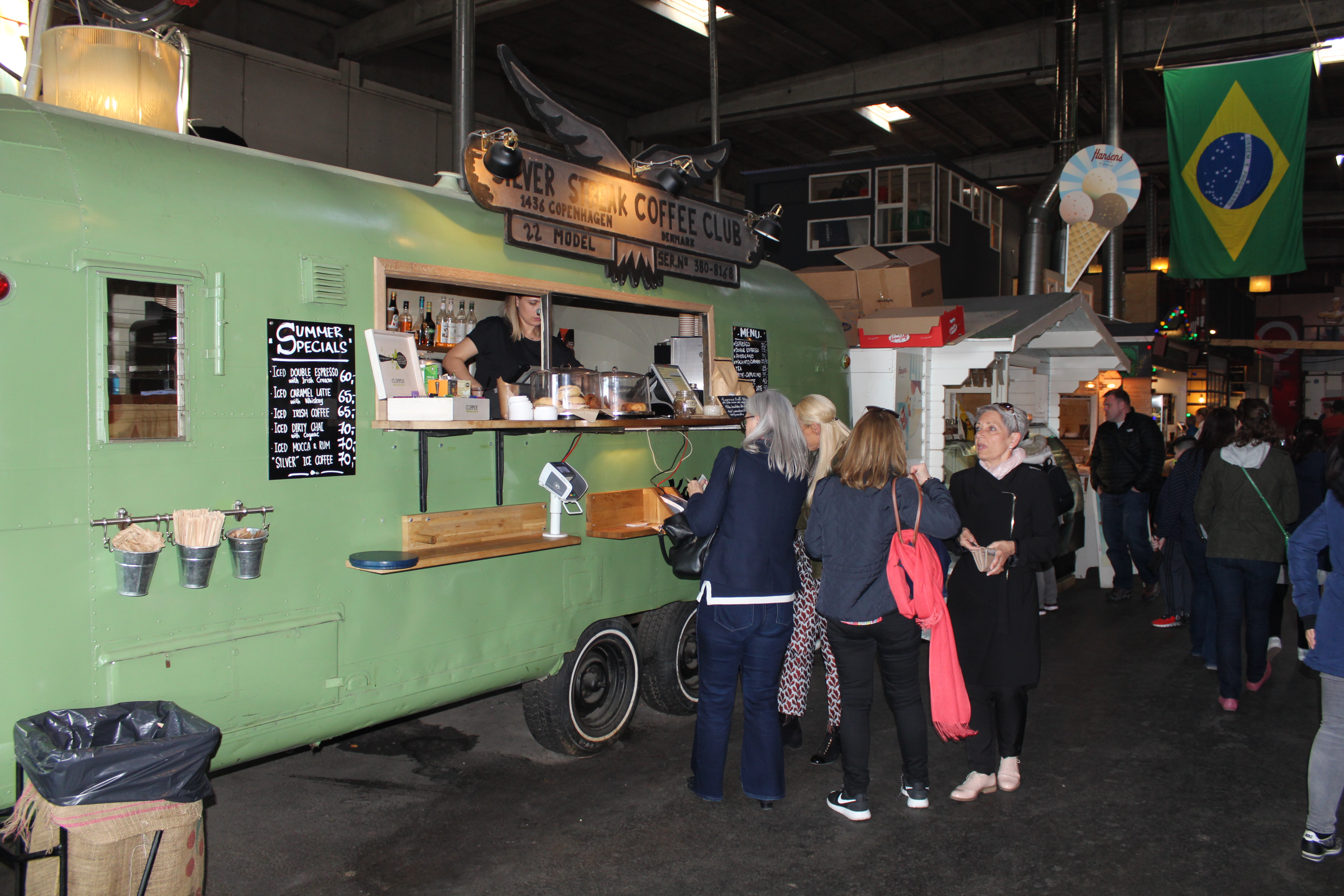
Street food restaurants PAPIRØEN – indoor:
Click on photos and use your zoom control and you see the in full screen size.
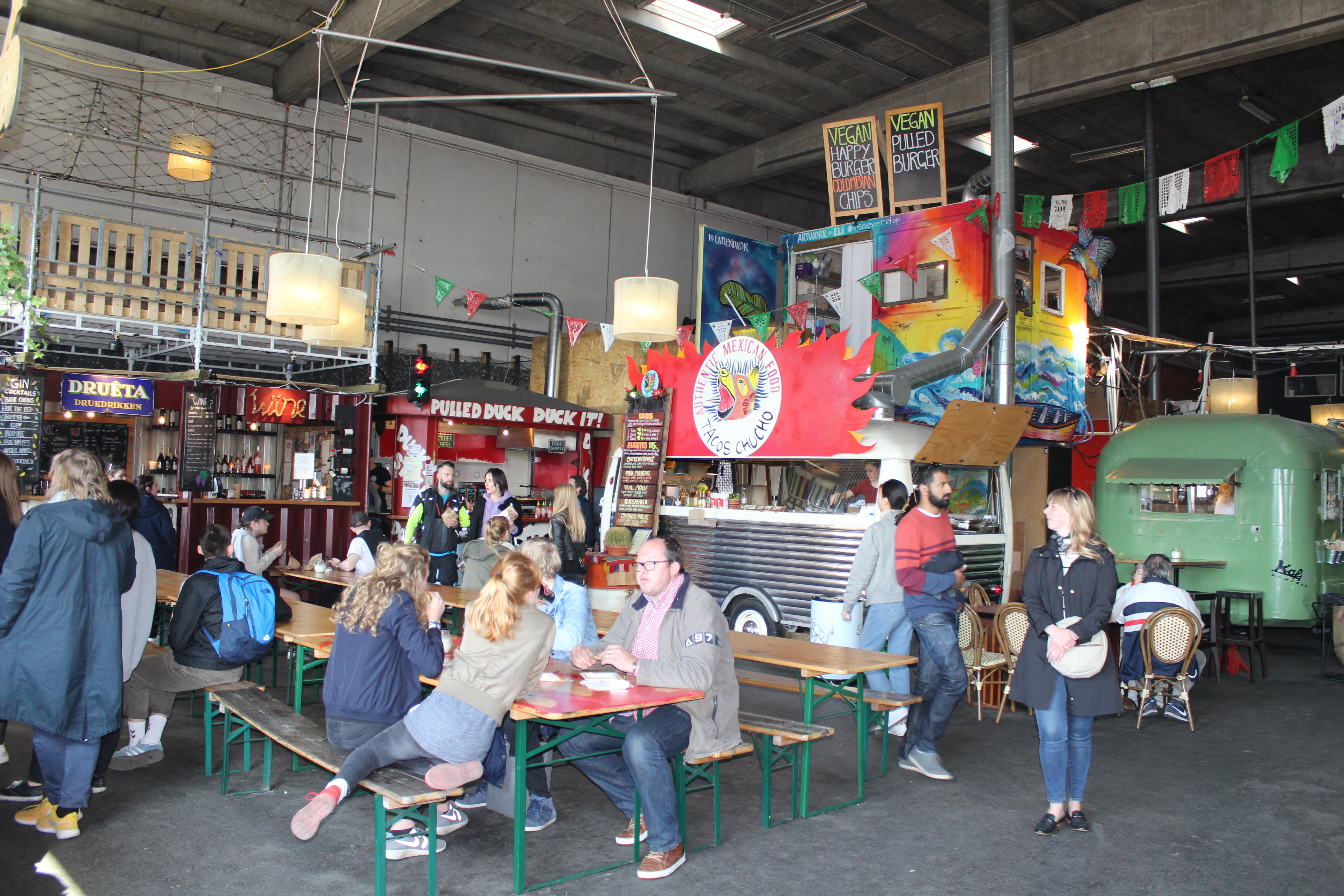
Street food restaurants PAPIRØEN – indoor:
Click on photos and use your zoom control and you see the in full screen size.
Street food restaurants PAPIRØEN – outdoor:
Click on photos and use your zoom control and you see the in full screen size.
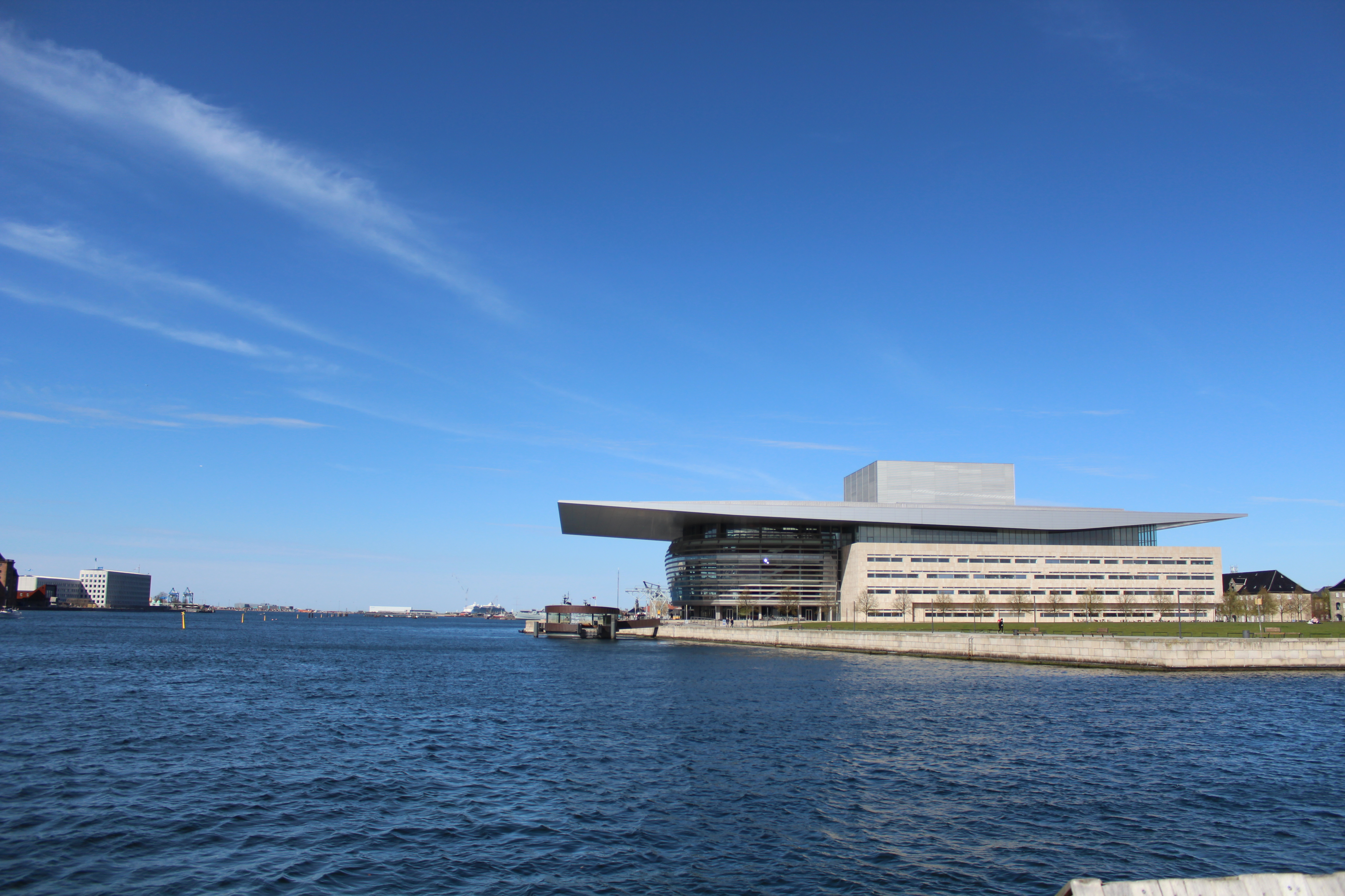
Copenhagen Inner Harbour – view to Copenhagen Opera built 2002-04:
Click on photos and use your zoom control and you see the in full screen size.
Copenhagen Inner Harbour
– view in direction west to new walk and bike slide bridge “Inderhavnsbroen”:
Street food restaurants PAPIRØEN – outdoor:
Click on photos and use your zoom control and you see the in full screen size.

Paper Island – Papirøen, Holmen.
Relaxed “Cosy” atmosphere at bulwarks in Copenhagen Inner Harbour:
Click on photos and use your zoom control and you see the in full screen size.

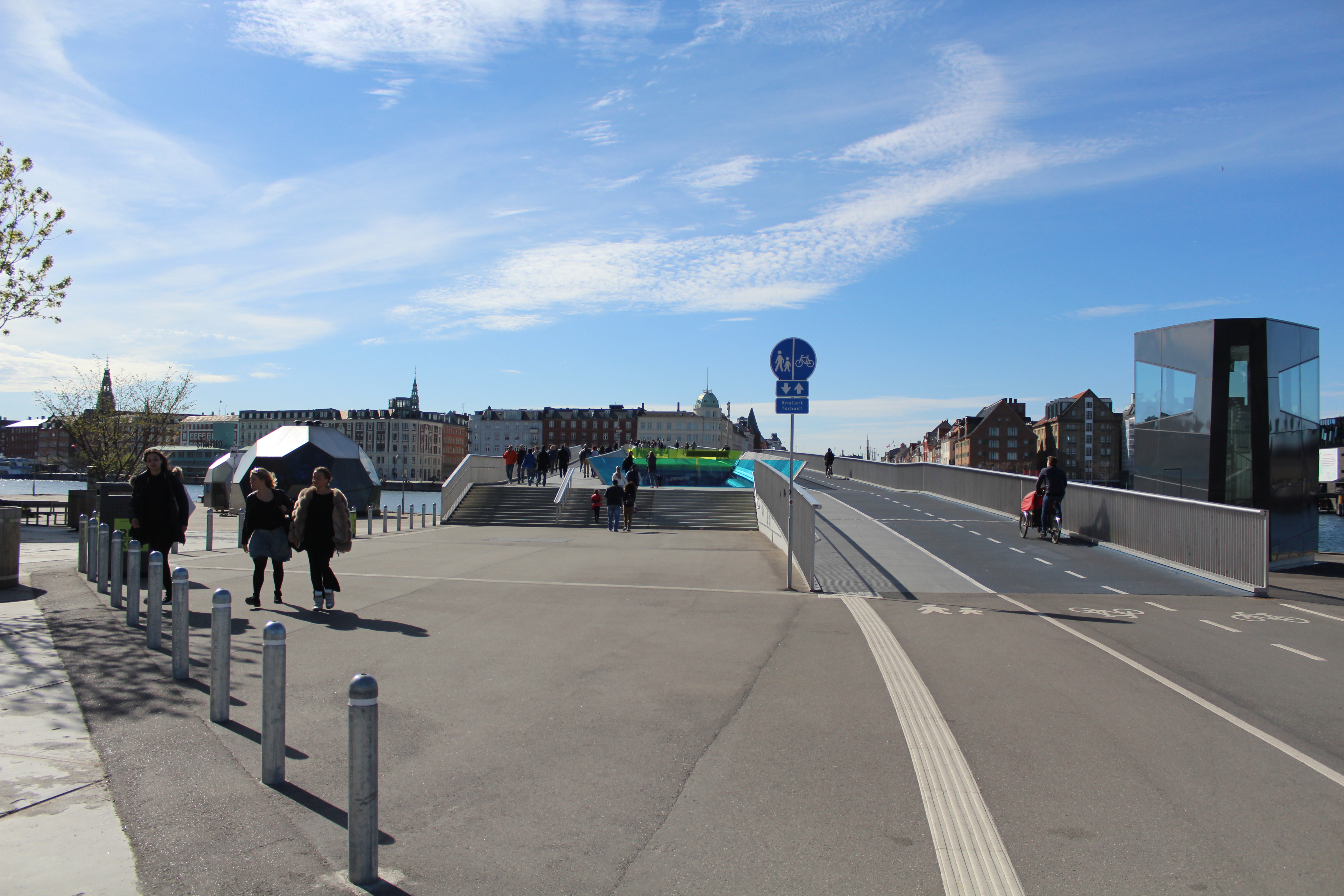
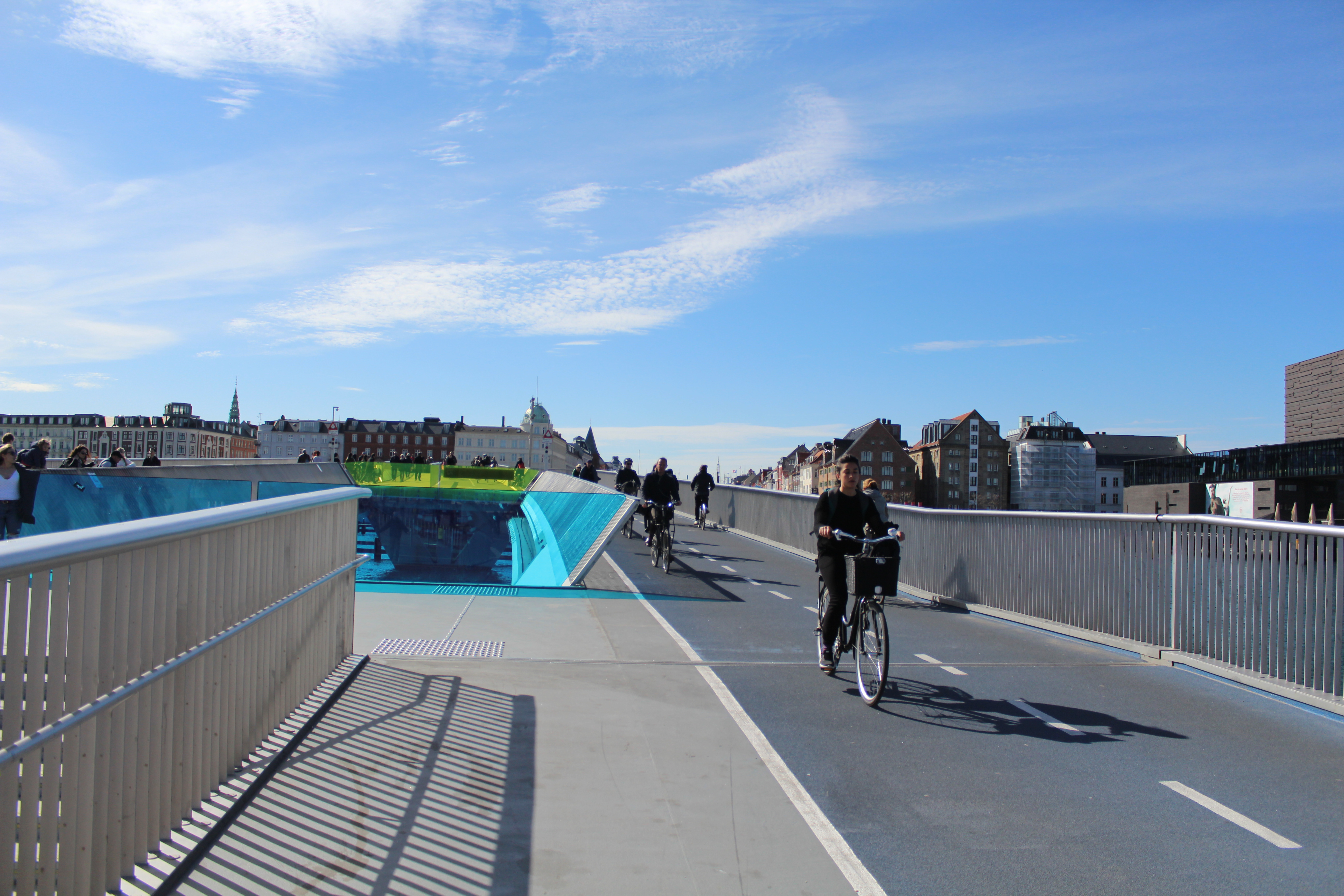
New walk and bike slide bridge “Inderhavnsbroen” constructed 2013-16 – opened 6. july 2016:
Click on photos and use your zoom control and you see the in full screen size.
New bike and walk bridge between Christianshavn – Greenland- and Iceland Squares and Arsenaløen:
Click on photos and use your zoom control and you see the in full screen size.

View in direction west to Christianshavn Canal from new bike-and walk bridge “Trangravsbroen”:
Click on photos and use your zoom control and you see the in full screen size.

New bike and walk slide bridge “Inderhavnbroen” between Christianshavn – Greenland Square and Nyhavn:
Click on photos and use your zoom control and you see the in full screen size.
New bike and walk bridge “Inderhavnsbroen” between Christianshavn and Nyhavn – constructed 2013-16:
Click on photos and use your zoom control and you see the in full screen size.
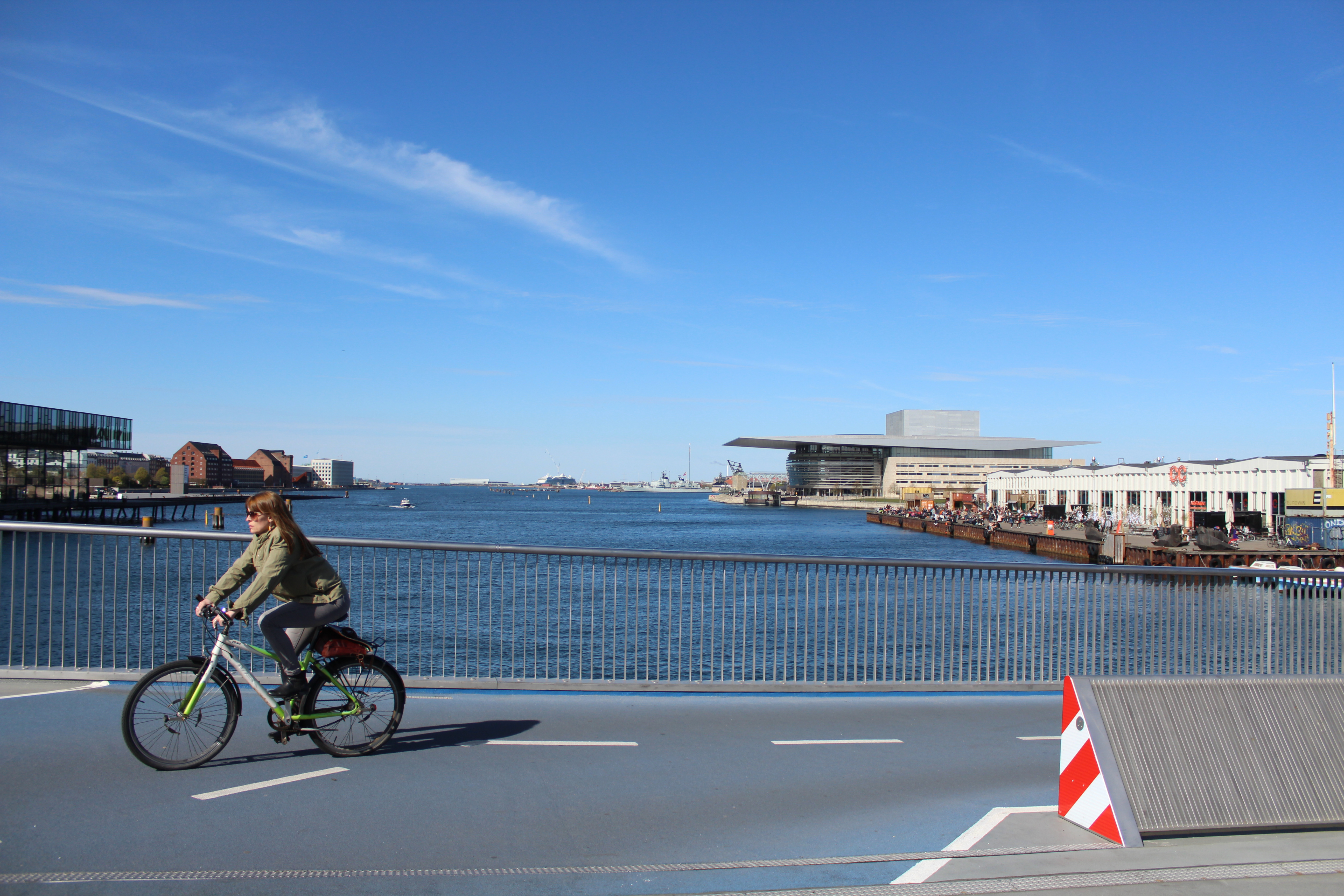
New bike and walk bridge “Inderhavnsbroen” between Christianshavn and Nyhavn – constructed 2013-16 – view in direction east to Copenhagen Inner Harbour, Copenhagen Opera, street food restaurants Paper Island (Papirøen) and and museum Navy Ship “Peder Skram”:
Click on photos and use your zoom control and you see the in full screen size.

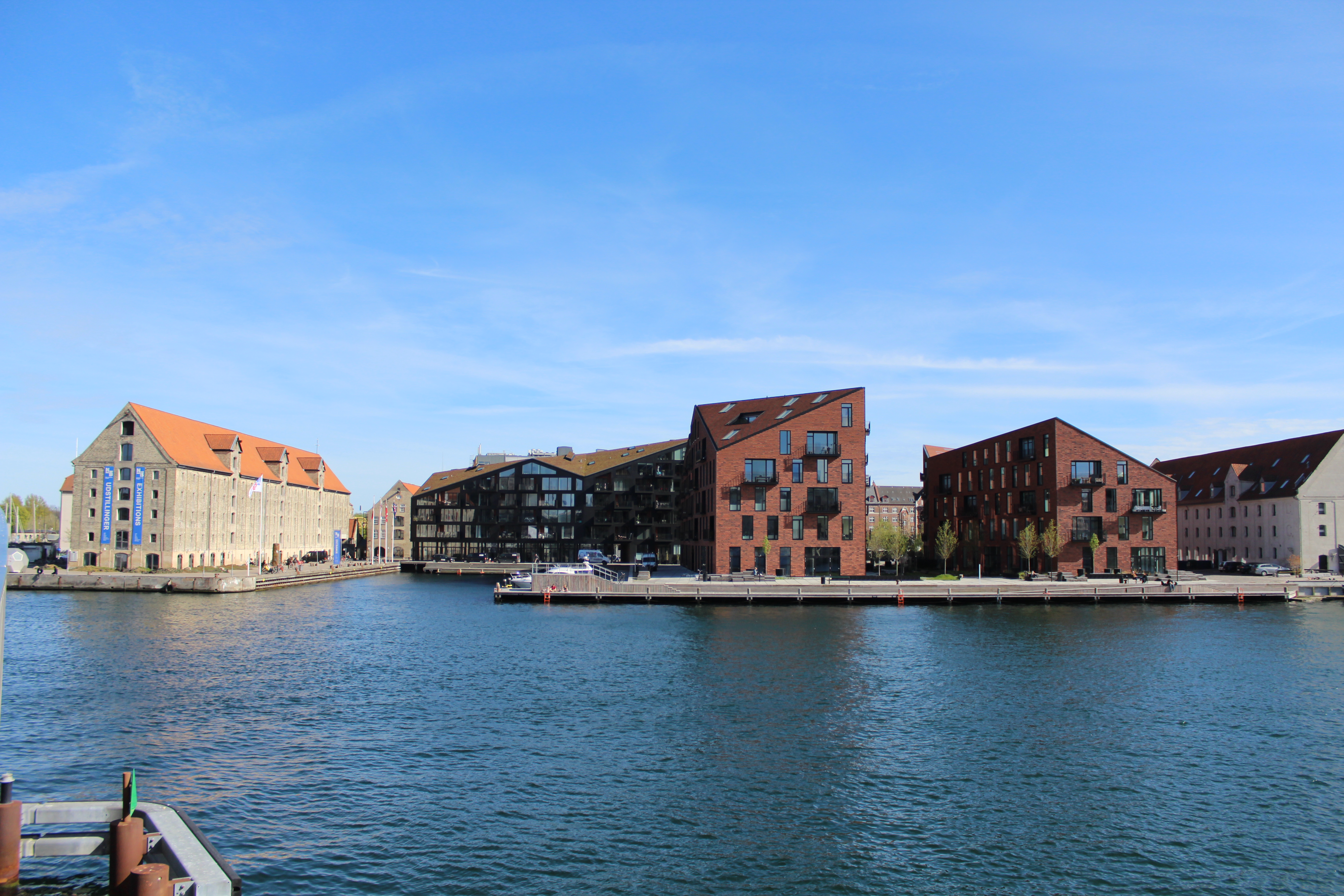
View in direction south to Greenland Square (Nordatlantens Brygge) on Christianshavn with Store house built 1766-69 and 3 new residential houses built 2012-16 on Krøyers Square:
Click on photos and use your zoom control and you see the in full screen size.
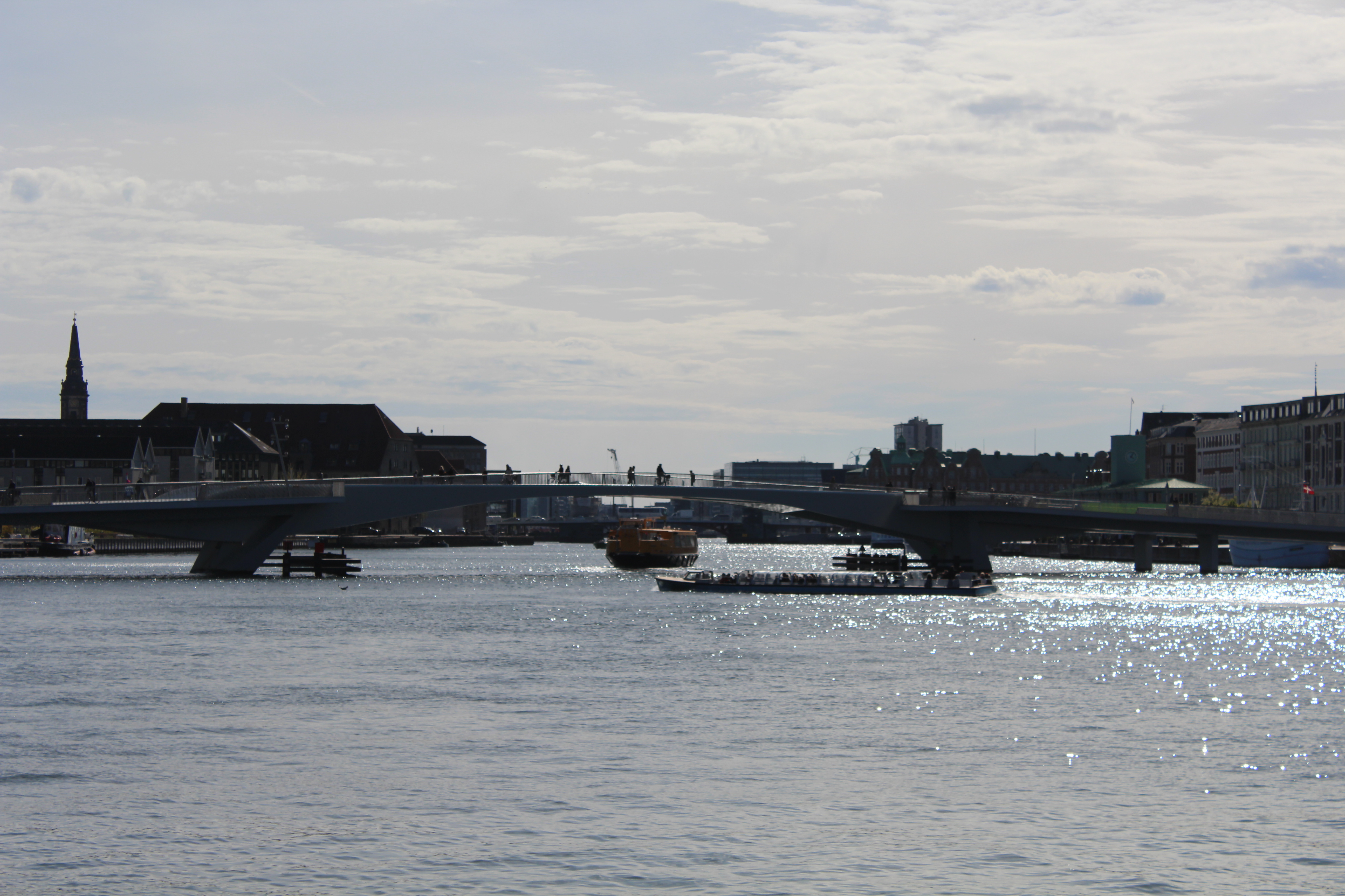
View in direction west to Copenhagen Inner Harbour to Knippels Bridge connecting Copenhagen City with Christianshavn:
Click on photos and use your zoom control and you see the in full screen size.

View in direction north to Nyhavn from new bike and walk slide bridge “Inderhavnbroen”:
Click on photos and use your zoom control and you see the in full screen size.

View in direction north to Nyhavn from new bike and walk slide bridge “Inderhavnbroen”:
Click on photos and use your zoom control and you see the in full screen size.

View in direction north to Nyhavn from new bike and walk slide bridge “Inderhavnbroen”:
Click on photos and use your zoom control and you see the in full screen size.

New bike and walk slide bridge “Inderhavnsbroen” – view from Nyhavn in direction south to Christianshavn:
Click on photos and use your zoom control and you see the in full screen size.

View in direction south from Nyhavn to new bike and walk slide bridge “Inderhavnsbroen” passing Copenhagen Inner Harbour from Nyhavn to Christianshavn:
Click on photos and use your zoom control and you see the in full screen size.

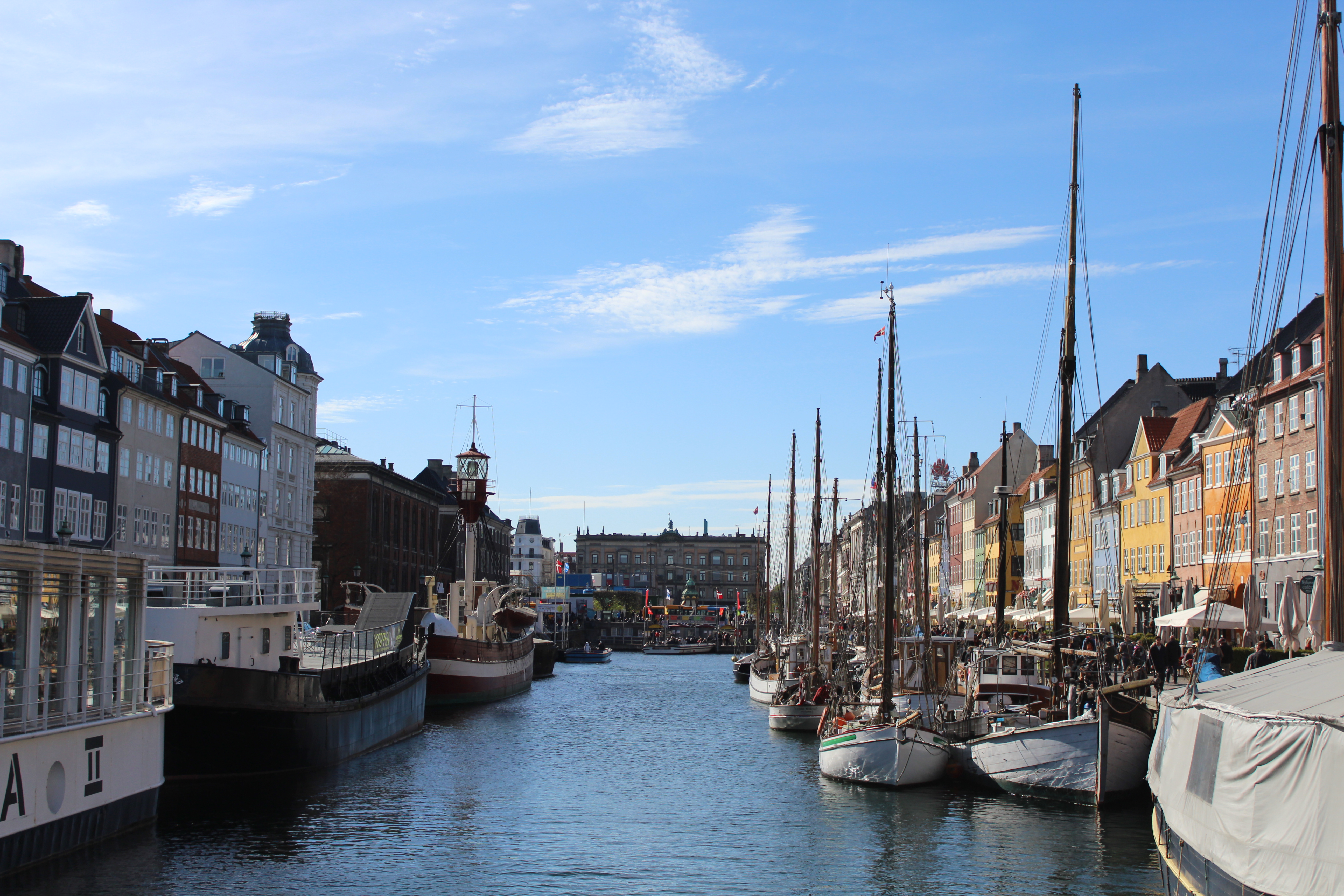
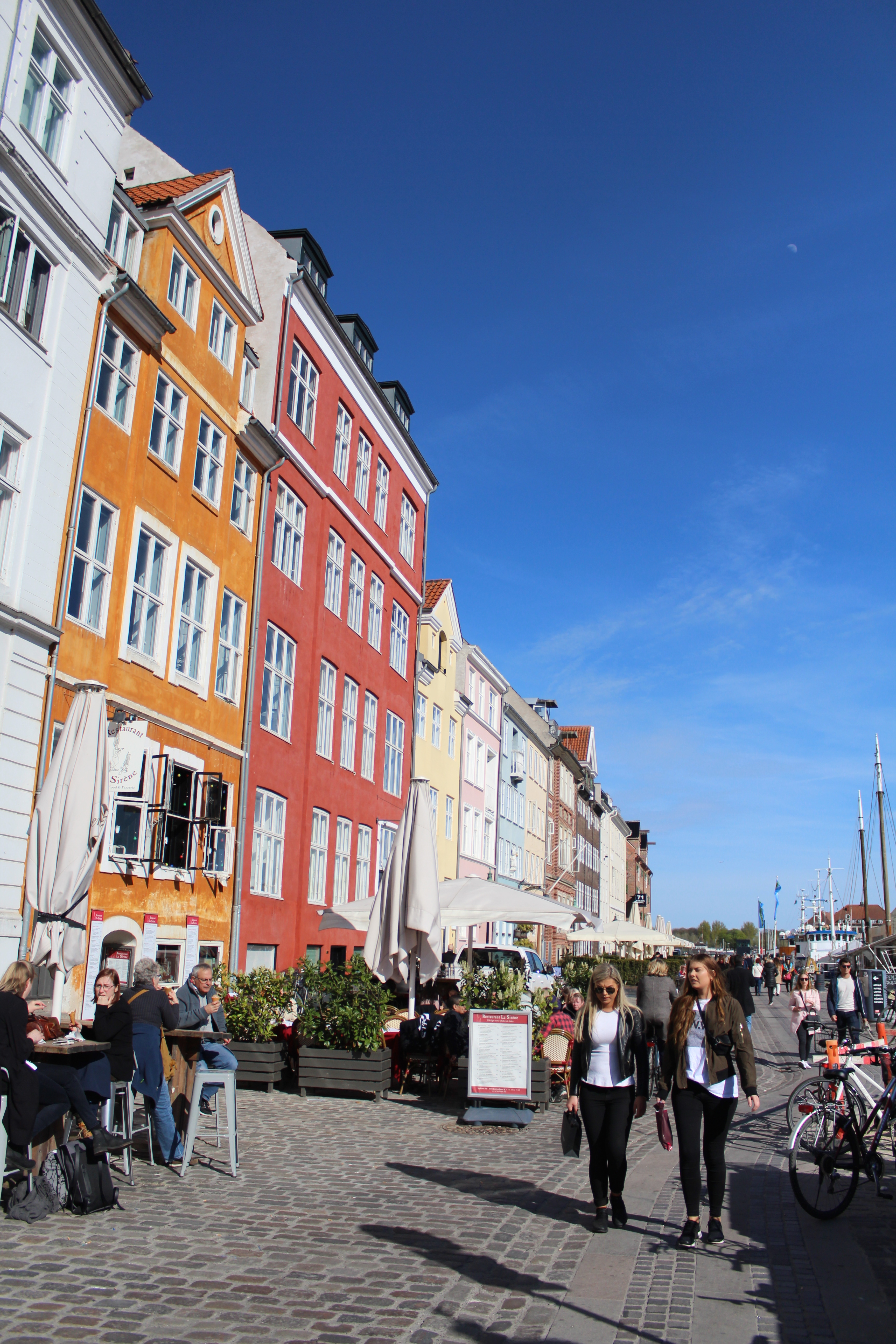
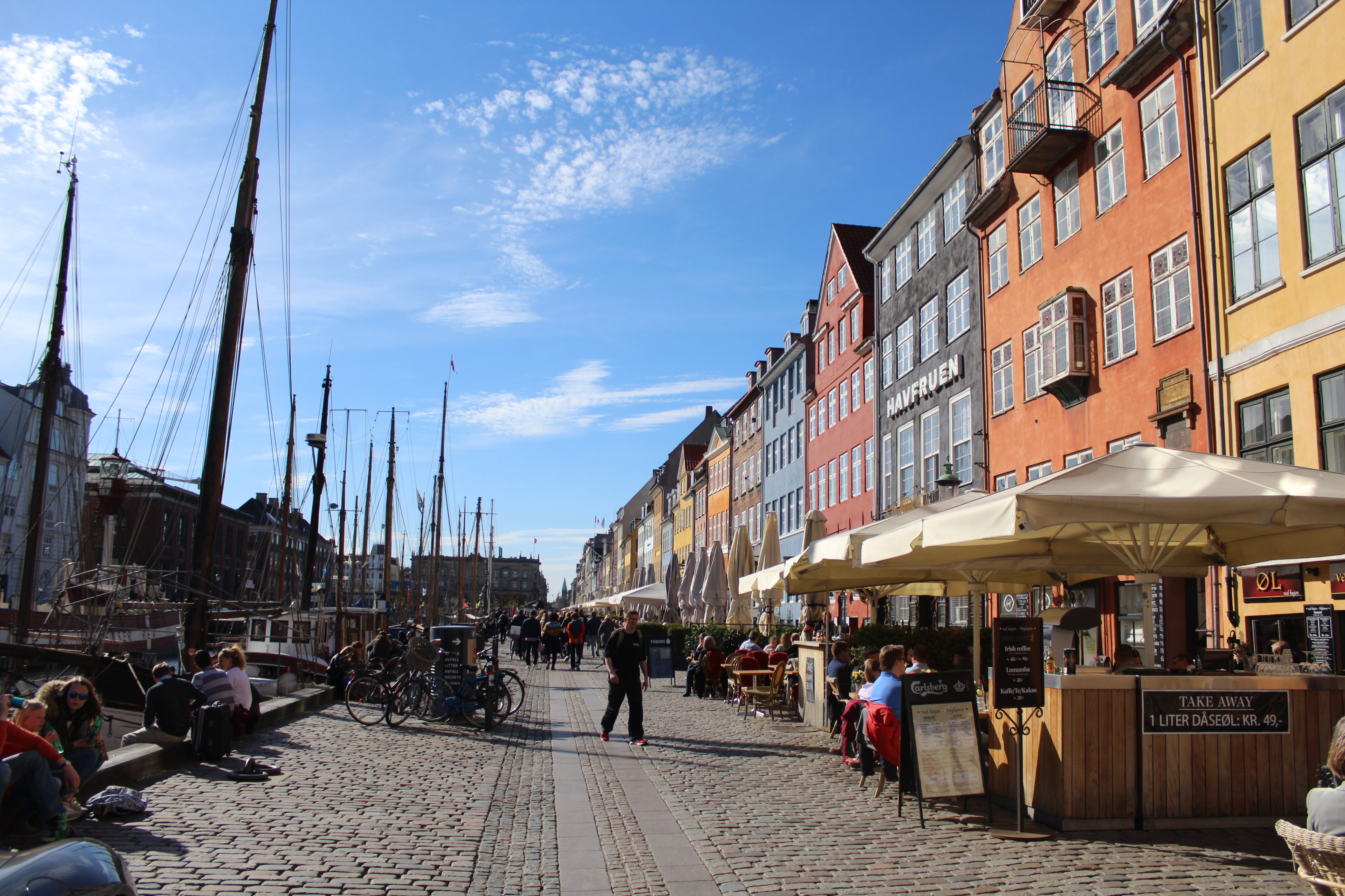
Nyhavn – spring 2017 – cosy danish atmosphere of love, joy and fun:
New Harbour, Nyhavn built as a canal in 1671-73:
View to right on photo below the eastern/northern side of the canal, “the sunny side” with residence houses and former storehouses and the wharf (bolwark) of the canal King Christian 5 built in 1671-73. The canal is 400 meter long, 25 meter wide and 3 meter deep. The king wanted to stimulate trade and to get a direct acces to the new central square Kongens Nytorv. From now on merchantships could do their loading and piloting close to the merchantyards- and houses in Nyhavn.
Click on photos and use your zoom control and you see the in full screen size.
Nyhavn – view in direction south to Copenhagen Inner Harbour – danish fairy tail writer Hans Christian Andersen (1805-75) lived in house nr. 67 from 1845-64 on “the sunny side” of Nyhavn:
Click on photos and use your zoom control and you see the in full screen size.
View to “sunny” side of Nyhavn with outdoor restaurants and cosy poetic atmosphere on the bulwark:
Click on photos and use your zoom control and you see the in full screen size.
Nyhavn – relaxed atmosphere on outdoor restaurants on “sunny side” of Nyhavn:
Click on photos and use your zoom control and you see the in full screen size.

Nyhavn – old wood sailing ships at bulwark – spring 2017:
Click on photos and use your zoom control and you see the in full screen size.

Nyhavn – old wood sailing ships at bulwark – spring 2017:
Click on photos and use your zoom control and you see the in full screen size.

I hope that you have enjoyed my impressions on my afternoon visit to Copenhagen 3. may 2017.
I live 60 km north of Copenhagen close to Kattegat Sea and enjoy to visit Copenhagen once a week.
Open your mind and spirit to the beauty of life and meet all people of all ages and all nations with an open heart full of love and forgiveness.
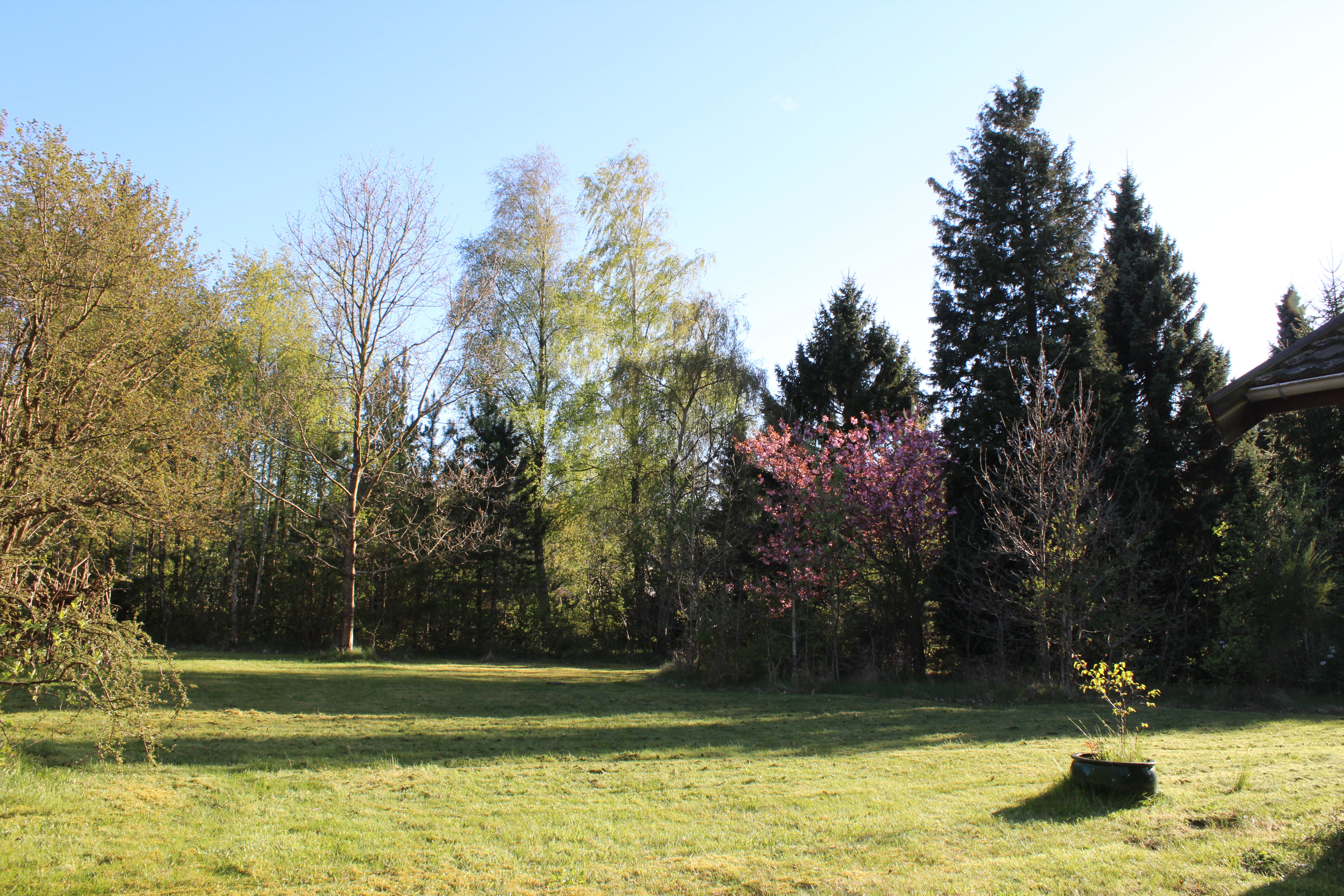
The beauty of light and shadow in nature:
Twilight spring 2017 in Melby, North Sealand, Denmark:
View to my garden the 8. may 2017 at 7 pm:
Click on photos and use your zoom control and you see the in full screen size.
And early morning 9. may 2017 8 am:
Click on photos and use your zoom control and you see the in full screen size.

-and the same subject MIDDAY 12. may at 2 PM:
Click on photos and use your zoom control and you see the in full screen size.

Text and photos copyright by Erik K Abrahamsen 2017
All right reserved
Enjoy life – be happy!
Melby , Nortsealand, Denmark 5. mai 2017
Best wishes
Erik
Updated 12. may 2017