København forår 2019 – oplev Inderhavnen, ny cykel- og gangbroer “Inderhavnsbroen” og “Lille Langebro”, Nyhavn, Kongens Nytorv og Rosenborg Slot i Kongens Have.
Text and photos by Erik K Abrahamsen, april and may 2019.
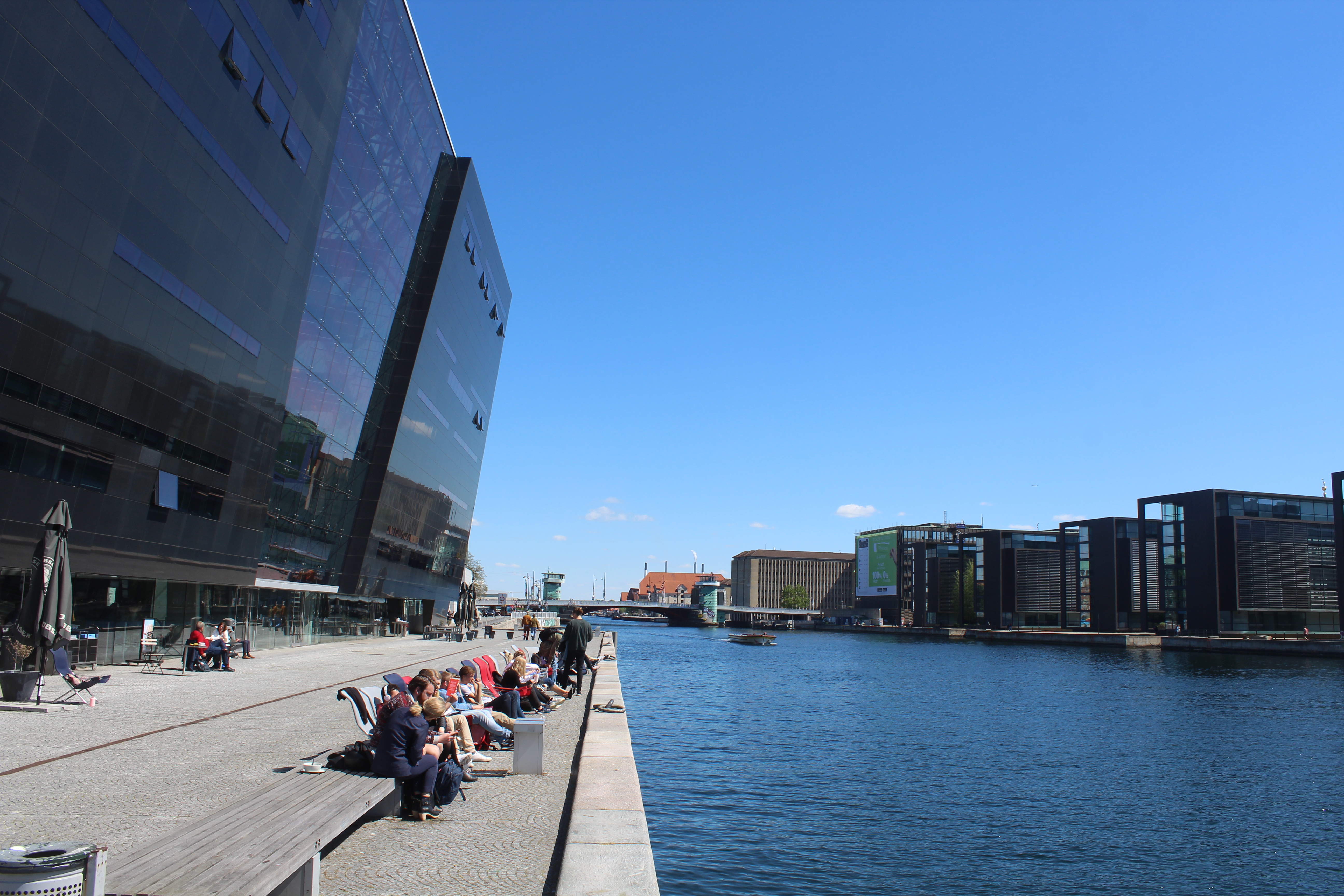
Royal Danish Library, “Diamanten”, Copenhagen Inner Harbour:
Click on photos and use your zoom control and you see them in full screen size.
Here in spring 2019 I will take you on a 5 km walk, bike and run trip from shopping center Fisketorvet on Havneholmen through Copenhagen Inner Harbour to Nyhavn, Kings Square and Kings Garden with Rosenborg Palace.
Its midday – lunchtime and the weather is beautiful with around 20 degrees celcius.
In the last 20 years Copenhagen Inner Harbour has been open up for residences and recreation for all inhabitants of Copenhagen.
From serving as a busy commercial harbour the last 500 years now Copenhagen Inner Harbour have become a unique area of splendid architecture, walk and bike bridges, swimming pools close to wharfs and bathing in the clean water of the harbour.
You can walk, run and bike along the north- and south side of Copenhagen Inner Harbour.
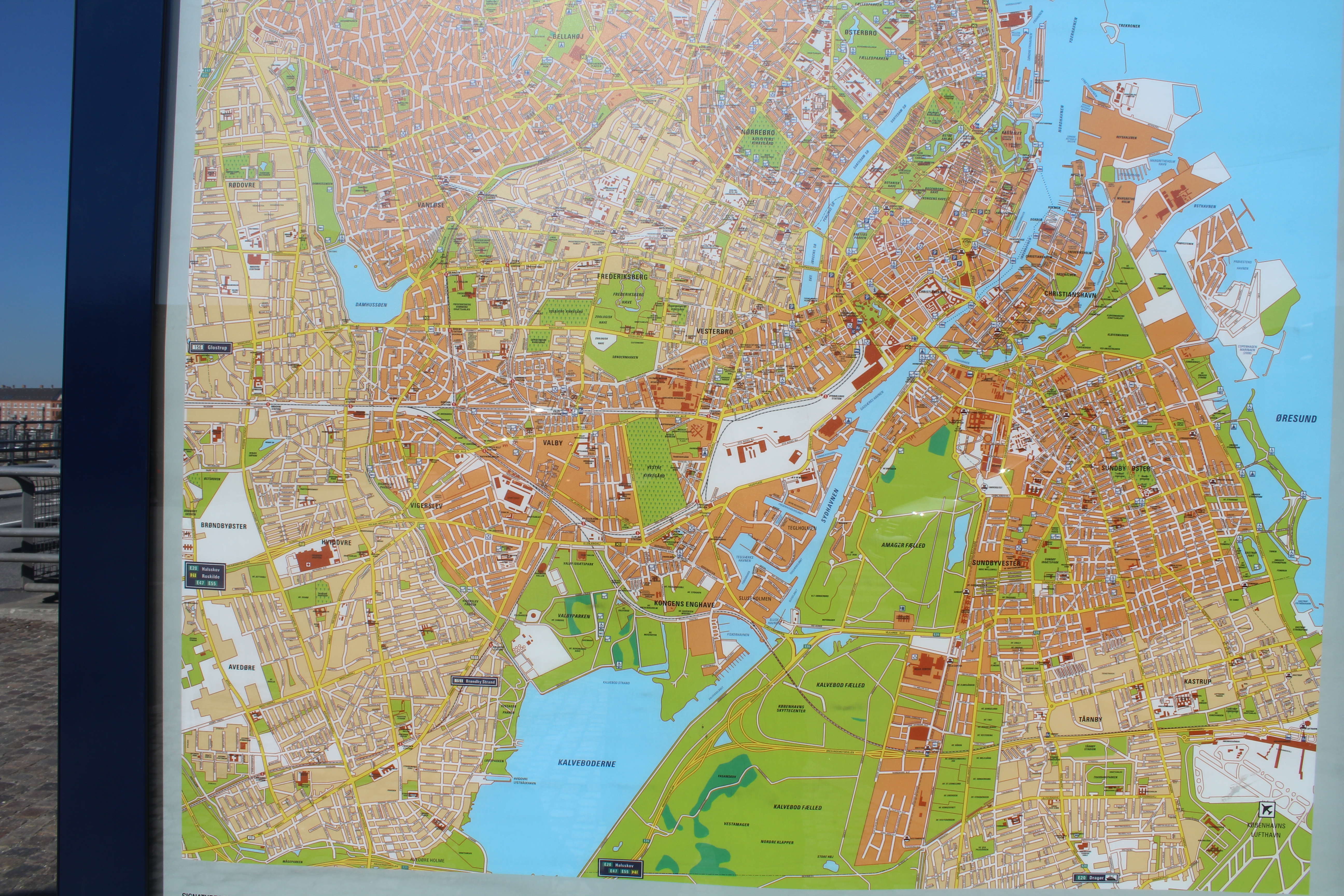
Map of Copenhagen:
Click on photos and use your zoom control and you see them in full screen size.
I start my walk and bike at Fisketorvet Shopping Center close to The Snake Bridge “Cykelslangen” at Havneholmen in Copenhagen Inner Harbour.
Fisketorvet, Havneholmen at Copenhagen Inner Harbour – view to The Snake Bridge (Cykelslangen) i direction east to Inner Harbour:
Click on photos and use your zoom control and you see them in full screen size.

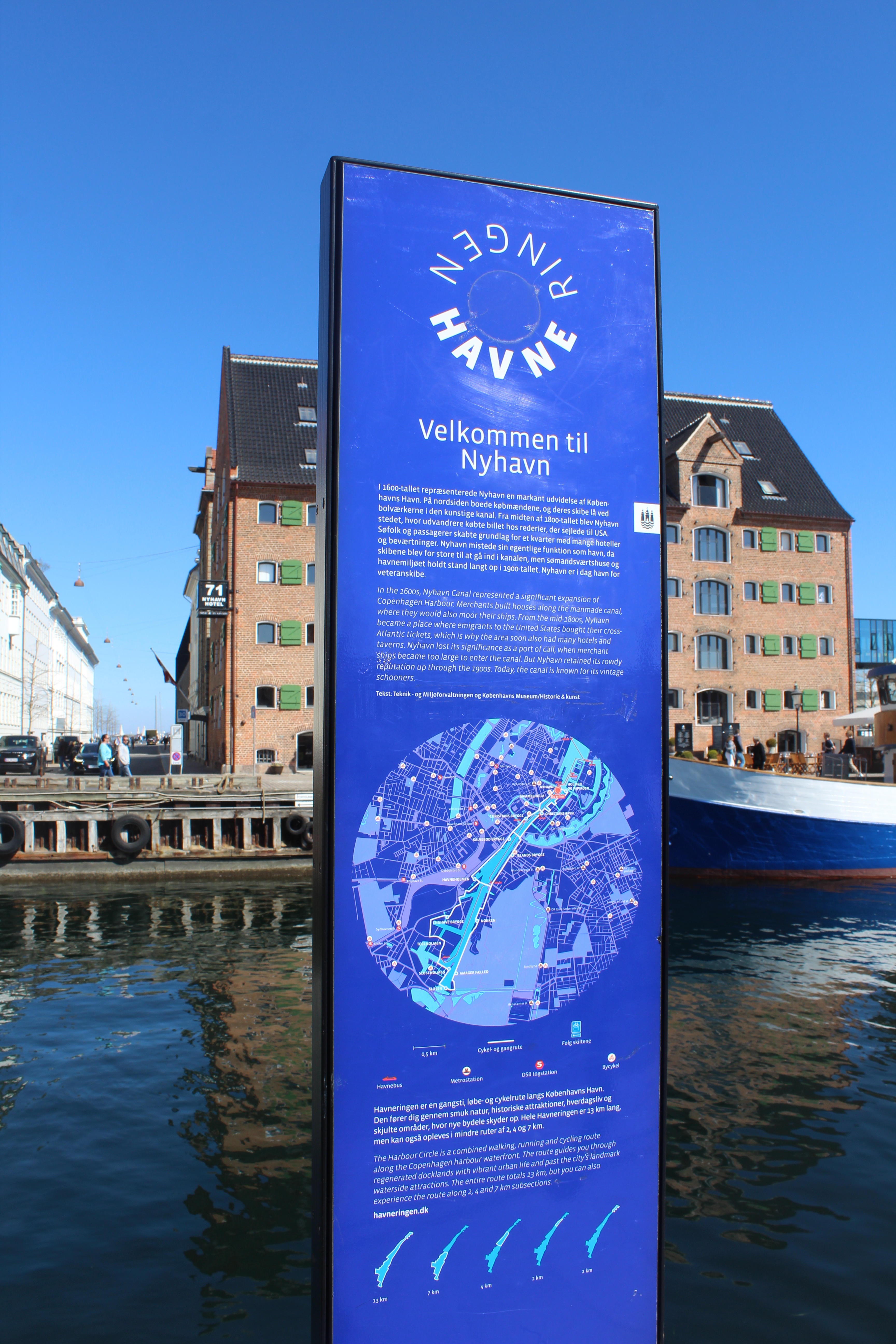
From east at Nyhavn/”Inderhavnsbroen” to west at Sluseholmen and back you can follow the 13 km long “Havneringen” alongside quays and wharfs:
Map of the 13 km long walk-, run- and bike route “Havneringen” in Copenhagen Inner Harbour:
Click on photos and use your zoom control and you see them in full screen size.

Map of “Havneringen” in Copenhagen Inner Harbour. Thanks to Copenhagen Kommune, Teknik- og Miljøforvaltningen for using this map.
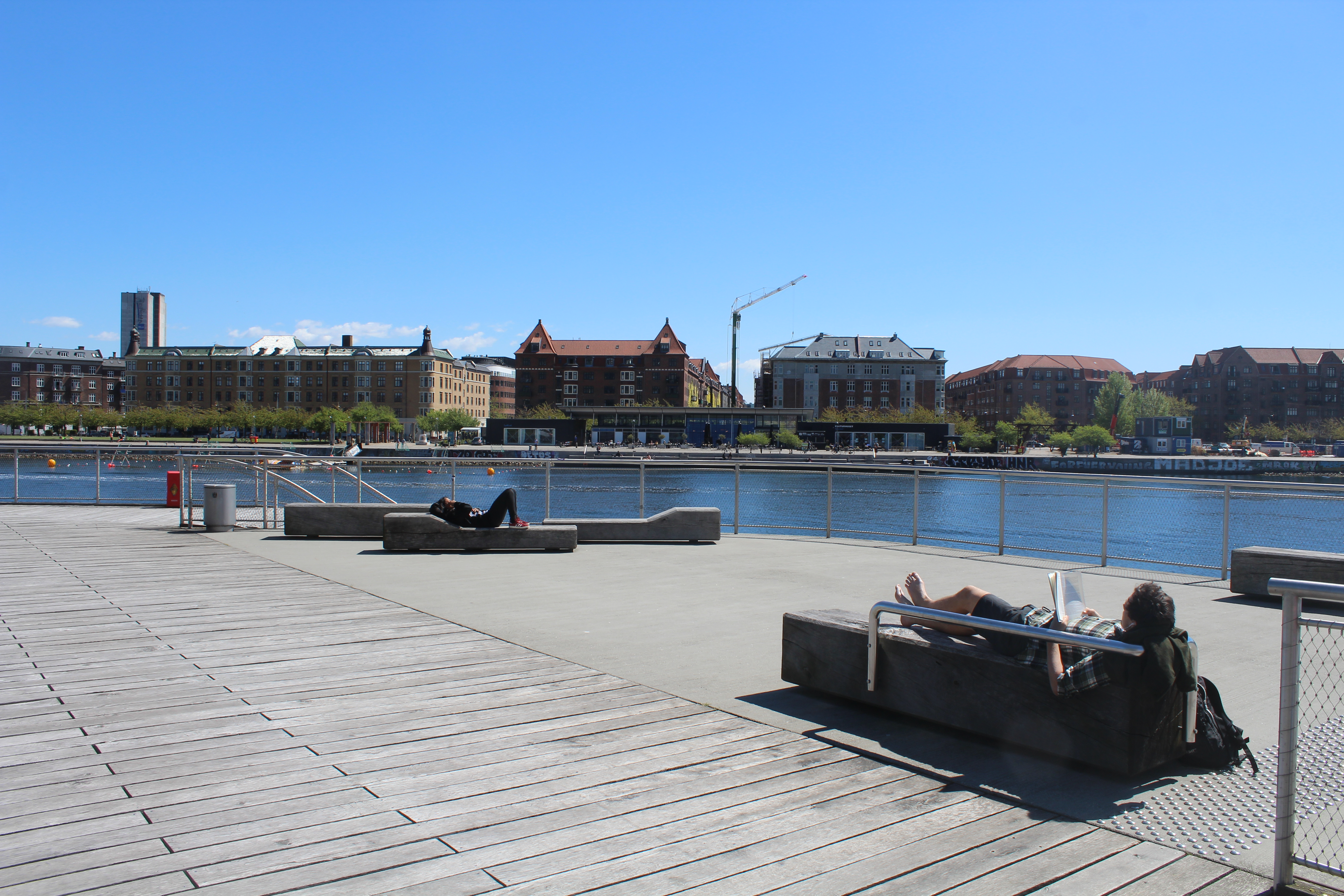
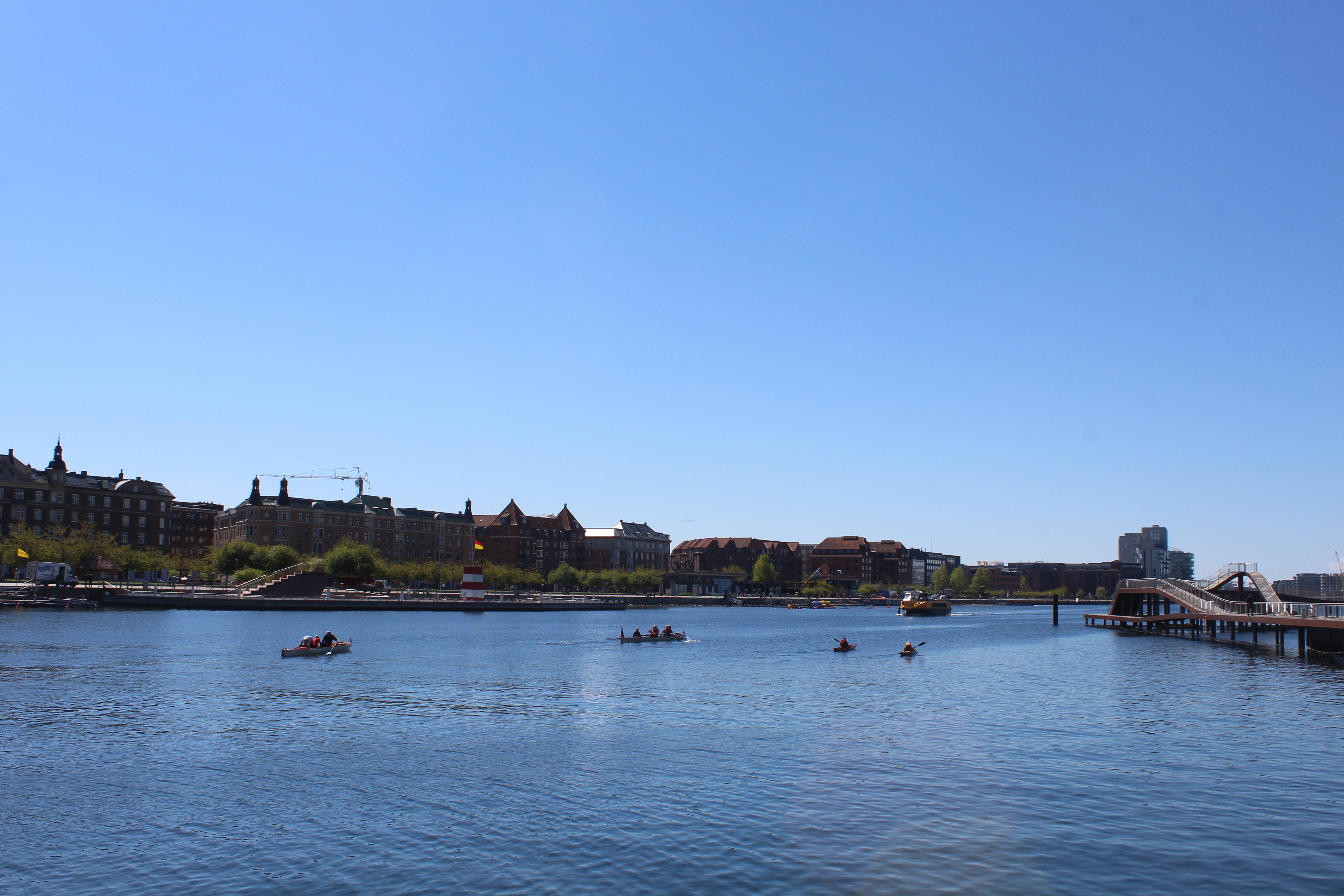
I walk/bike on wharfs alongside Copenhagen Inner Harbour from Havneholmen to Kalvebod Brygge:
Kalvebod Brygge:
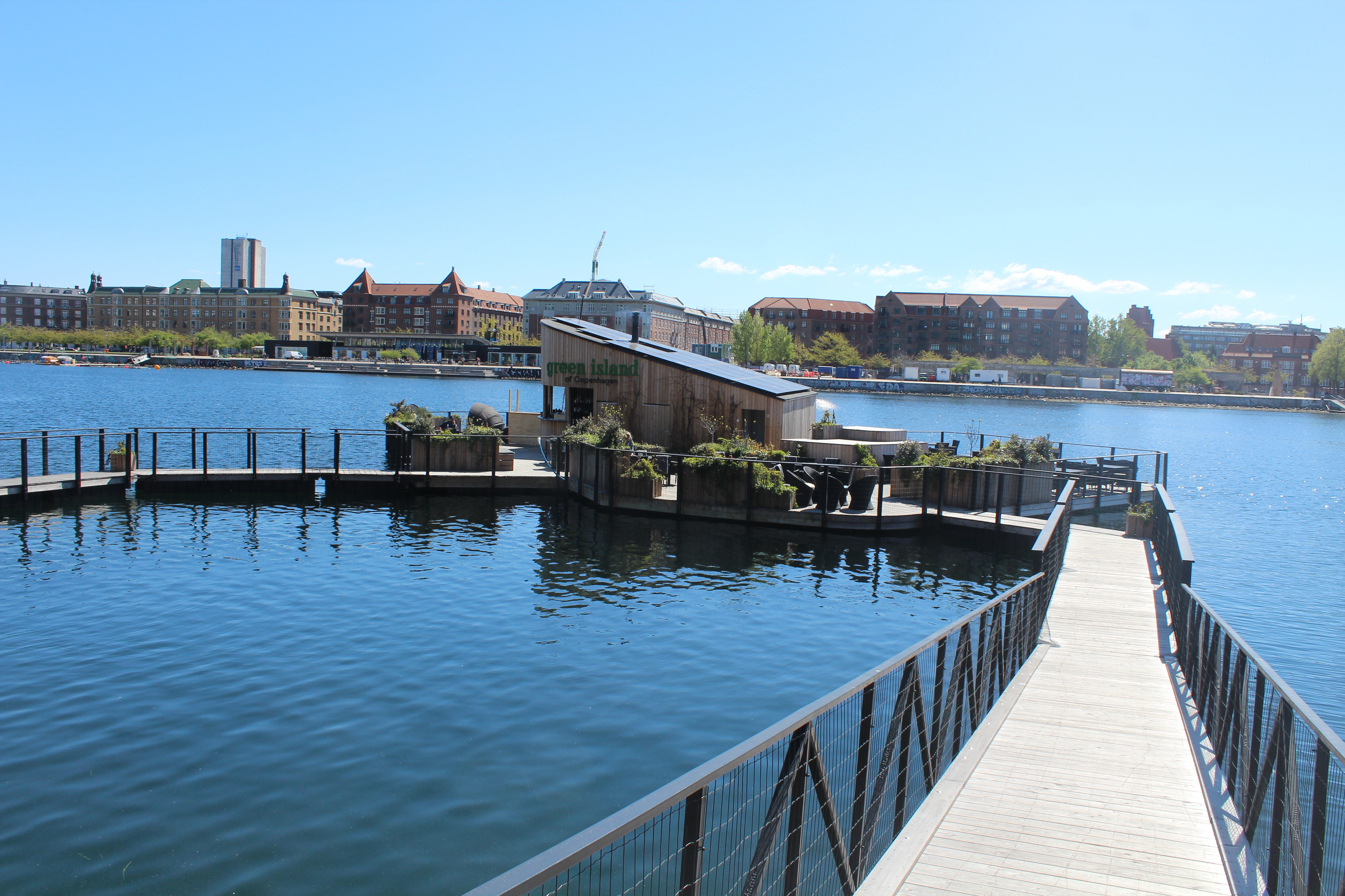
I pass this water restaurant “green Island” in Copenhagen Inner Harbour:
Click on photos and use your zoom control and you see them in full screen size.
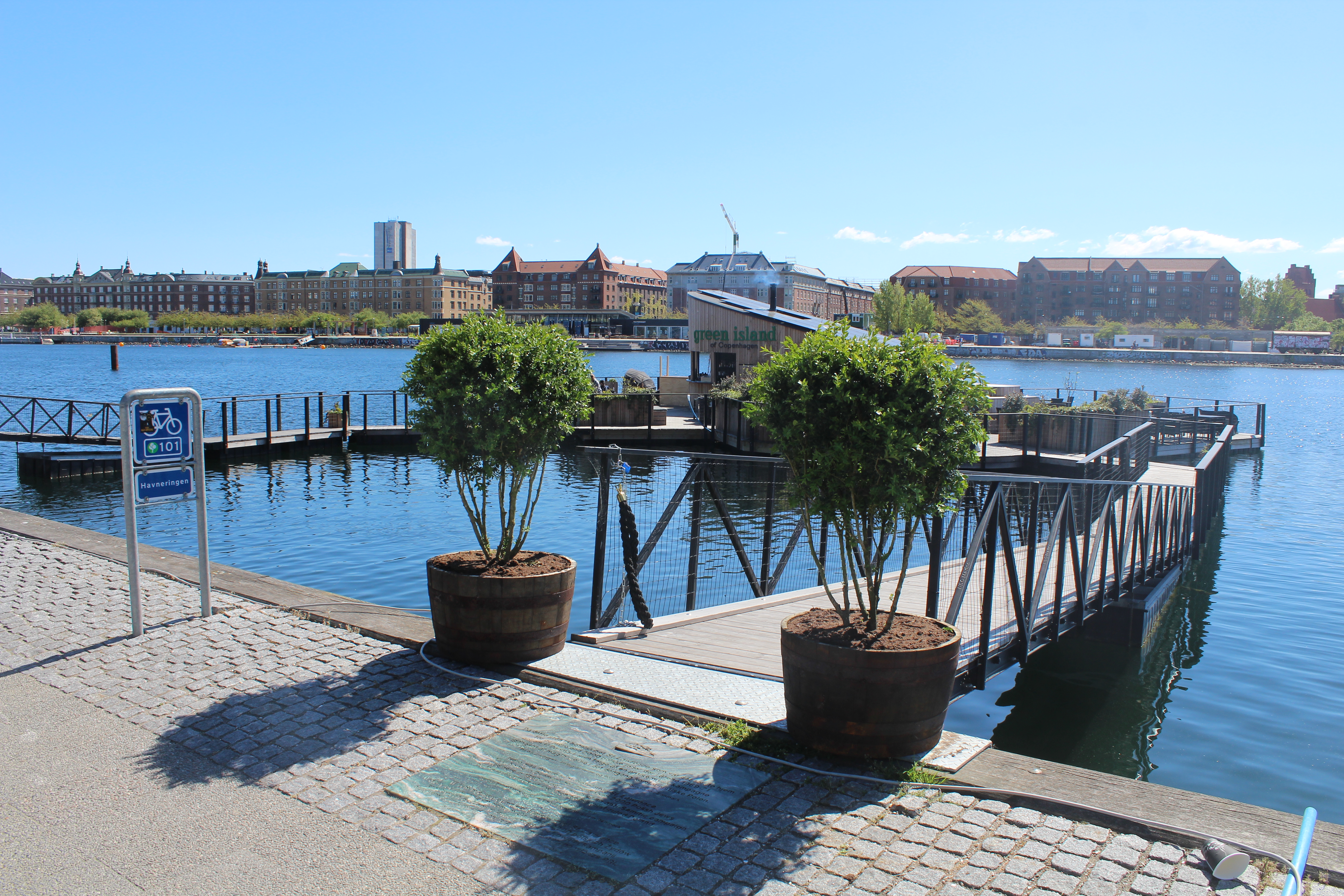
Restaurant “green Island” in Copenhagen Inner Harbour:
View in direction south ti Islands Brygge on Island Amager.
Click on photos and use your zoom control and you see them in full screen size.
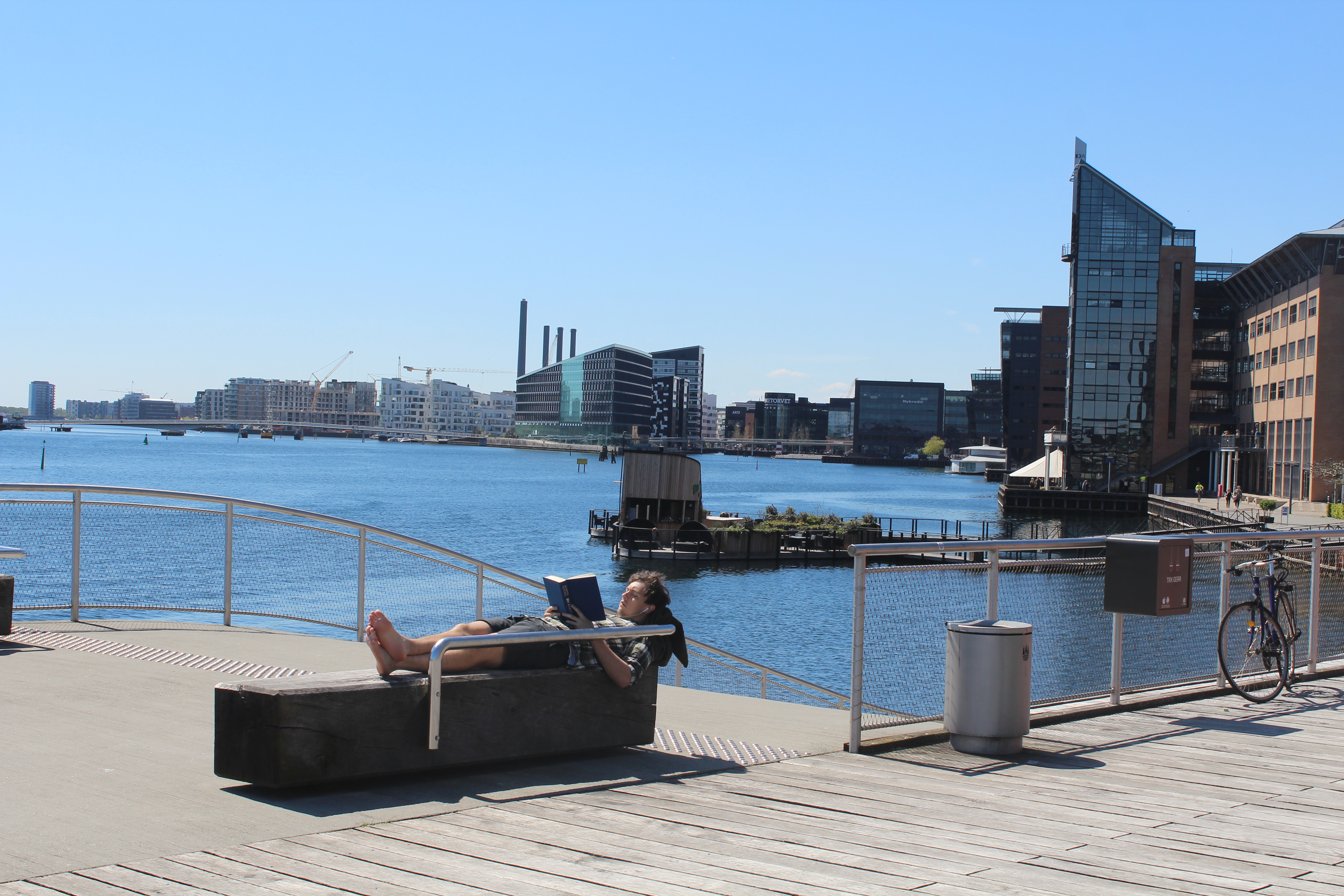
Kalvebod Brygge
– view in direction east to Mariott Hotel and bathing jetty for recreation and exercises in Copenhagen Inner Harbour:
Click on photos and use your zoom control and you see them in full screen size.

Kalvebod Brygge
– bathing jetty for recreation and exercises in Copenhagen Inner Harbour:
Click on photos and use your zoom control and you see them in full screen size.

Kalvebod Brygge
– bathing jetty for recreation and exercises in Copenhagen Inner Harbour:
Click on photos and use your zoom control and you see them in full screen size.

Kalvebod Brygge
– bathing jetty for recreation and exercises in Copenhagen Inner Harbour:
Click on photos and use your zoom control and you see them in full screen size.
View from Kalvebod Brygge to Havneholmen and “Bryggebroen” connecting Havneholmen and Fisketorvet via “The bicycle Snake” (Cykelslangen) with Islands Brygge on Island Amager:
Click on photos and use your zoom control and you see them in full screen size.
View from Kalvebod Brygge to Havneholmen and “Bryggebroen” connecting Havneholmen and Fisketorvet via “The bicycle Snake” (Cykelslangen) with Islands Brygge on Island Amager:
Click on photos and use your zoom control and you see them in full screen size.
Kalvebod Brygge – view to Langebro bridge connecting Copenhagen City with island Amager
– bathing jetty for recreation and exercises in Copenhagen Inner Harbour:
Click on photos and use your zoom control and you see them in full screen size.
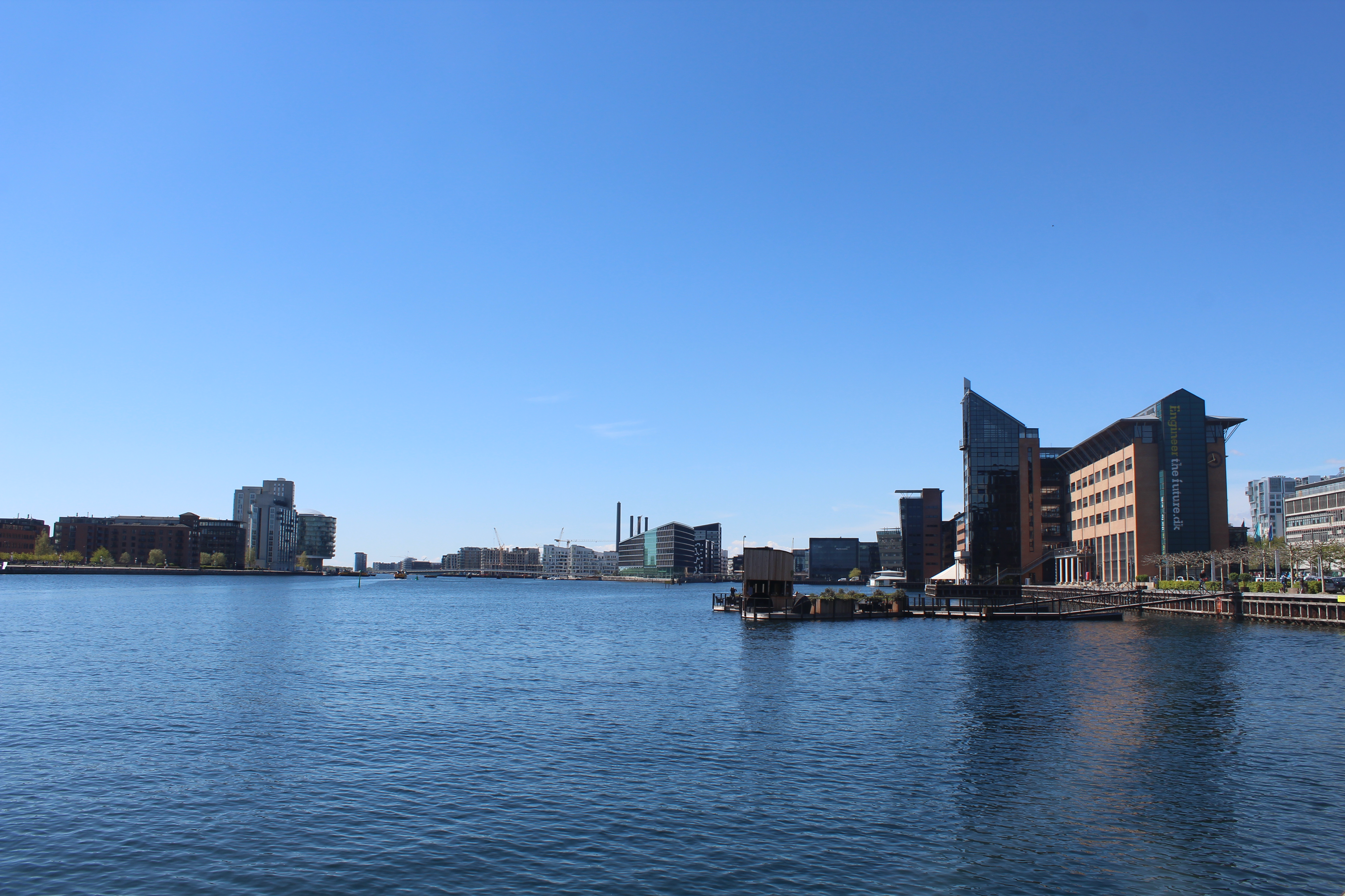
Kalvebod Brygge – view in direction west Copenhagen Inner Harbour and Islands Brygge with outdoor swimming pool:
– bathing jetty for recreation and exercises in Copenhagen Inner Harbour:
Click on photos and use your zoom control and you see them in full screen size.
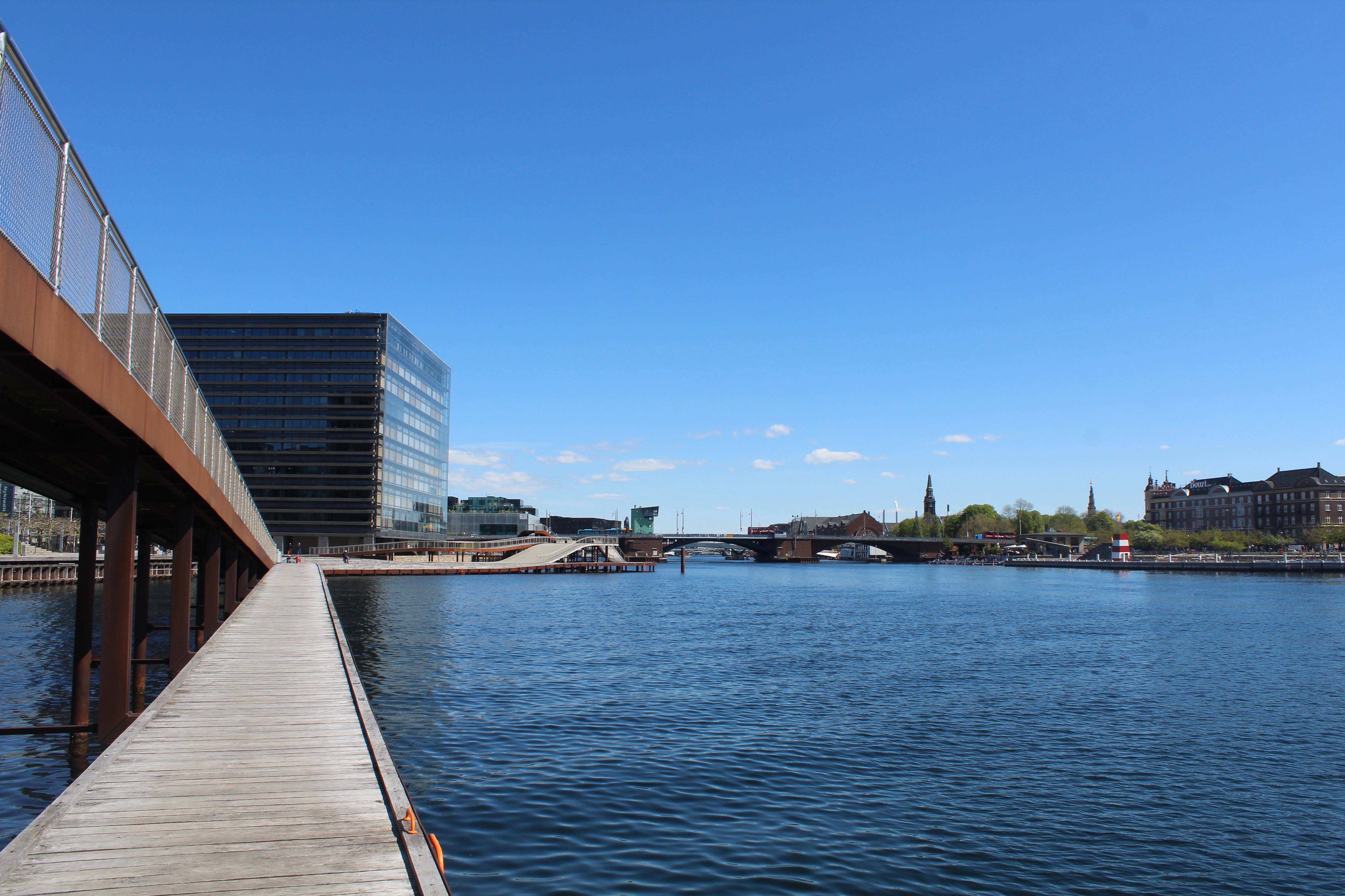
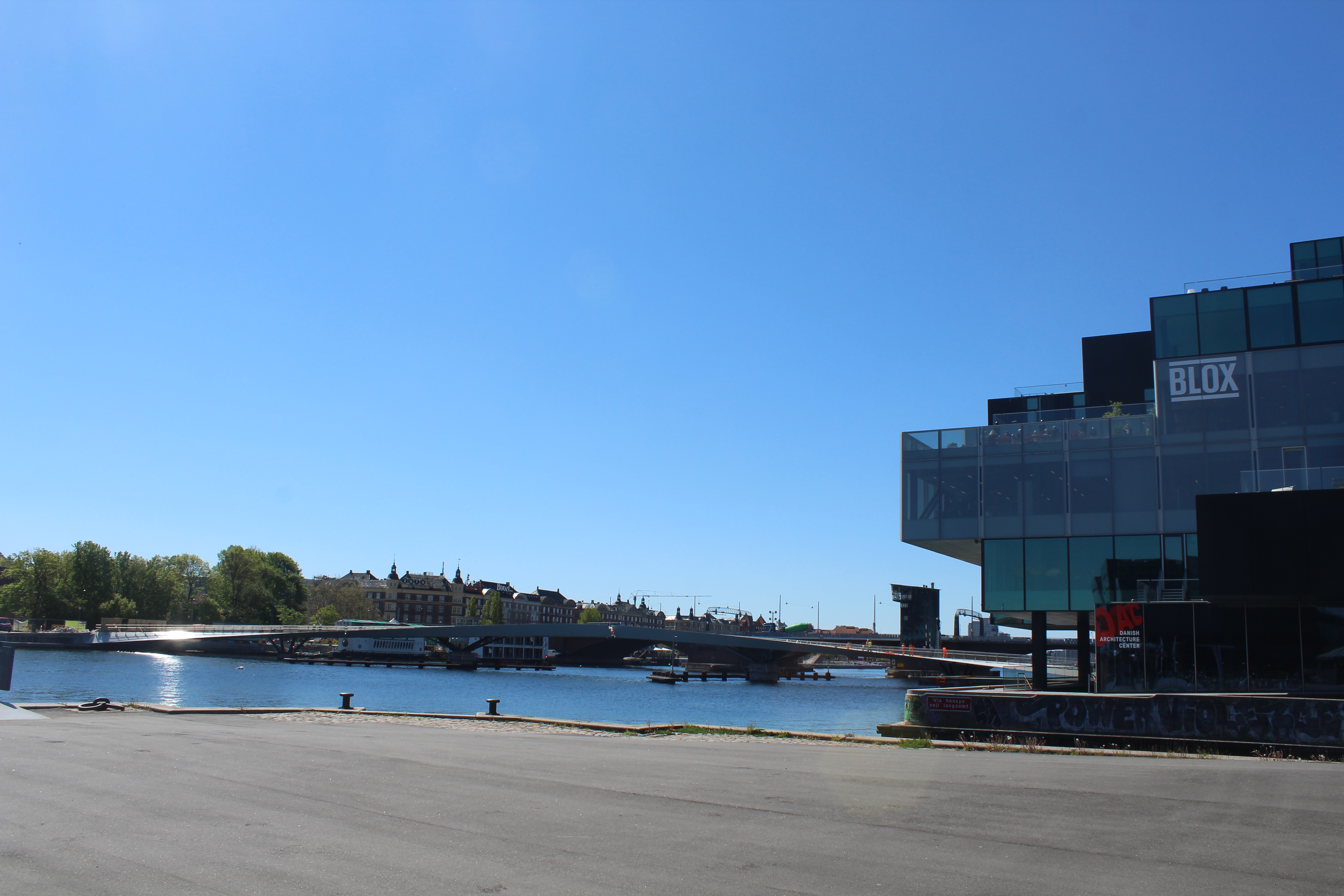
I continue my walk passing under Langebro bridge and through the new Realdania building BLOX with Dansk Arkitektur Center (DAC) to
Christians Brygge.
Christians Brygge:
View to Søren Kirkegaards Plads, BLOX with Dansk Arkitektur Center and new bike and walk bridge “Lille Langebro” between Amager and Copenhagen City:
Realdania.dk Cykel og gangbro “Lille Langebro” åbner efteråret 2019
Click on photos and use your zoom control and you see them in full screen size.

Christians Brygge.
View to Søren Kirkegaards Plads, BLOX with Dansk Arkitektur Center and new bike and walk bridge “Lille Langebro” between Amager and Copenhagen City:
Click on photos and use your zoom control and you see them in full screen size.
Christians Brygge.
BLOX with Dansk Arkitektur Center and new bike and walk bridge “Lille Langebro” between Amager and Copenhagen City:
Click on photos and use your zoom control and you see them in full screen size.

Christians Brygge.
View from Realdania BLOX and Dansk Arkitektur Center to Søren Kirkegaards Plads, Royal Danish Library “Diamanten” and Knippels Bridge connecting Copenhagen City and Christianshavn:
Click on photos and use your zoom control and you see them in full screen size.

Christians Brygge – view to Søren Kirkegaards Plads and Royal Danish Library “Diamanten”:
Click on photos and use your zoom control and you see them in full screen size.
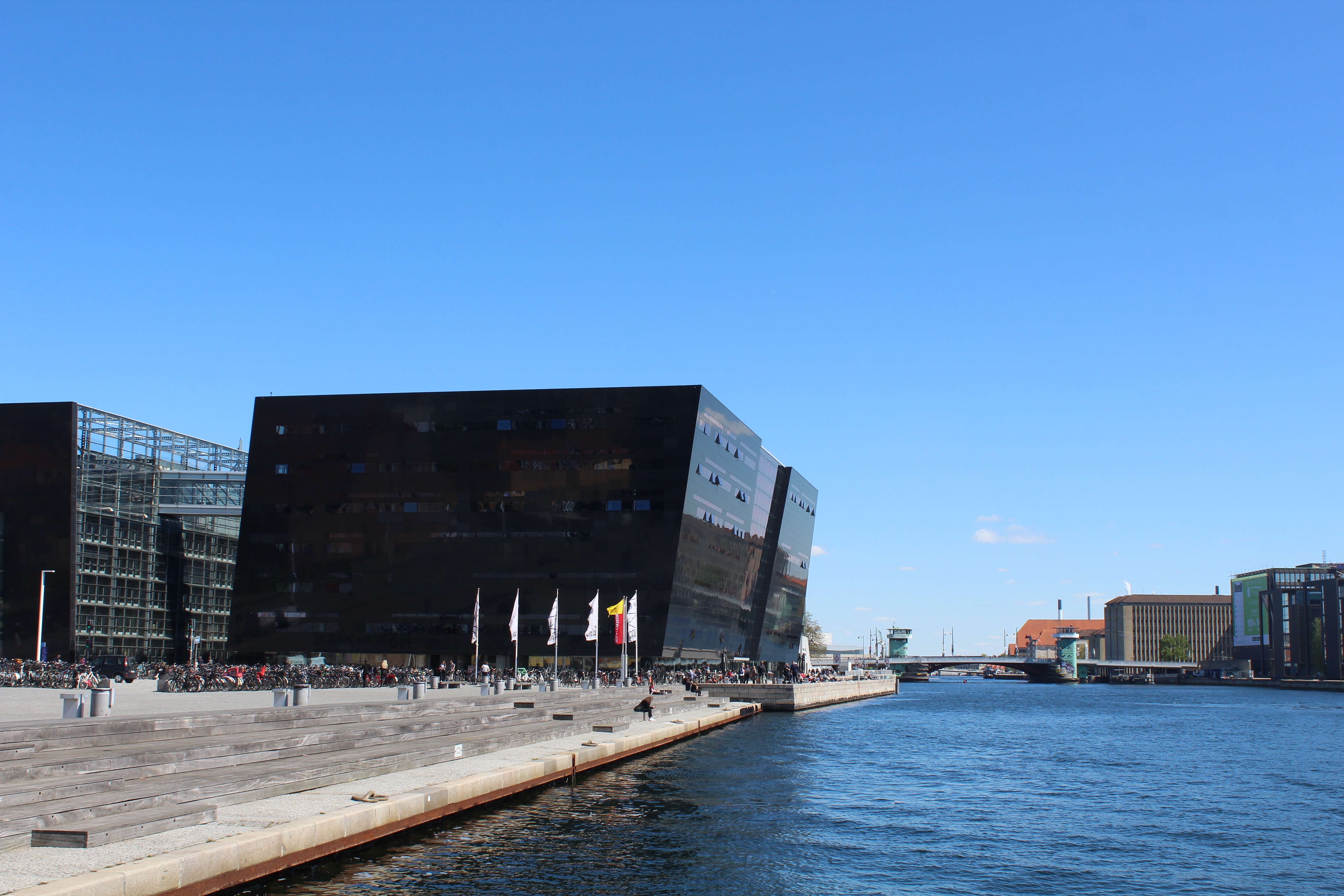
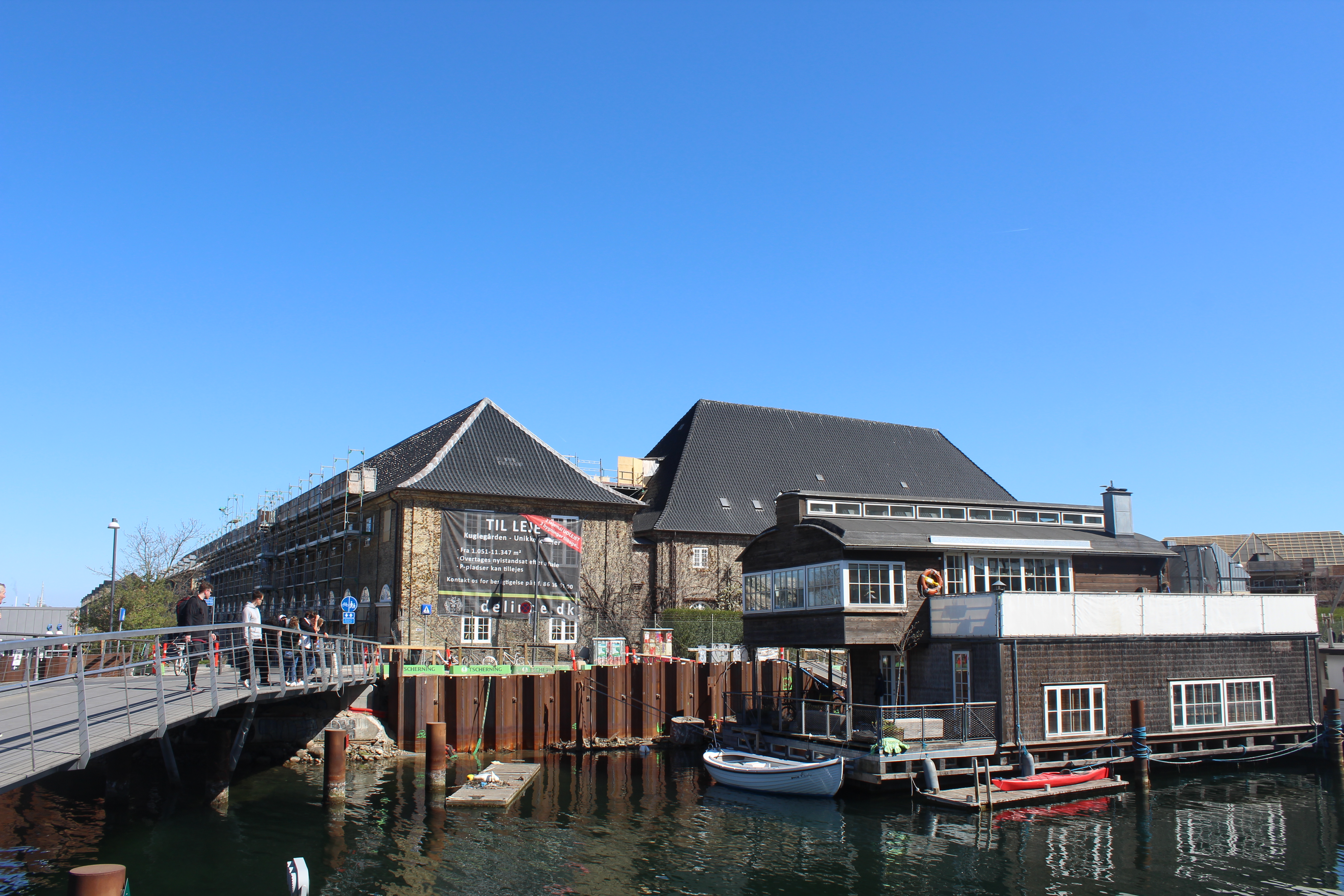
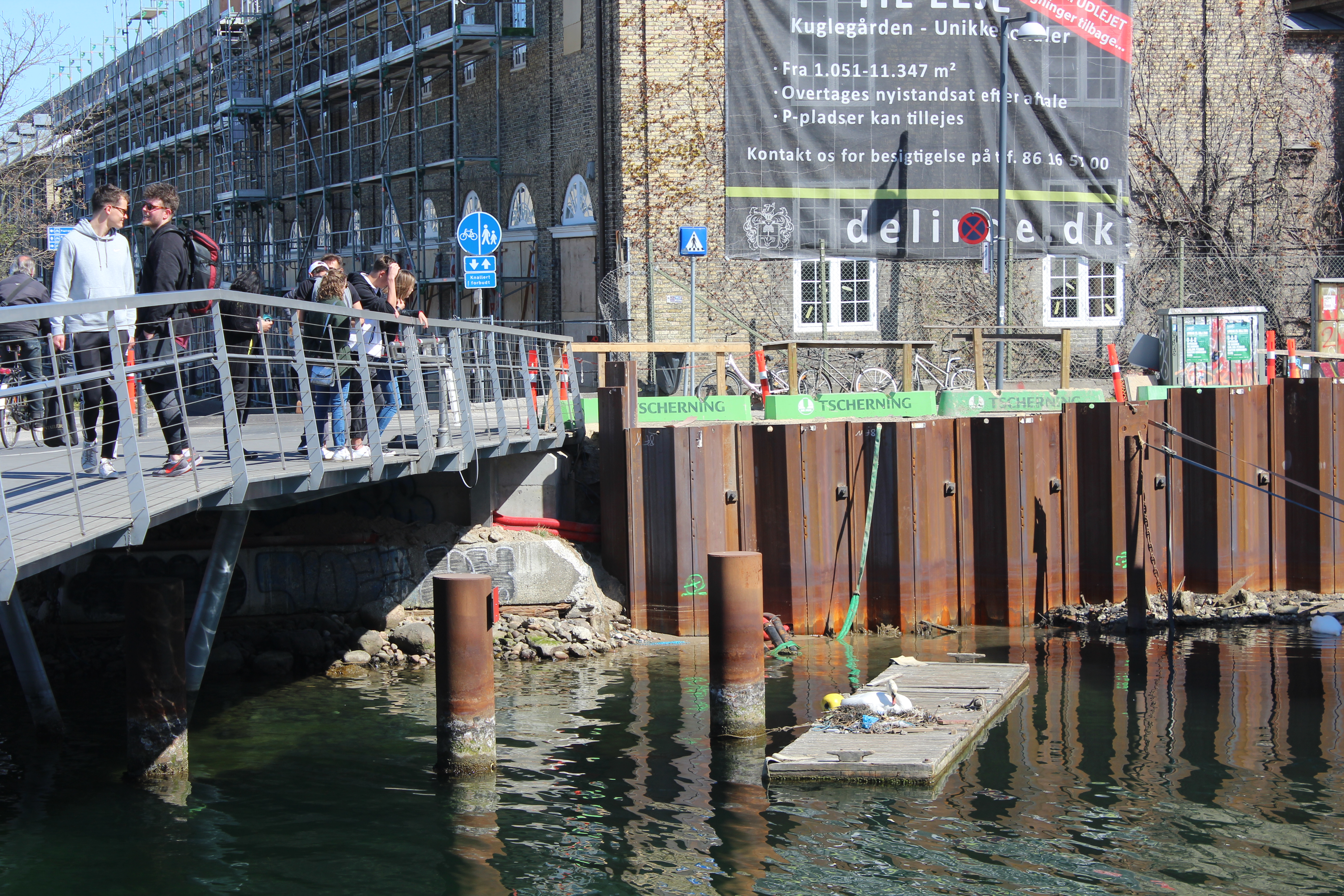
Christians Brygge.
Royal Danish Library “Diamanten”:
Click on photos and use your zoom control and you see them in full screen size.

View in direction south from promenade in from of Royal Danish Library “Diamanten” to Christianshavn with Circle Bridge designed by Olafur Elliassen:
Click on photos and use your zoom control and you see them in full screen size.

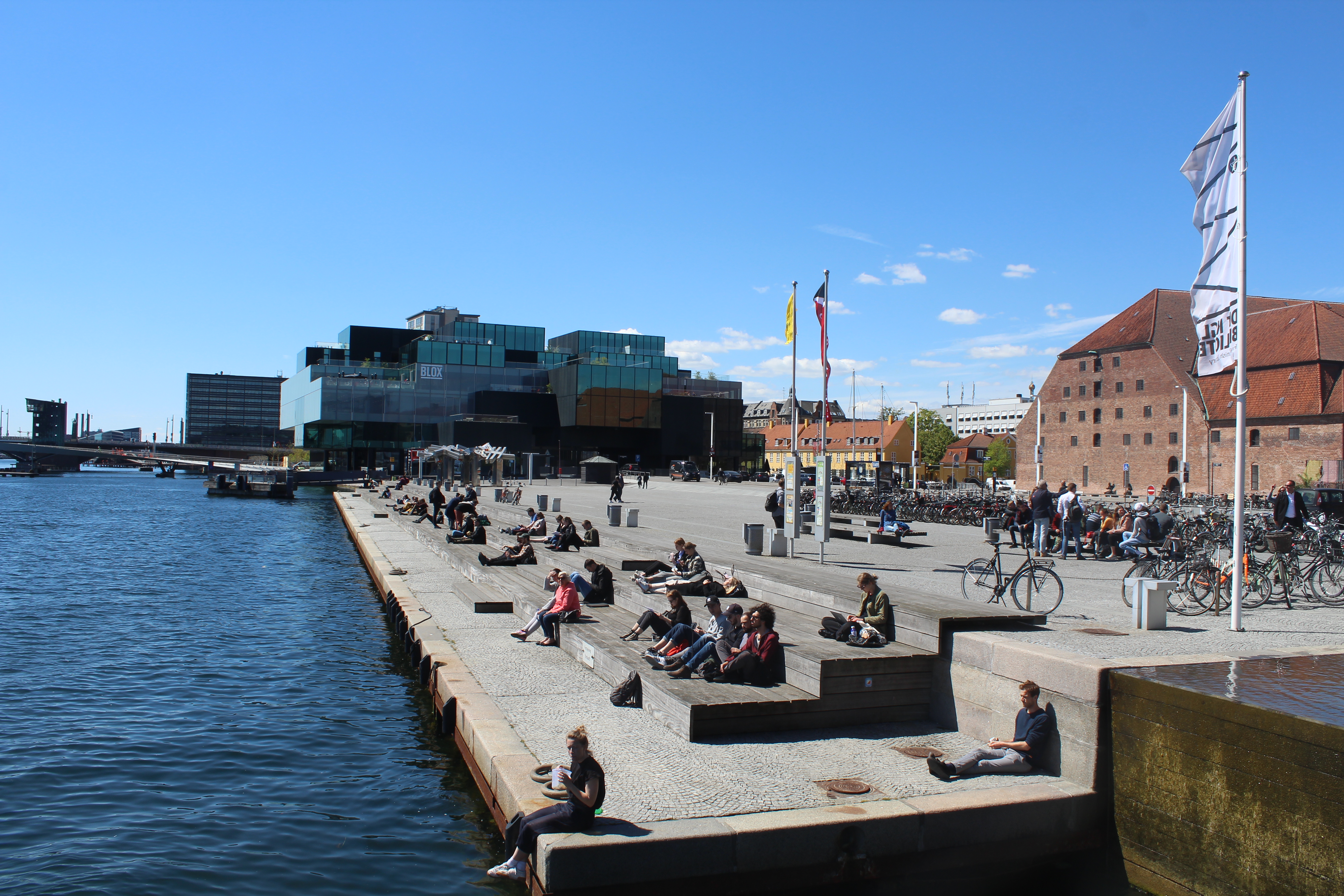
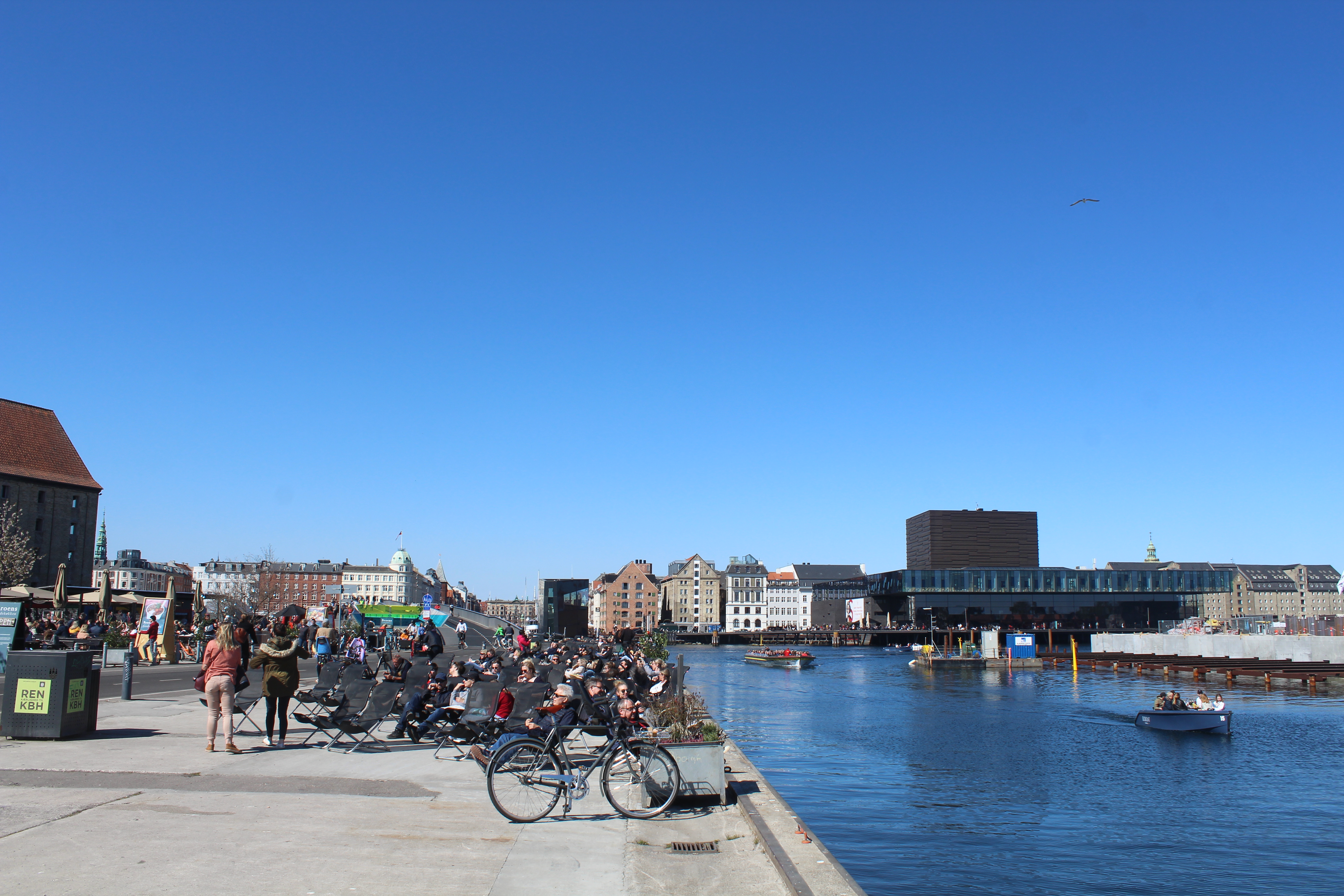
Relaxed atmosphere on Søren Kirkegaards Plads this sunny spring in may 2019:
View to BLOX and Dansk Arkitektur Center.
Click on photos and use your zoom control and you see them in full screen size.
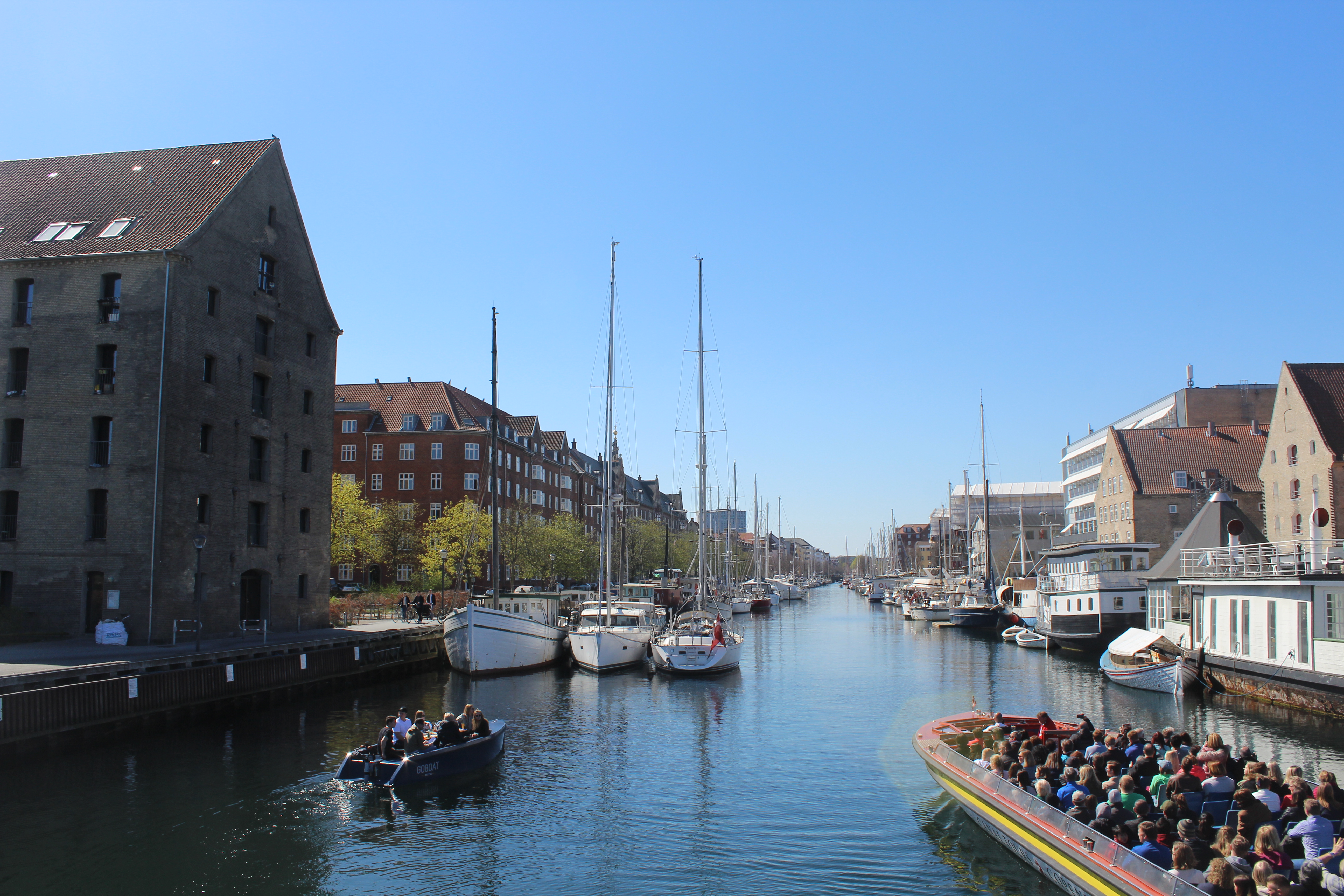
We continue our walk, bike and run route passing quarter Gammelholm to Nyhavn with new 180 m long bike- and walk bridge “Inderhavnsbroen” connecting Nyhavn and Christianshavn on island Amager:
Map of Copenhagen City:
Click on photos and use your zoom control and you see them in full screen size.

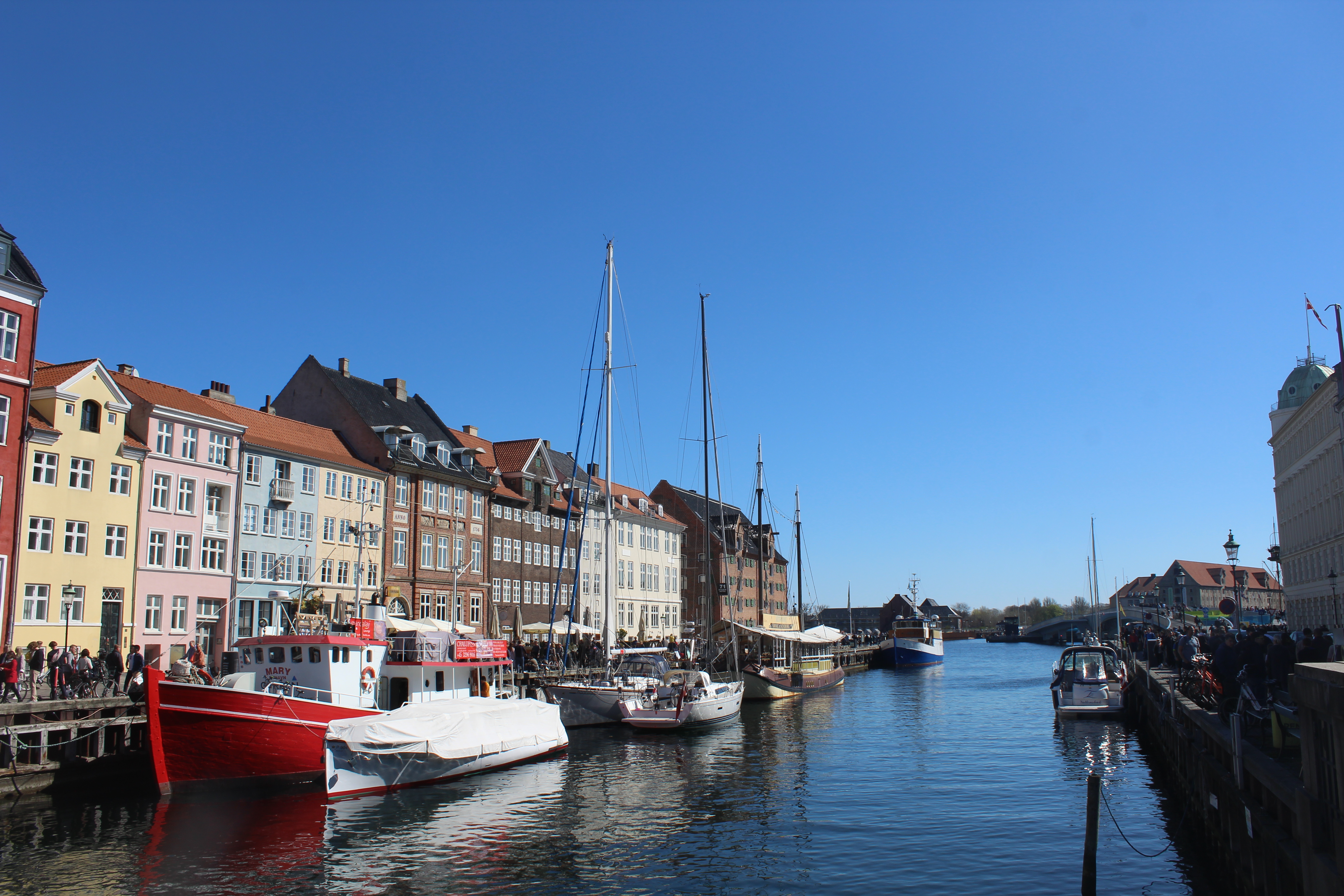
Nyhavn at Copenhagen Inner Harbour:
Click on photos and use your zoom control and you see them in full screen size.

Planche at Nyhavn Canal “Havneringen”, the 13 km long Copenhagen Inner Harbour Ring Route:
Click on photos and use your zoom control and you see them in full screen size.
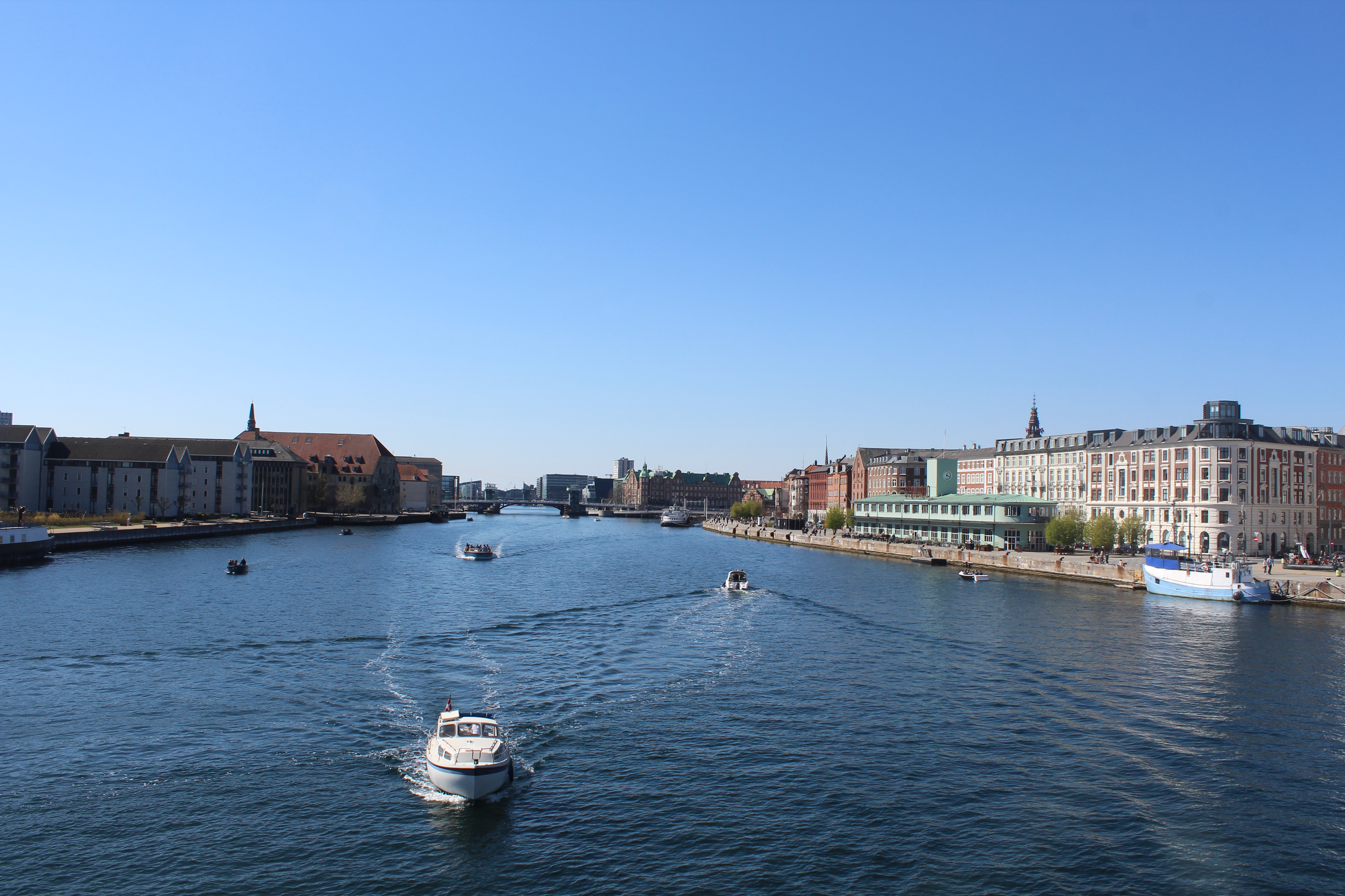
Copenhagen Inner Harbour.
View in direct west from top of 180 m long new walk- and bike bridge “Inderhavnsbroen” connecting Nyhavn with Christianshavn on island Amager:
Click on photos and use your zoom control and you see them in full screen size.
View from top of Inderhavnsbroen in direction south to North Atlantic Brygge with storehouse built 1766-67, Christianhavn:
Click on photos and use your zoom control and you see them in full screen size.
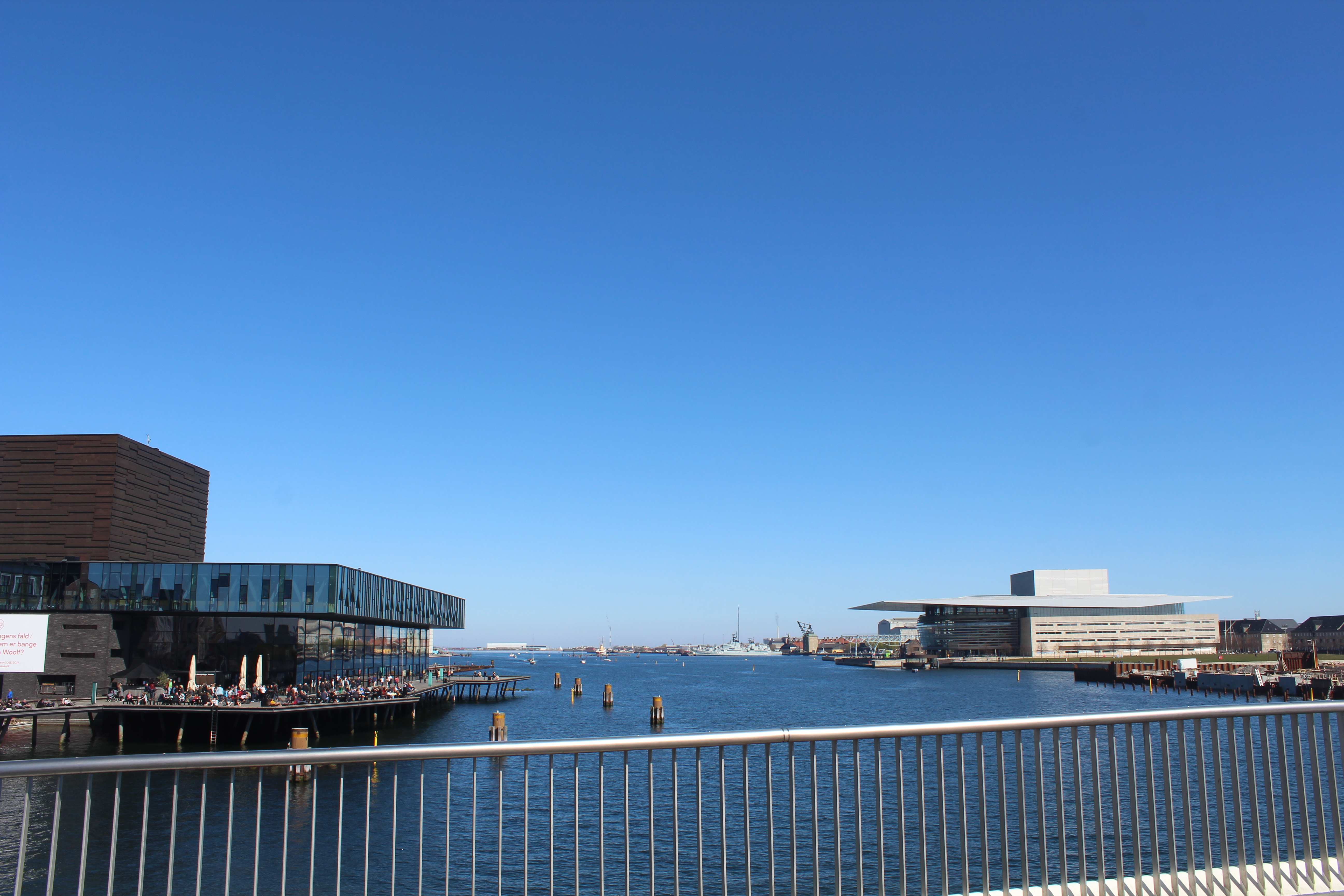
Copenhagen Inner Harbour.
View in direct east from top of 180 m long new walk- and bike bridge “Inderhavnsbroen” connecting Nyhavn with Christianshavn on island Amager to Royal Theater at left and Royal Opera at right:
Click on photos and use your zoom control and you see them in full screen size.
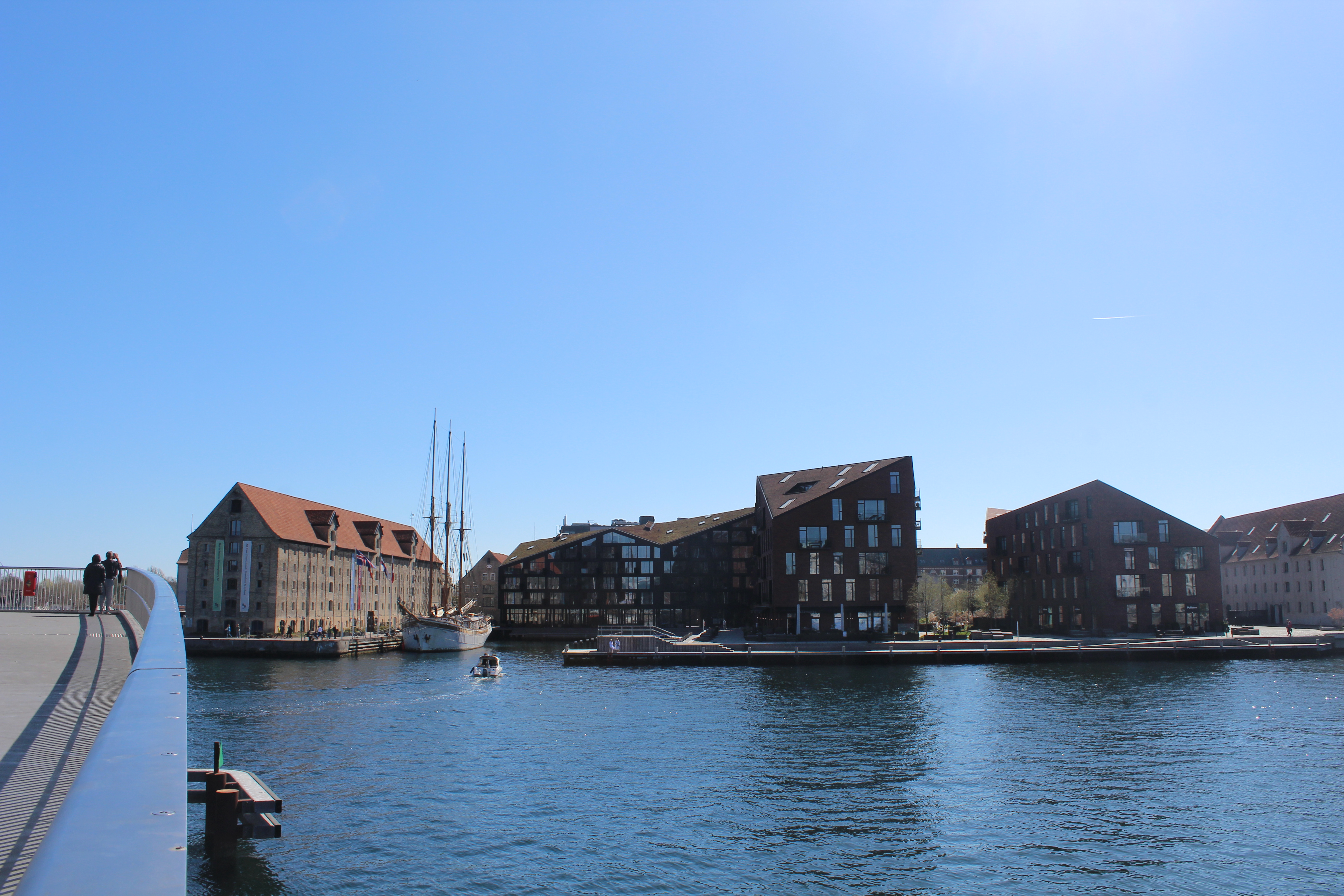
View from walk-and bike bridge Trangravsbroen on Christianshavn to new 180 m long walk and bike bridge “Inderhavnsbroen” from Christianhavn to Nyhavn :
At left on photo outdoor street food restaurants.
Click on photos and use your zoom control and you see them in full screen size.

View from bike-and walk bridge “Trangravsbroen” connecting Iceland Brygge with North Atlantic Brygge and island Arsenaløen on Christianshavn:
Click on photos and use your zoom control and you see them in full screen size.
View from bike-and walk bridge “Trangravsbroen” connecting Iceland Brygge with North Atlantic Brygge and island Arsenaløen on Christianshavn to houseboat and a swan on its nest:
Click on photos and use your zoom control and you see them in full screen size.
View from bike-and walk bridge “Trangravsbroen” connecting Iceland Brygge with North Atlantic Brygge and island Arsenaløen on Christianshavn to houseboat and a swan on its nest, birds use what is at hand!!:
Click on photos and use your zoom control and you see them in full screen size.
Have a lunch?
Here is outdoor street food restaurants:
View from Christianshavn to new 180 m long walk and bike bridge “Inderhavnsbroen” from Christianhavn to Nyhavn :
At left on photo outdoor street food restaurants.
Click on photos and use your zoom control and you see them in full screen size.
Nyhavn:
View in direction south to Copenhagen Inner Harbour and 180 m long bike- and walk bridge “Inderhavnsbroen” connection Nyhavn with Christianshavn.
Click on photos and use your zoom control and you see them in full screen size.
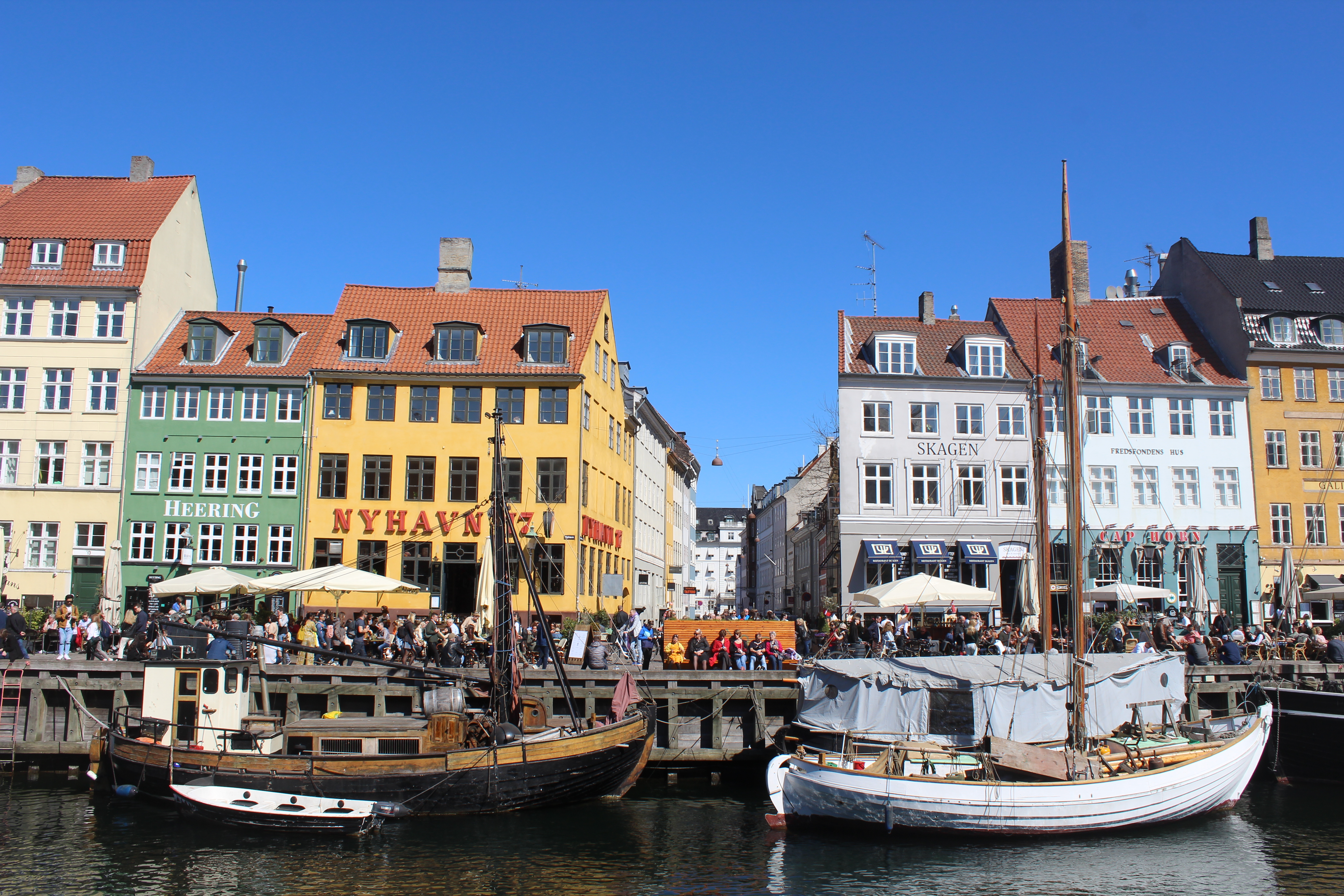
Nyhavn – view in direction north to “sunny side”:
Click on photos and use your zoom control and you see them in full screen size.

Nyhavn – built 1672-74:
Click on photos and use your zoom control and you see them in full screen size.
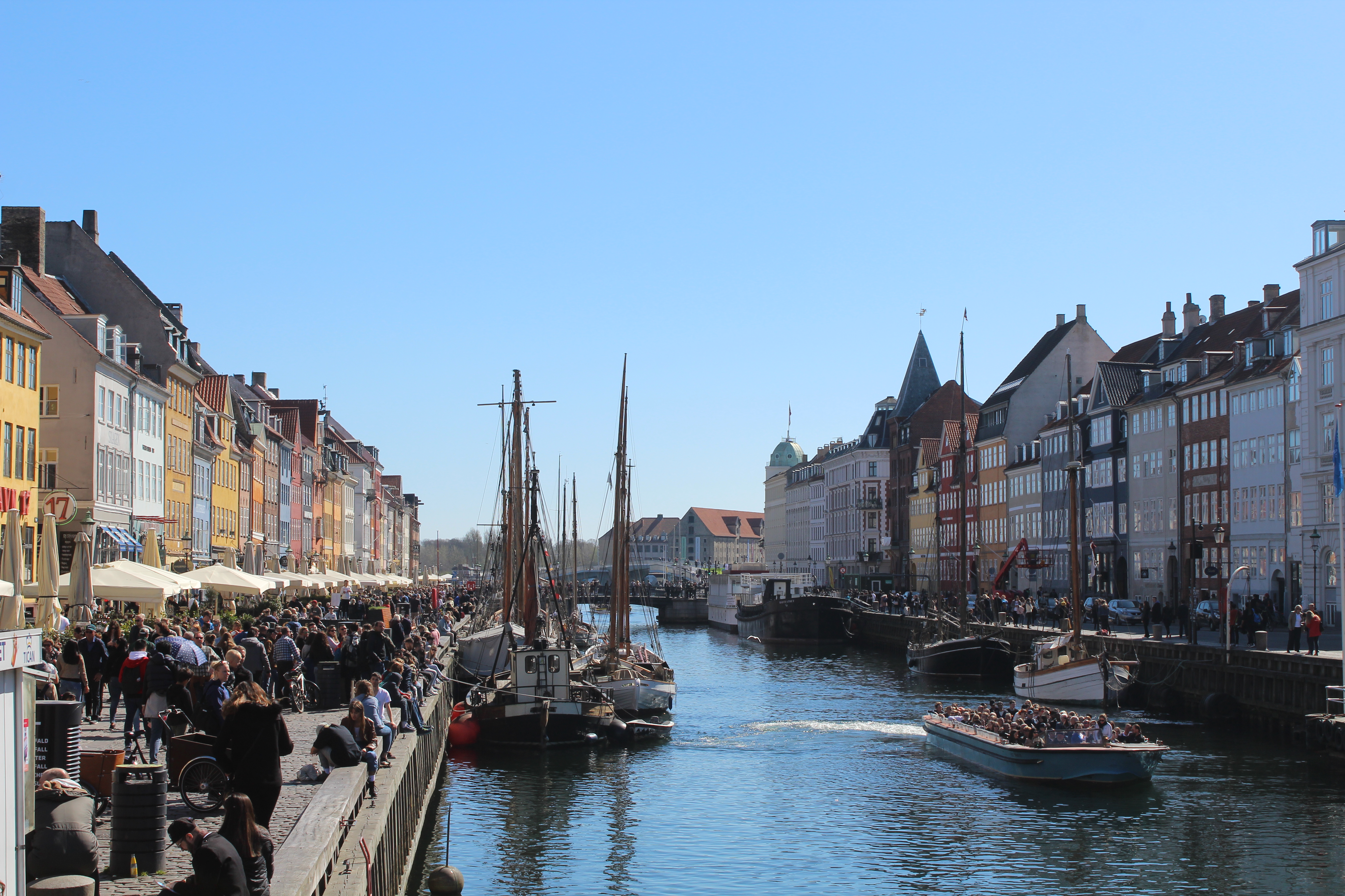
Nyhavn – view in direction south:
Nyhavn Canal is 400 meter long, 25 meter wide and 6 meter deep.
Click on photos and use your zoom control and you see them in full screen size.
Nyhavn – view in direction north to Kings New Square, Kongens Nytorv:
Click on photos and use your zoom control and you see them in full screen size.

Selling homemade handcraft on wharf in Nyhavn:
Click on photos and use your zoom control and you see them in full screen size.

I continue my walk, bike and run tour to Kings Square- Kongens Nytorv which is neighbor to Nyhavn:
Originally built of King Christian 5 1672-84.
To day under reconstruction aften 7 years underground construction of Copenhagen Circle Metro.
Click on photos and use your zoom control and you see them in full screen size.

Kings Square- Kongens Nytorv which is neighbor to Nyhavn:
Originally built of King Christian 5 1672-84.
French Embassy – built as Thott Palace 1683-86 by danish admiral Niels Juel:
Click on photos and use your zoom control and you see them in full screen size.

I continue my walk, bike and run tour to Kings Garden through street Gothersgade:
Spring in Kings Garden – Kongens Have:
Click on photos and use your zoom control and you see them in full screen size.

Spring in Kings Garden. Photo april 2019 by Erik K Abrahamsen.
Spring in Kings Garden, Kongens Have – view to Rosenborg Palace built in style nederland-renaissance 1630-35 by king Christian 4, king of Denmark and Norway 1588-1648:
Click on photos and use your zoom control and you see them in full screen size.

I hope you have enjoyed this 5 km walk, bike and run tour alongside Copenhagen Inner Harbour from Havneholmen/Fisketorvet to Nyhavn, Kings Square to Kings Garden.
SPRING COPENHAGEN, DENMARK 2019:
Kings Garden – Kongens Have.
Click on photos and use your zoom control and you see them in full screen size.

Links:
Realdania.dk Cykel og gangbro “Lille Langebro” åbner efteråret 2019
I recommend my articles on my homepage danculture.dk (click on text):
- Experience Copenhagen – 1000 years of history on walk. The era of King Christian 4. Tour 3
- Experience Copenhagen – 1000 years of history on walk: Christianity takes up the city. Tour 2
- Experience Copenhagen – 1000 years of history on walk.The Center of power, Tour 1
or write on GOOGLE: “danculture.dk copenhagen inner harbour”
Text and photos Copyright Erik K Abrahamsen 2019
All rights reserved
Melby, North Sealand 18. may 2019
Best wishes
Erik