Coronavirus pandemi lukker Danmark ned – men åbner op for oplevelser i naturen til fods, under løb og på cykel i skov og på strand.
Text and photos Erik K Abrahamsen, den 23. marts 2020.
Nature in Denmark.
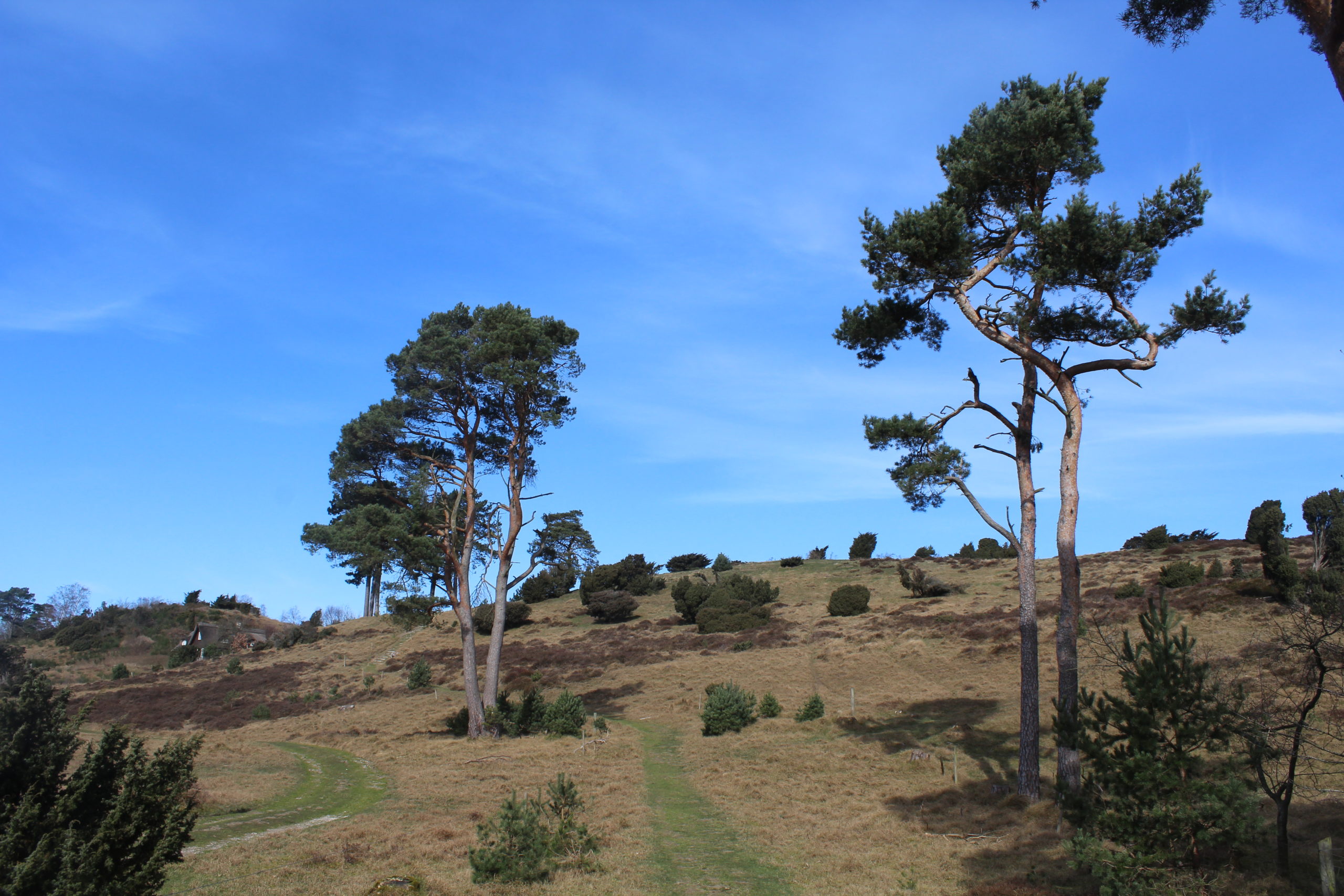
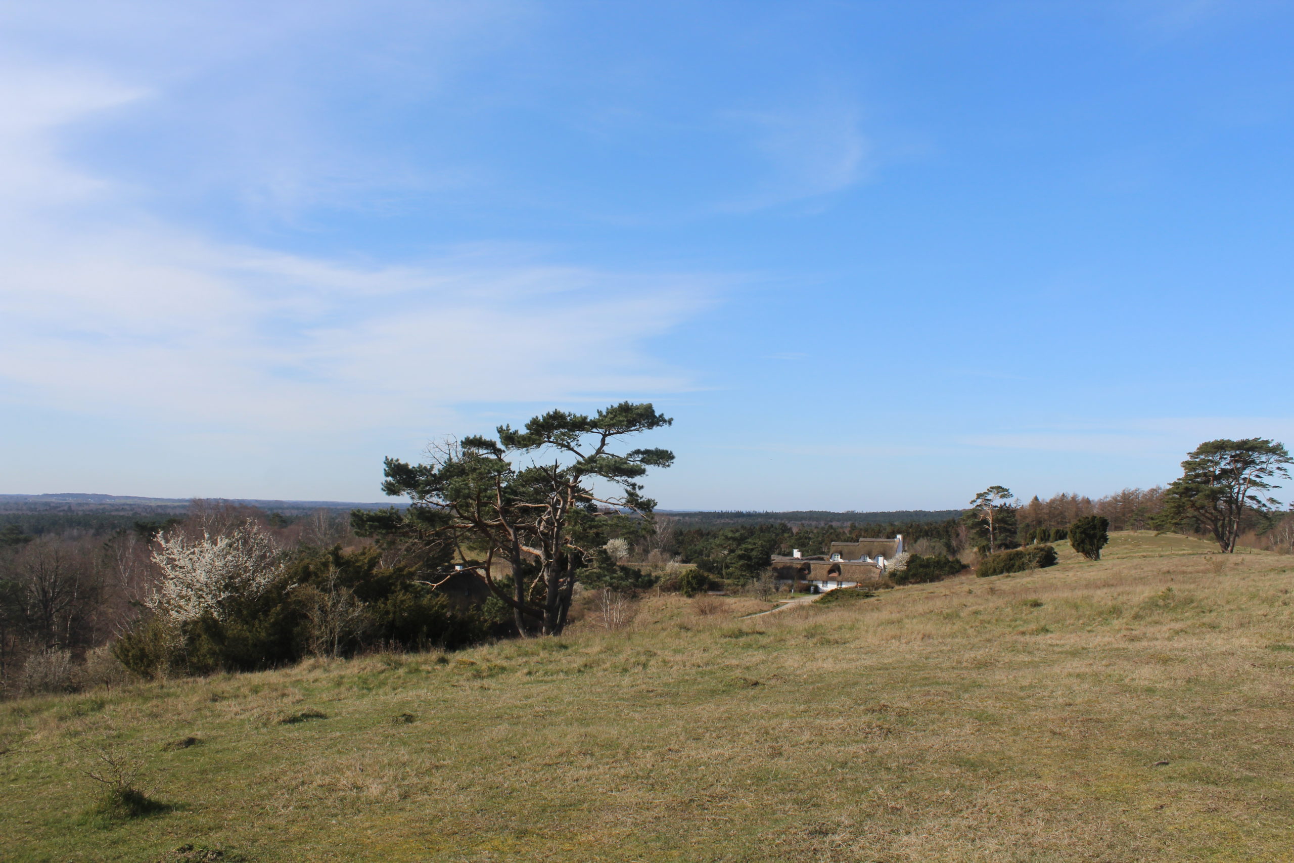
Tibirke Bakker – Tibirke Hills, North Sealand, Denmark – view to lake Arresø in horizon:
Click on photo and use your zoom control and you see them in full screen size.

Den danske statsminister Mette Frederiksen har idag den 23. marts 2020 forlænget alle forhold omkring begrænsninger for danskernes adfærd og af erhvervslivet aktiviteter indtil foreløbigt til den 13. april 2020.
Danskere og udlændige må i det offentlige rum ikke samles i grupper større end 10 personer.
Alle offentlige institutioner er lukket: skoler, gymnasier, universiteter, læreanstalter, børnehaver, vuggestuer, efterskoler, biblioteker, museer m.m.
Plejehjem er lukket for alle ikke strengt nødvendige besøg.
Alle restauranter, cafeer, barer, fitnesscentre m.m. er lukket.
When Denmark close down – then nature open up.
When you keep distance of 2 m you can enjoy fellowship with family and friends in nature – on walk, bike and run.
It is extremely important to stay outdoor in movement and exercise daily. It will improve your immune system and give you an excellent health to avoid sickness.
In Denmark we have excellent nature in parks, forests, lakes and beaches.
I will take you to some of my favour forests, lakes and beaches in the surroundings of North Sealand, where I live all year around:
Arresø, Arresø lake,
Tibirke Bakker, Tibirke Hill with viewpoint “Udsigten” – 58 m above sea level,
Holløse Bredning and Tibirke Ancient Trackway.
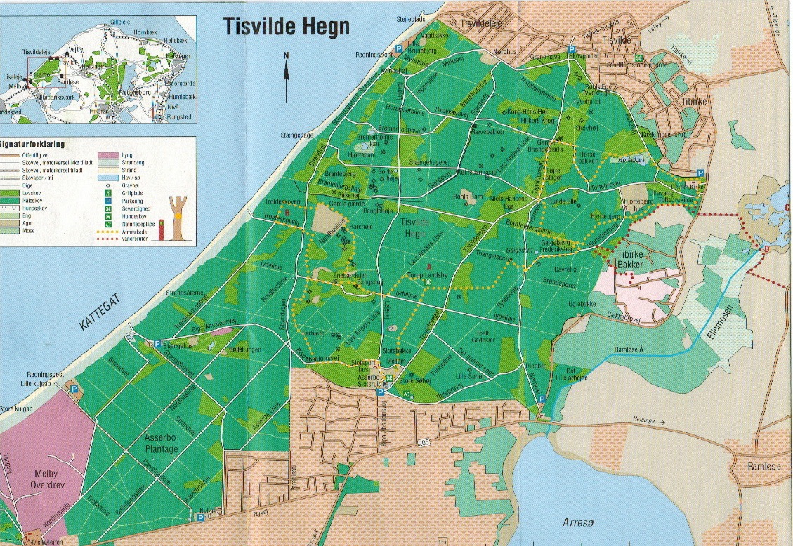
Map of Tisvilde Hegn, Tibirke bakker, Holløse Bredning, Ramløse River and Arresø Lake:
Click on photo and use your zoom control and you see them in full screen size.
On monday 23. march 2020 I drive 7 km from my home in Melby, North Sealand to lake Arresø in North Sealand for a walk:
Arresø Lake, North Sealand, Denmark:
Click on photo and use your zoom control and you see them in full screen size.

Arresø Lake, North Sealand, Denmark – view to peninsula Arrenæs:
Click on photo and use your zoom control and you see them in full screen size.

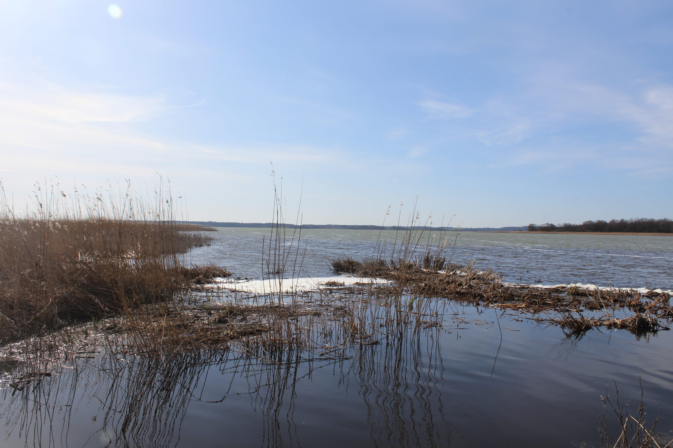
Arresø Lake – outfall of Ramløse River:
Click on photo and use your zoom control and you see them in full screen size.
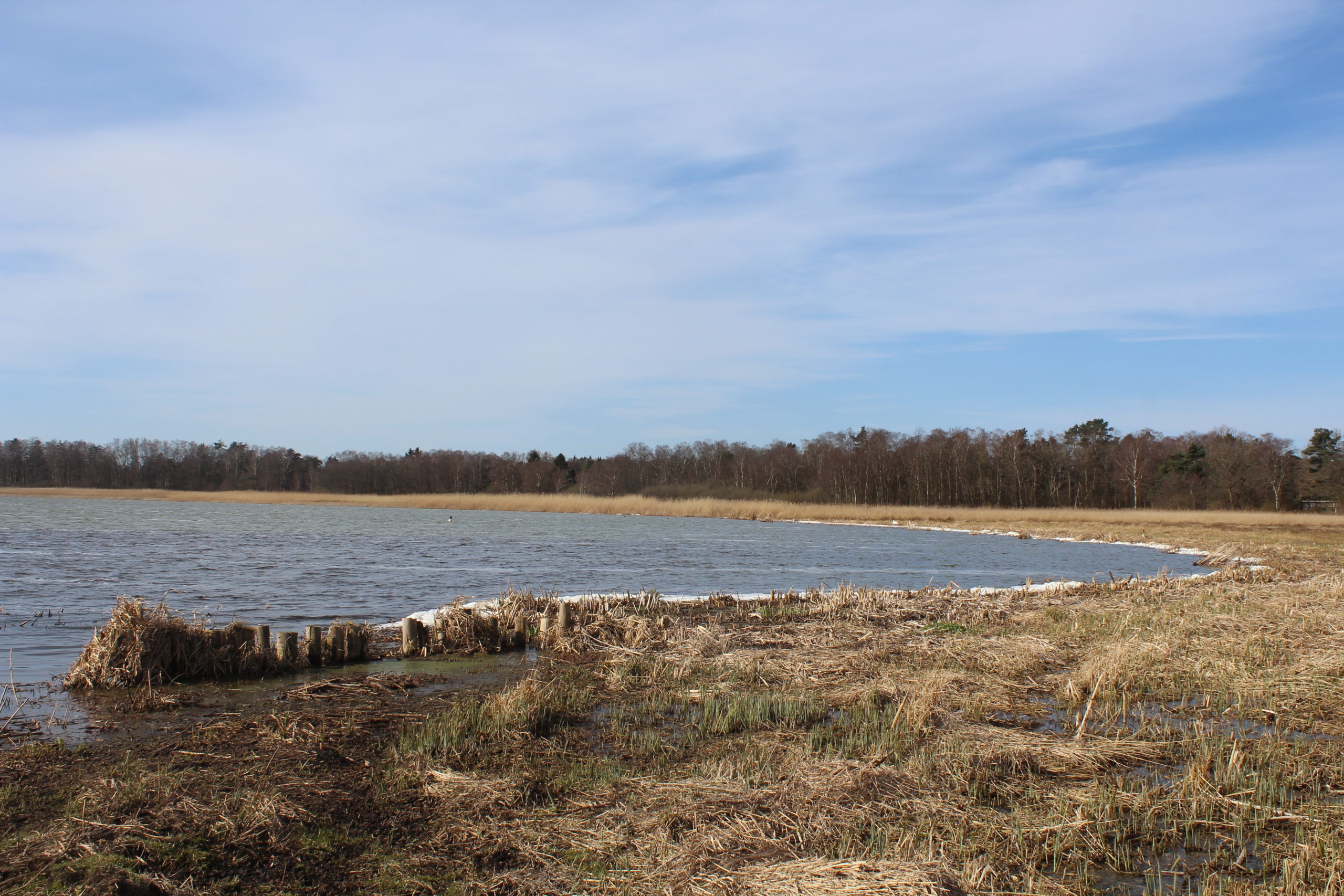
Arresø Lake – birds at the banks of the lake:
Click on photo and use your zoom control and you see them in full screen size.
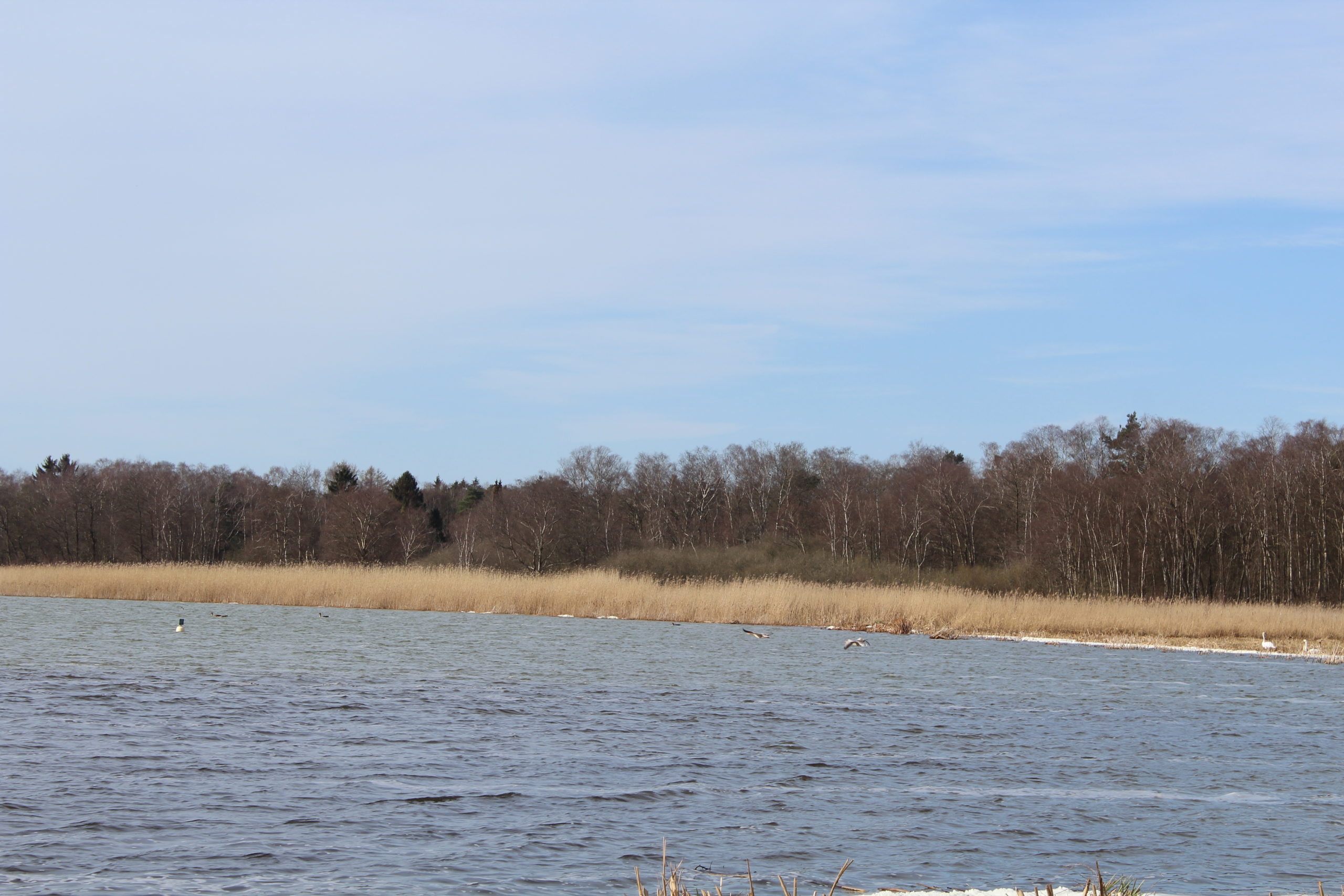
Arresø Lake – birds at the banks of the lake:
Click on photo and use your zoom control and you see them in full screen size.
On the road from lake Arresø to Tibirke Bakker I pass this beautiful house close to the road:
Click on photo and use your zoom control and you see them in full screen size.

I continue my drive 2 km further to Tibirke Bakker for a walk through the hills on a public path.
Tibirke Bakker er den sydøstlige del af Tisvilde Hegn og ligger som nabo til Arresø, Ellemosen og Holløse Bredning.
Området består af bølgede morænebakker, som er dannet af istidsgletchere fra den Sidste Istid for ca. 12-20.000 år siden.
Landskabet er bevokset med græs, lyng og spredte træer og buske.
Tisvilde hegn dækker et område på 13 km2 mellem Liseleje og Tisvildeleje. Området er fredet ifølge dansk lovgivning gennem bl.a. Naturbeskyttelsesloven.
Tisvilde Hegn, Melby Overdrev, Liseleje Plantage og Tibirke Bakker indgår i det europæiske netværk NATURA 2000 og er beskyttet af EU-fugledirektiv og EU-Habitatdirektiv.
Hele området er udpeget som EU-Habitatsområde (NATURA 2000), fordi det inderholder sjældne og bevaringsværdige naturtyper, dyr og planter.
Tibirke Bakker is an eastern part of the forest Tisvilde Hegn in North Sealand. Its a hilly area formed under the last Danish Ice Age from 16.000-10.000 B.C. with hills up to 74 meter above sea level.
Visit to Tibirke Bakker – Tibirke Hills in North Sealand.
Public path to “Udsigten” on top of the hill – 58 m above sea level:
Click on photo and use your zoom control and you see them in full screen size.
Visit to Tibirke bakker – Tibirke Hills in North Sealand.
View in direction west to lake Arresø from top of one of the three hills:
Click on photo and use your zoom control and you see them in full screen size.
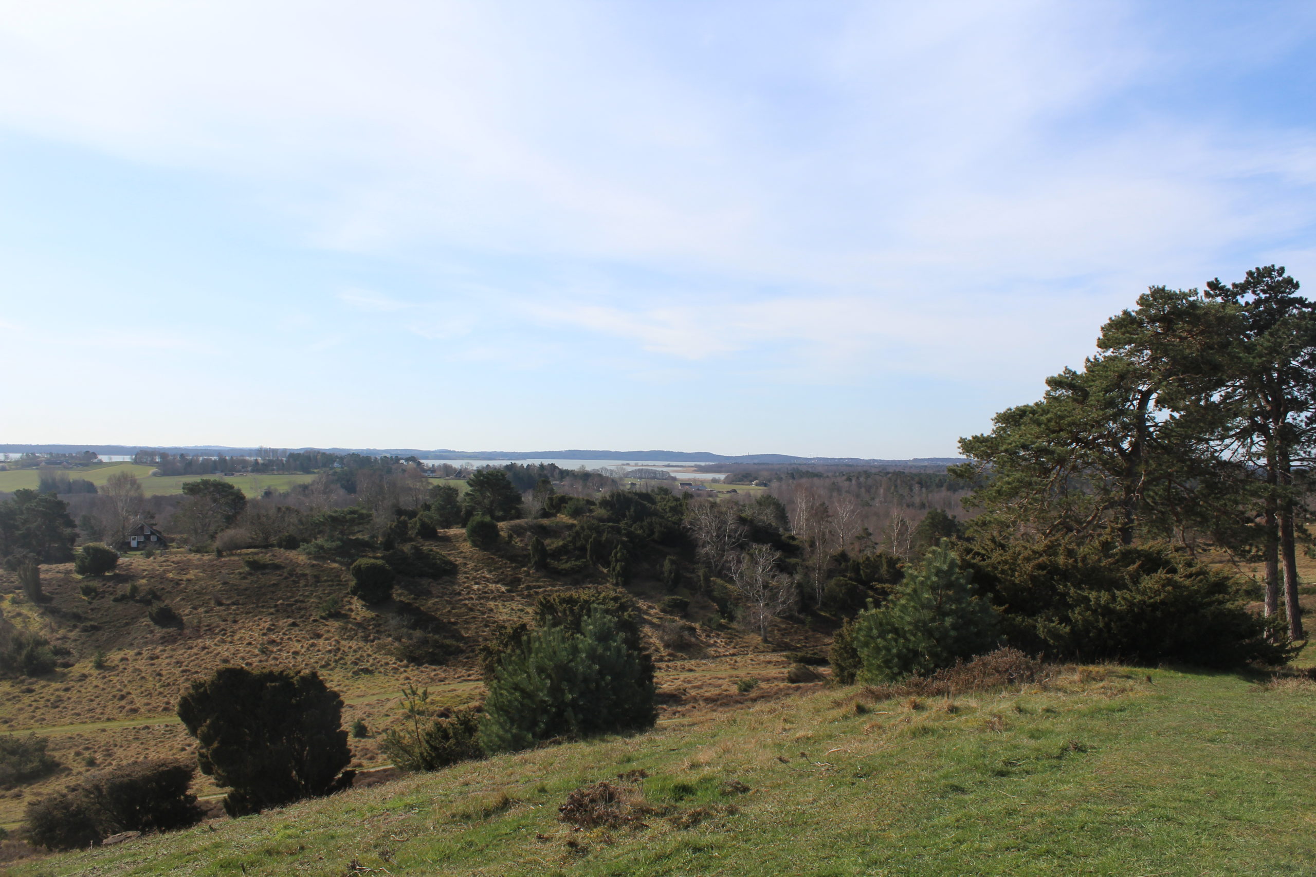
Visit to Tibirke bakker – Tibirke Hills in North Sealand.
View in direction east from top of one of the three hills to lake Holløse Bredning and Kullen hills in Sweden in horizon:
Click on photo and use your zoom control and you see them in full screen size.

Visit to Tibirke bakker – Tibirke Hills in North Sealand.
View in direction south from top of the highest Hill “UDSIGTEN” – 58 m above sea level to lake Arresø:
Click on photo and use your zoom control and you see them in full screen size.

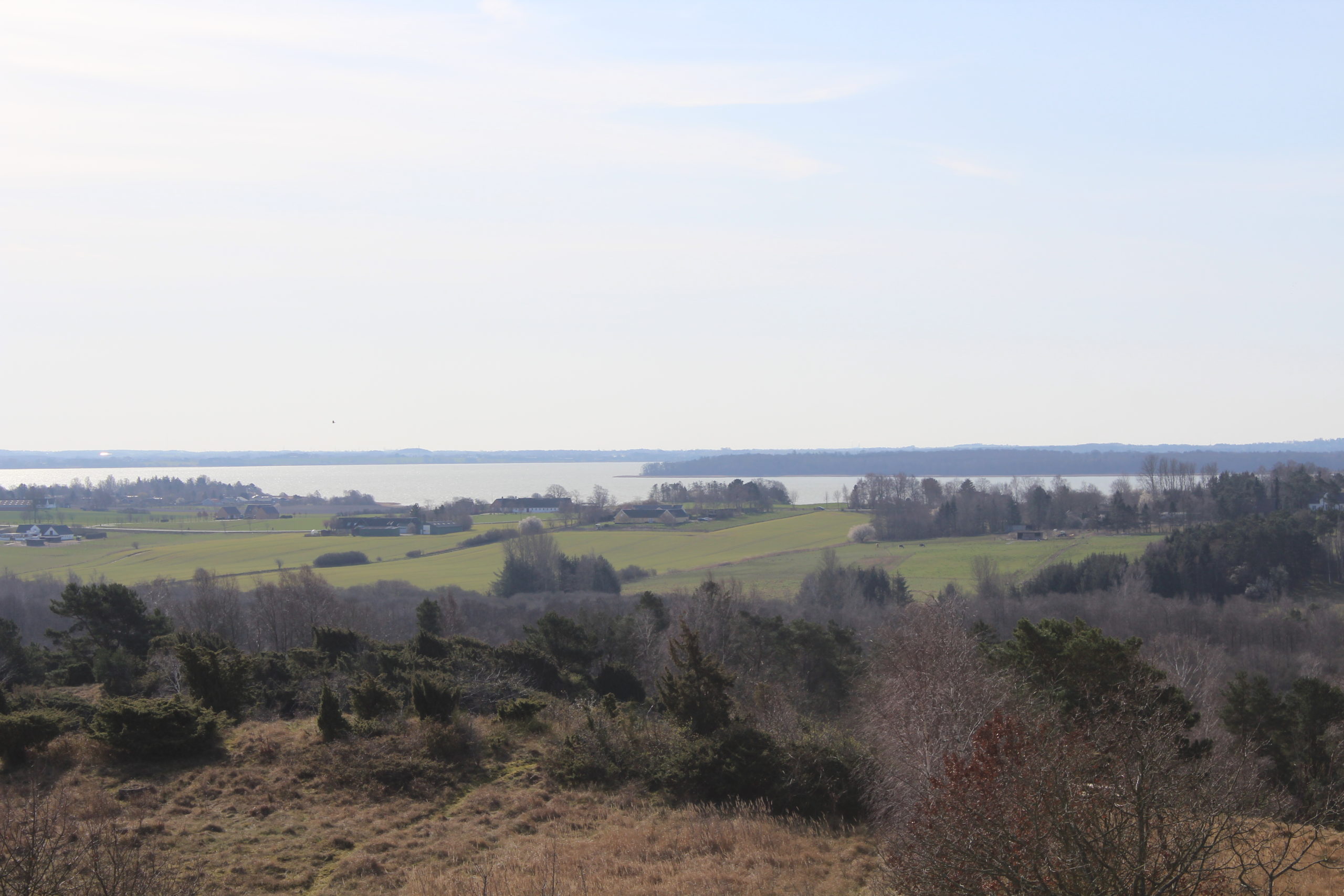
Tibirke bakker – Tibirke Hills in North Sealand.
View in direction south from top of the highest Hill “UDSIGTEN” – 58 m above sea level to lake Holløse Bredning:
Click on photo and use your zoom control and you see them in full screen size.

Tibirke bakker – Tibirke Hills in North Sealand.
Viewin direction south from top of the highest Hill “UDSIGTEN” – 58 m above sea level to lake Arresø and peninsula Arrenæs:
Click on photo and use your zoom control and you see them in full screen size.

Tibirke bakker – Tibirke Hills in North Sealand.
View in direction south from top of the highest Hill “UDSIGTEN” – 58 m above sea level to lake Arresø and peninsula Arrenæs:
Click on photo and use your zoom control and you see them in full screen size.
Tibirke bakker – Tibirke Hills in North Sealand.
View from top of the highest Hill “UDSIGTEN” – 58 m above sea level to lake Arresø:
Click on photo and use your zoom control and you see them in full screen size.
Tibirke bakker – Tibirke Hills in North Sealand.
View in direction west to forest to neighboring forest in Tisvilde Hegn from top of the highest Hill “UDSIGTEN” – 58 m above sea level:
Click on photo and use your zoom control and you see them in full screen size.
Tibirke bakker – Tibirke Hills in North Sealand.
View in direction east to Lake Holløse Bredning and cliff of Kullen in Sweden (in horizon) from top of the highest Hill “UDSIGTEN” – 58 m above sea level:
View to public path through Tibirke Bakker to forest in Tisvilde Hegn and Kattegat Beach at Strandvejen between Asserbo and Tisvildeleje.
Click on photo and use your zoom control and you see them in full screen size.

Tibirke bakker – Tibirke Hills in North Sealand.
View in direction east to Lake Holløse Bredning and cliff of Kullen in Sweden (in horizon) from top of the highest Hill “UDSIGTEN” – 58 m above sea level:
Click on photo and use your zoom control and you see them in full screen size.

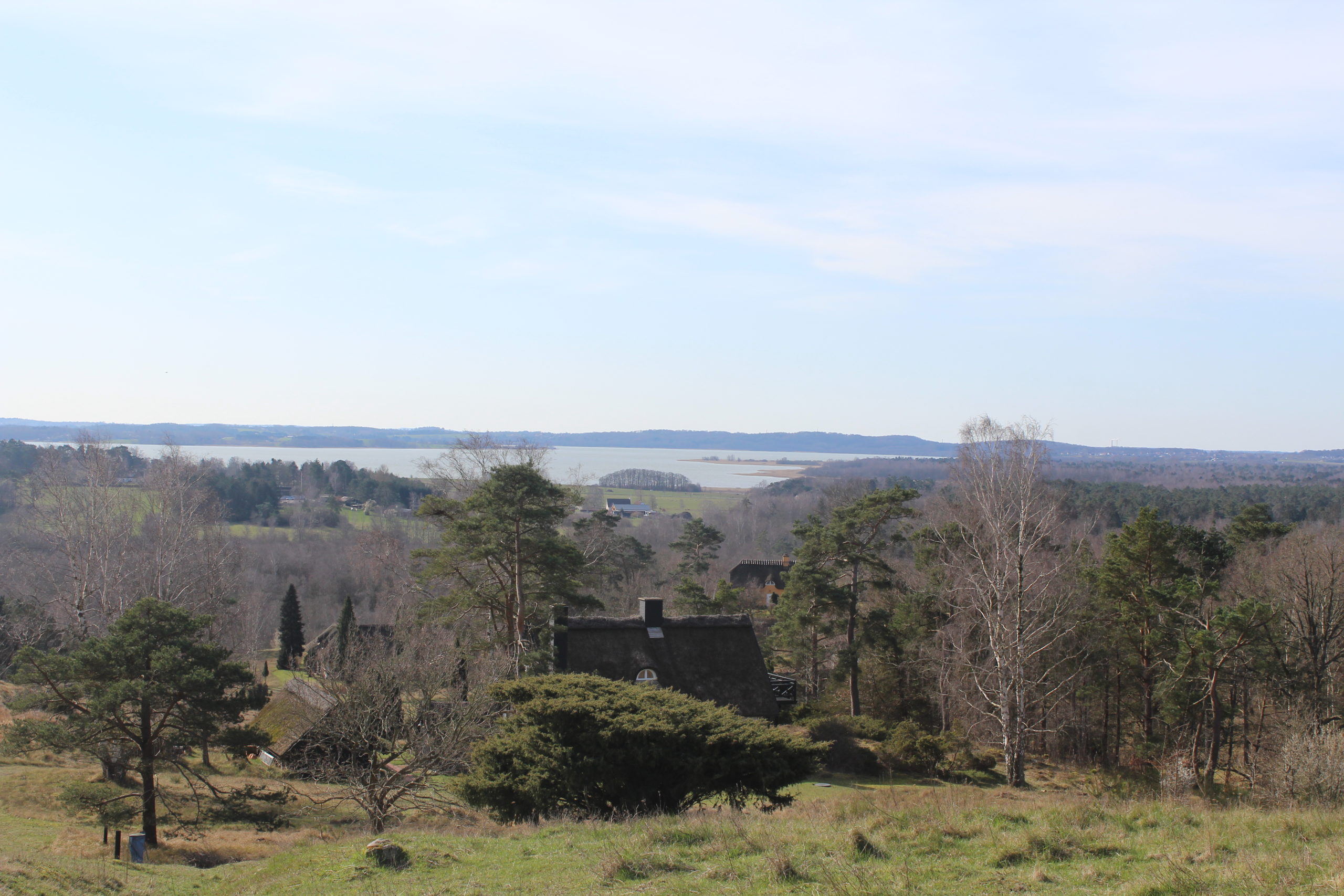
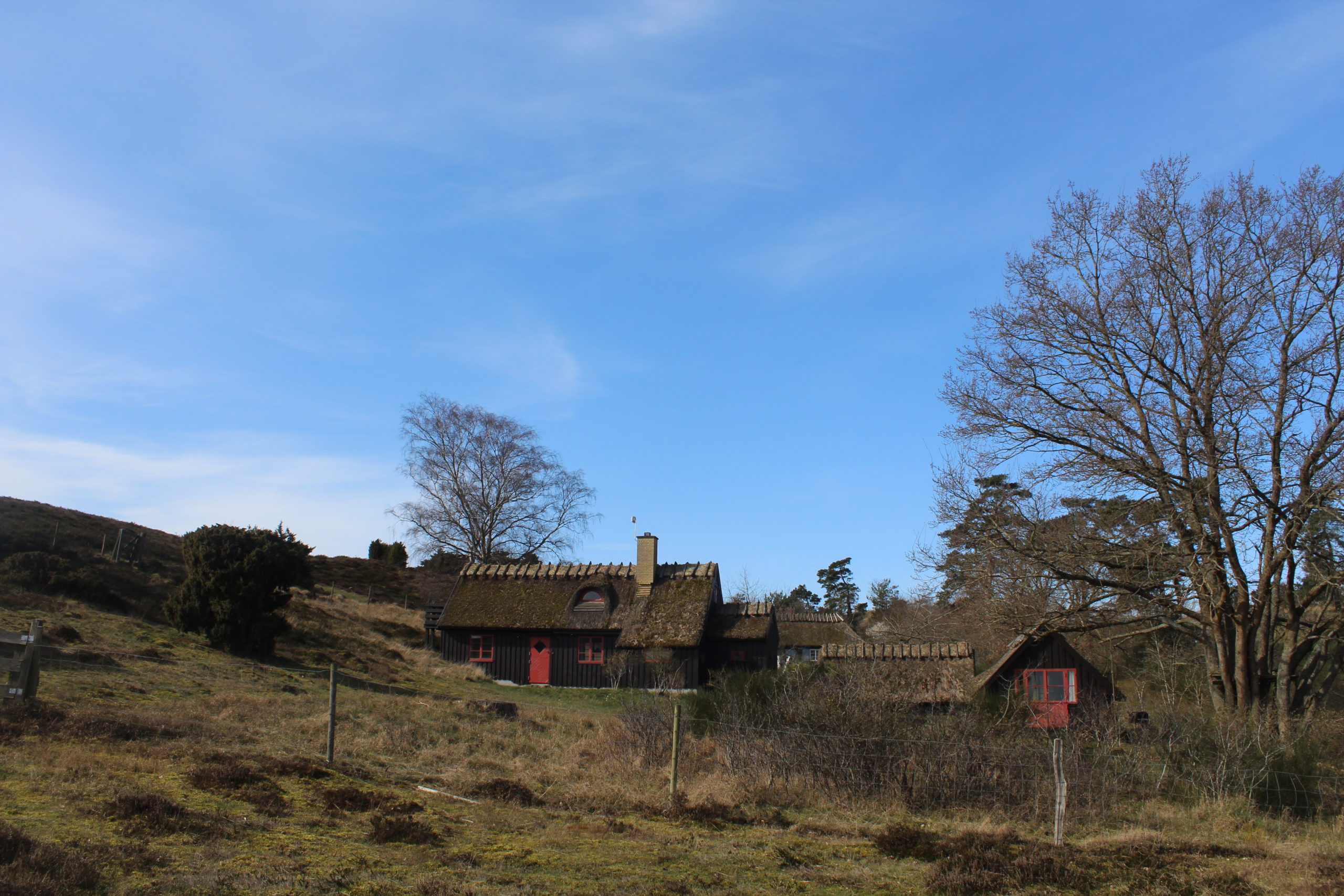
I walk down the hills and pass this summerhouse in Tibirke Bakker:
Click on photo and use your zoom control and you see them in full screen size.
I continue my drive 1 km further to Holløse Bredning for a walk to Lake Holløse Bredning and Tibirke Ancient Trackway:
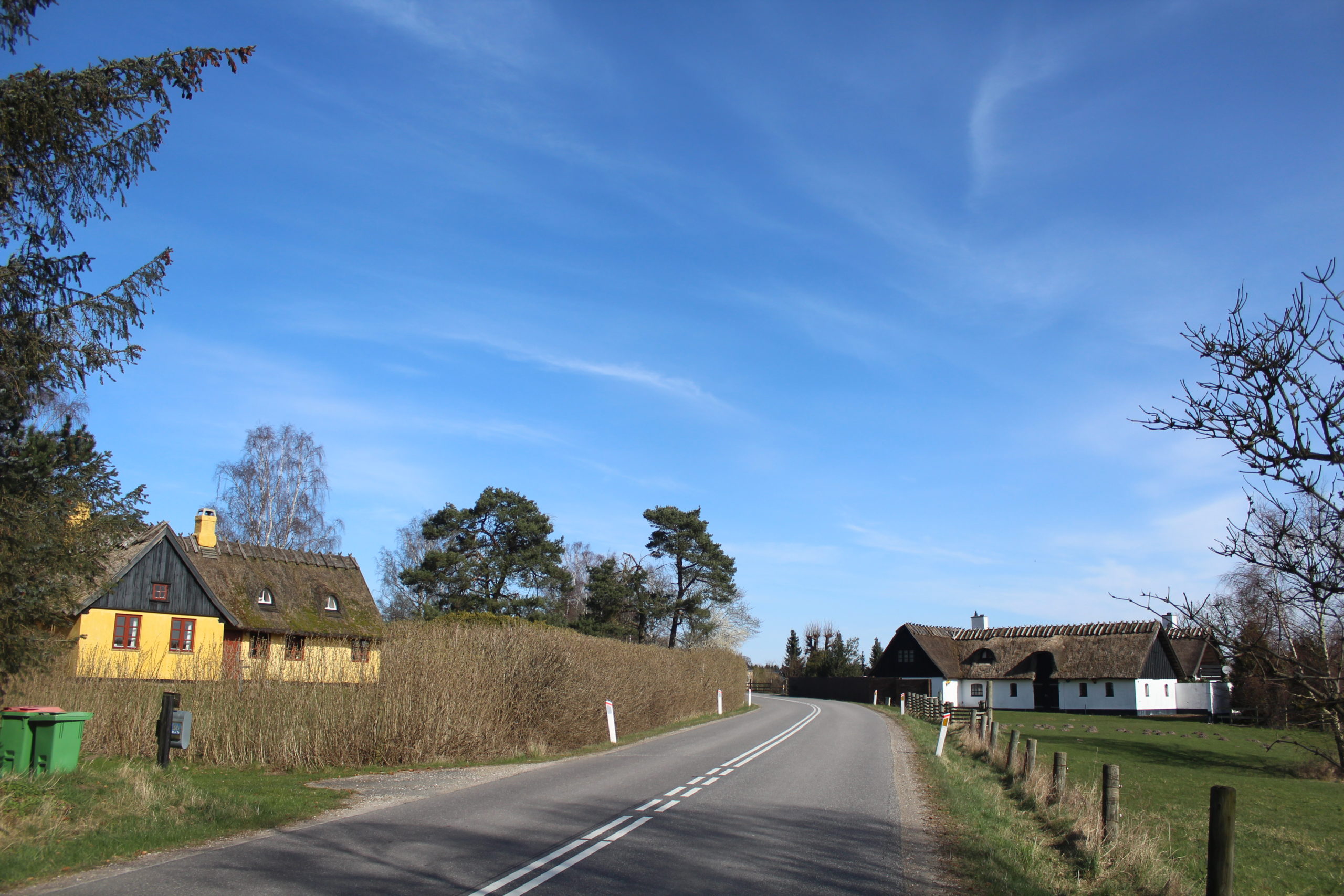
I pass this 2 houses – a summerhouse and a farm close to the road between Asserbo and Tivilde:
Click on photo and use your zoom control and you see them in full screen size.
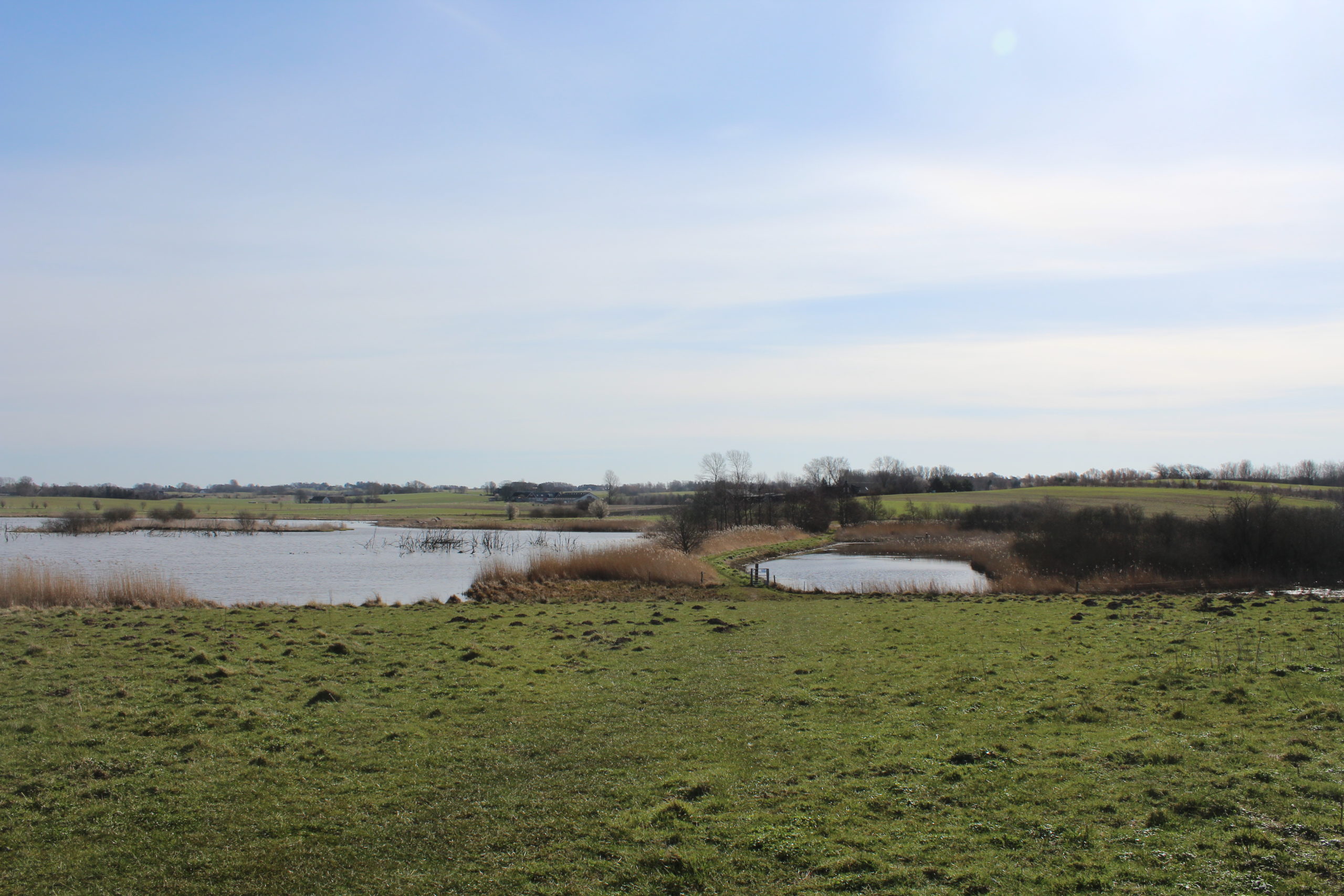
Holløse Bredning is a former part of the salted Arre Fjord connected to Kattegat Sea in The Old Danish Stone Age from 9000 – 2400 B.C. In the New Stone Age Period from 2400 – 1700 B.C. the land where Arre Fjord was connected to Kattegat Sea ( today Asserbo Plantage) rised and Arre Fjord became an inland lake “Arresø” together with Holløse Bredning at the eastern part of the lake.
Lake Holløse Bredning and Tibirke Ancient Trackway :
Path to Holløse Bredning and ancien pathway:
Click on photo and use your zoom control and you see them in full screen size.

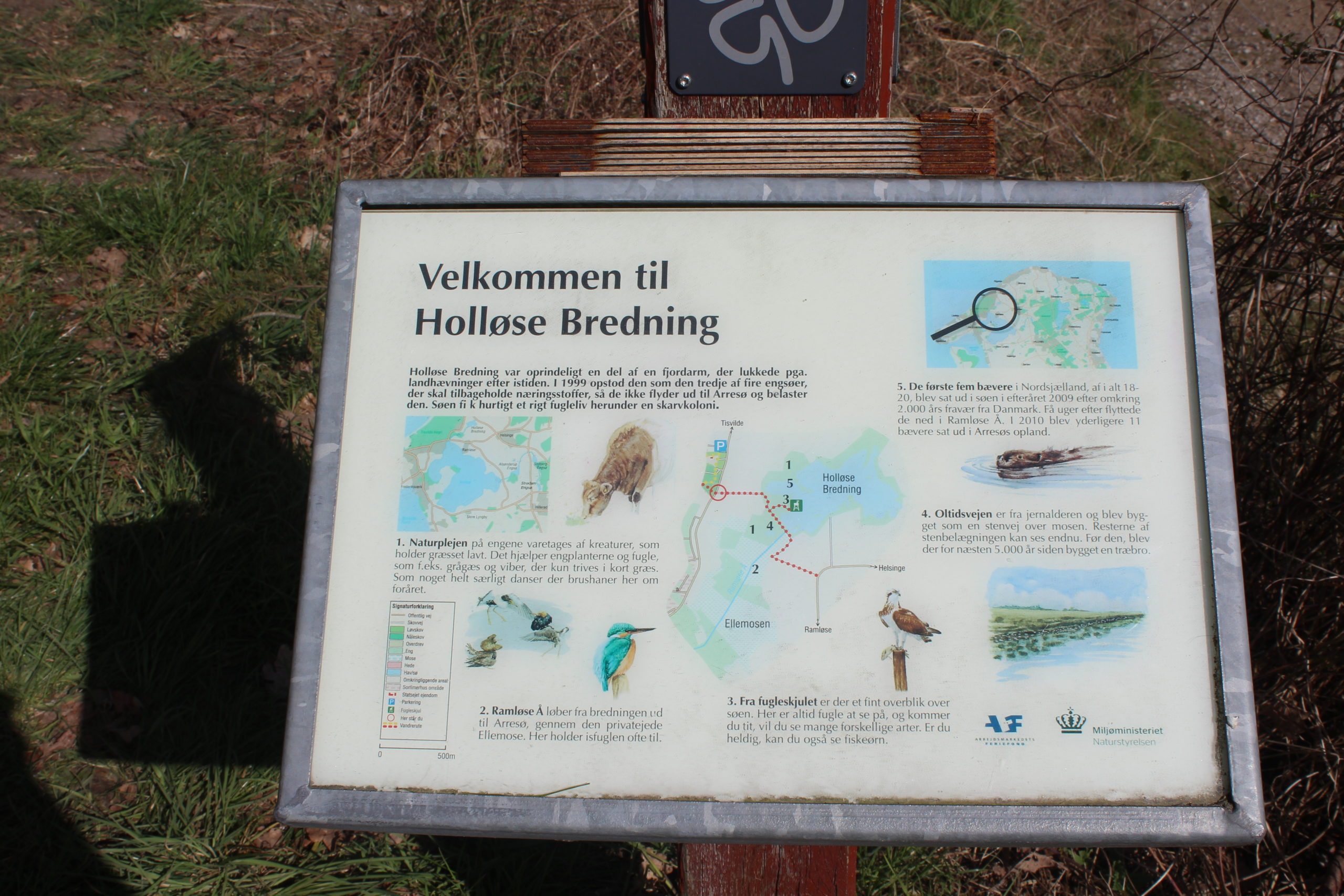
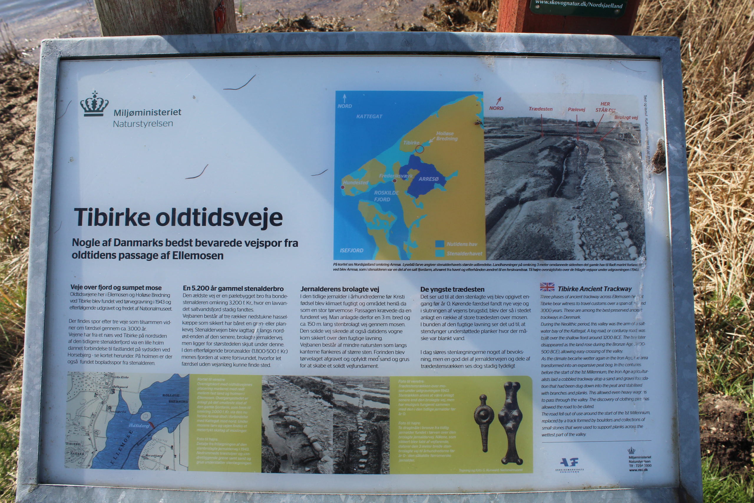
Plate of Lake Holløse Bredning and Tibirke Ancient Trackway:
Click on photo and use your zoom control and you see them in full screen size.
Path through Holløse Bredning to Tibirke Ancient Trackway:
Click on photo and use your zoom control and you see them in full screen size.
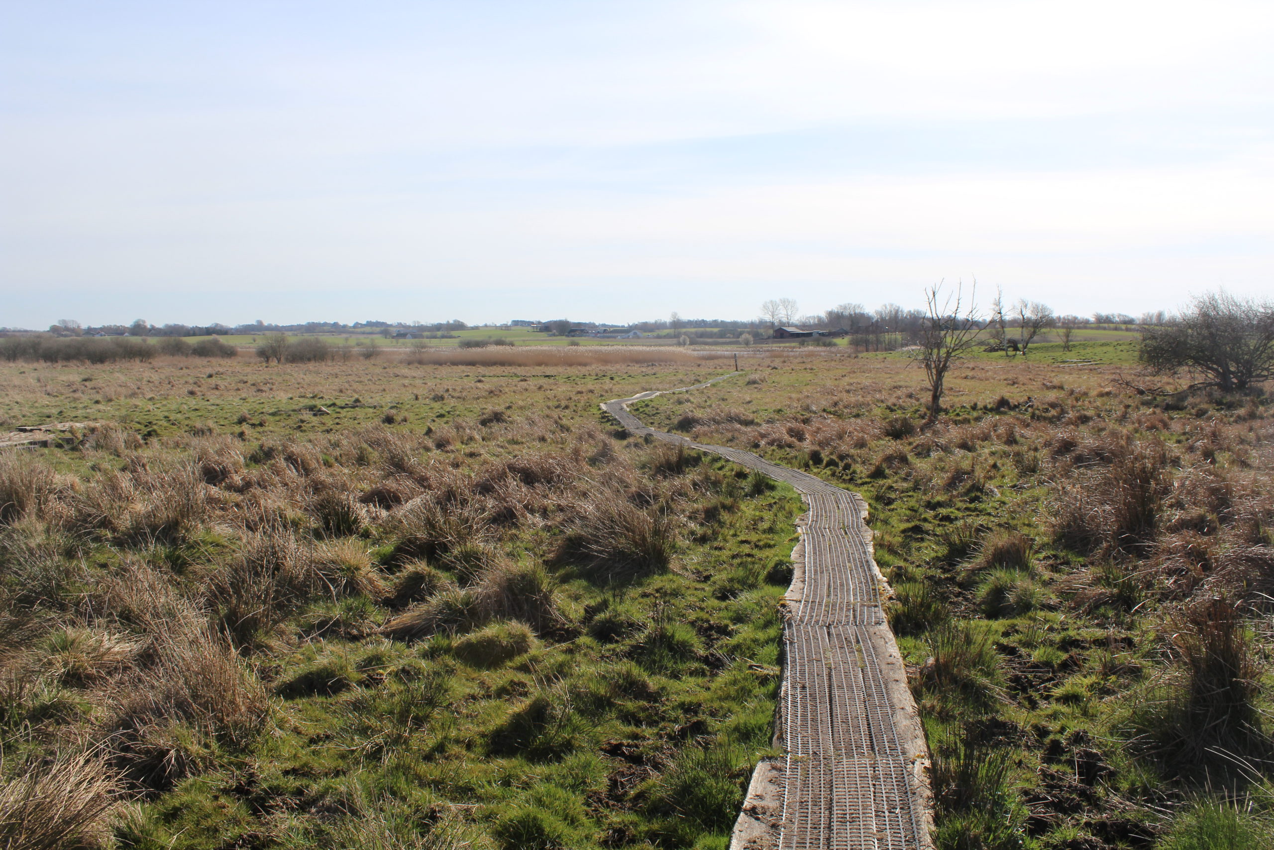
At left lake Holløse Bredning and at right former Tibirke Ancient Trackway – today full of rainwater:
Click on photo and use your zoom control and you see them in full screen size.
Holløse Bredning and Tibirke Ancient Trackway – photo from 2013 with no rain water on the former trackway:
Tibirke Ancient Trackway, “Oldtidsvejen” in direction north-south.
Click on photo and use your zoom control and you see them in full screen size.

Holløse Bredning and Tibirke Ancient Trackway – photo from 2013 with no rain water on the former trackway:
Tibirke Ancient Trackway, “Oldtidsvejen” in direction north-south.
At left the 3 meter broad road of stones from Danish Roman Iron Age 500 B.C. – 400 A.C. In the middle of the photo under the grass are the remains of a upright road made of wood from Danish Stone Age about 5000 B.C. to 2000 B.C.
Photo: 17. september 2013.
Click on photo and use your zoom control and you see them in full screen size.
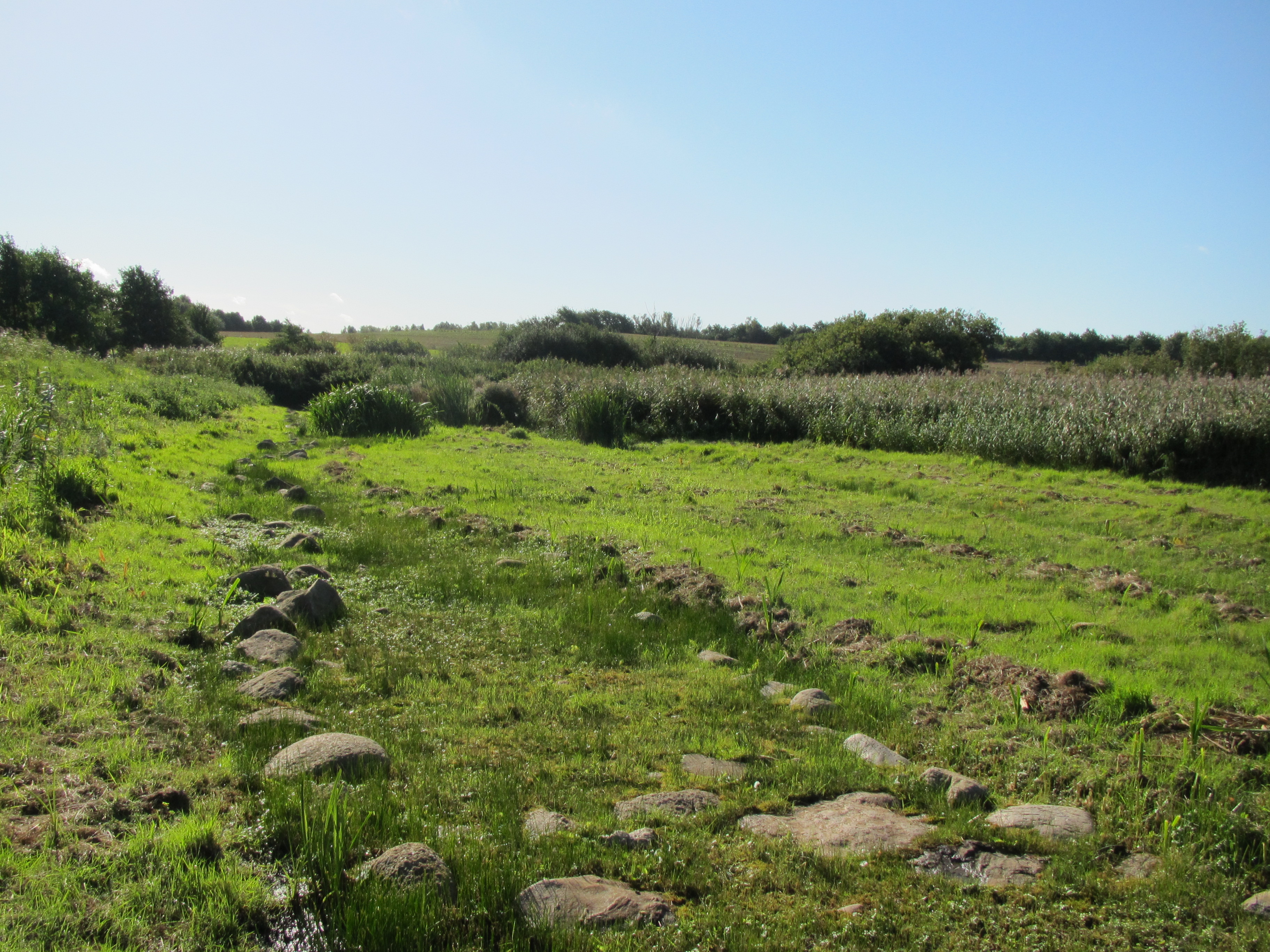
Plate of Holløse Bredning and Tibirke Ancient Trackway – a way of stone used since Danish Stone Age 3500 B.C.:
Click on photo and use your zoom control and you see them in full screen size.
Holløse Bredning Lake at left behind rush and Tibirke Ancient Trackway at right, today covered by rainwater – a way of stone used since Danish Stone Age 3500 B.C. – view in directon south with Tibirke Church in the distance:
Click on photo and use your zoom control and you see them in full screen size.

Holløse Bredning Lake at right behind rush and Tibirke Ancient Trackway, today covered by rainwater – a way of stone used since Danish Stone Age 3500 B.C. – view in directon north with Tibirke Church in the distance:
Click on photo and use your zoom control and you see them in full screen size.

Holløse Bredning – viewpoint House to Holløse Lake:
Click on photo and use your zoom control and you see them in full screen size.
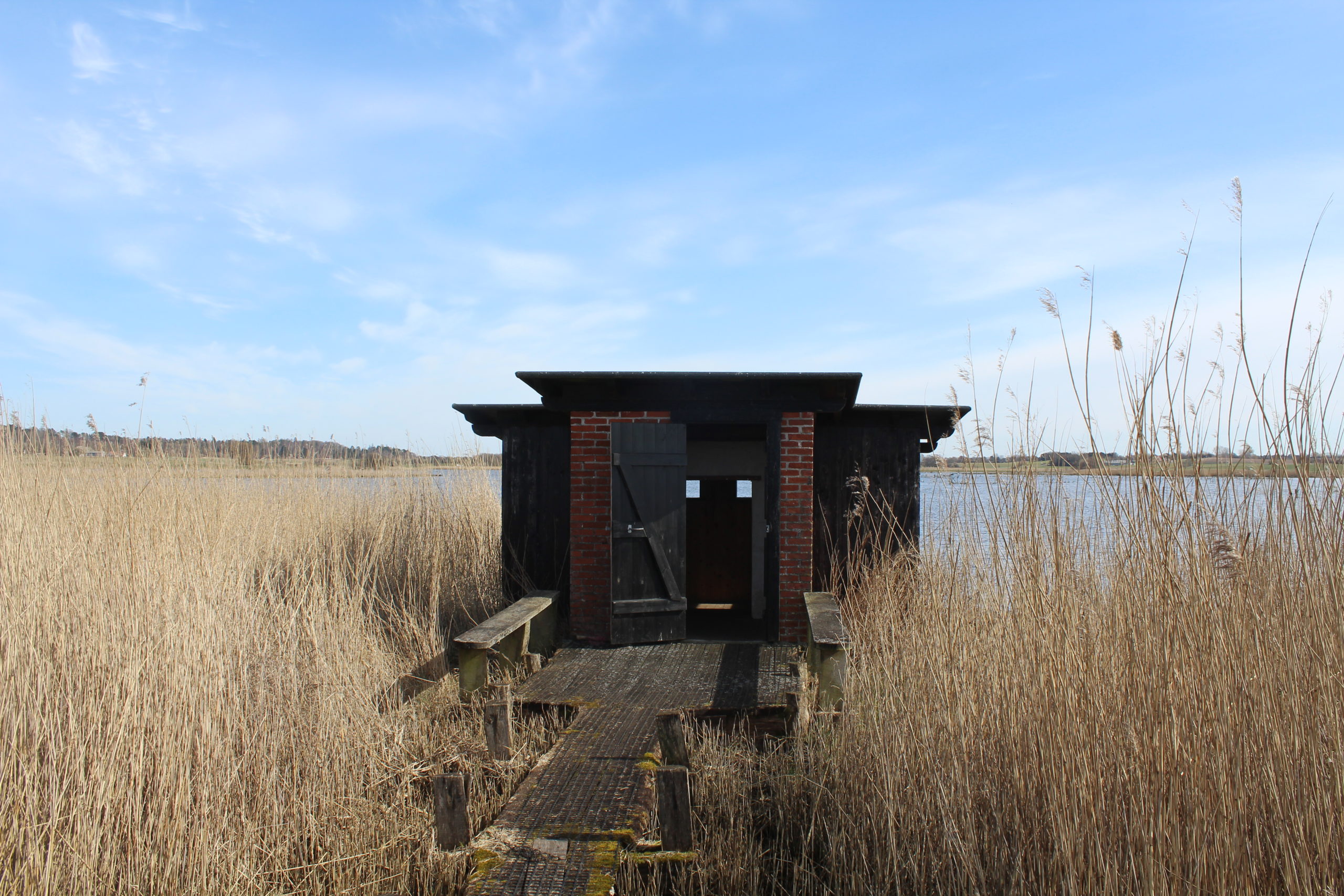
Holløse Bredning Lake.
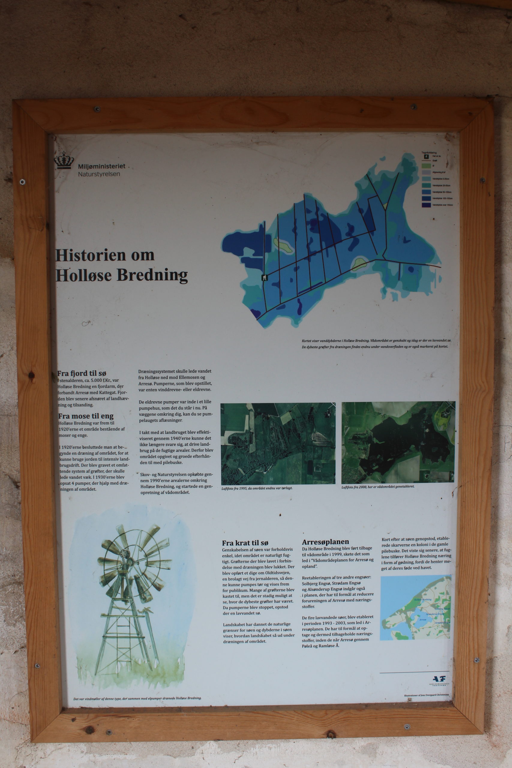
Plate inside viewpoint House:
Click on photo and use your zoom control and you see them in full screen size.
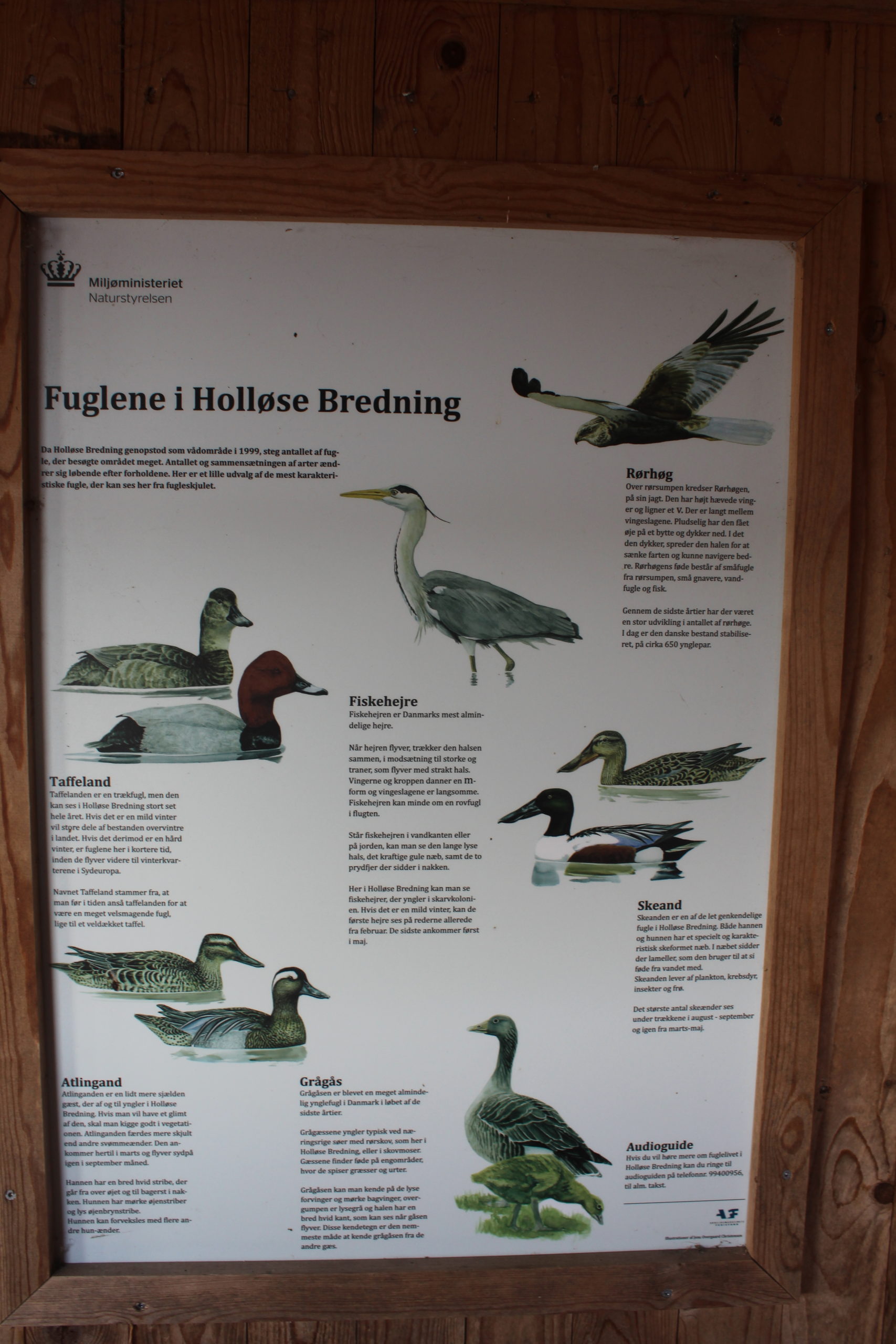
Holløse Bredning Lake.
Plate inside viewpoint House:
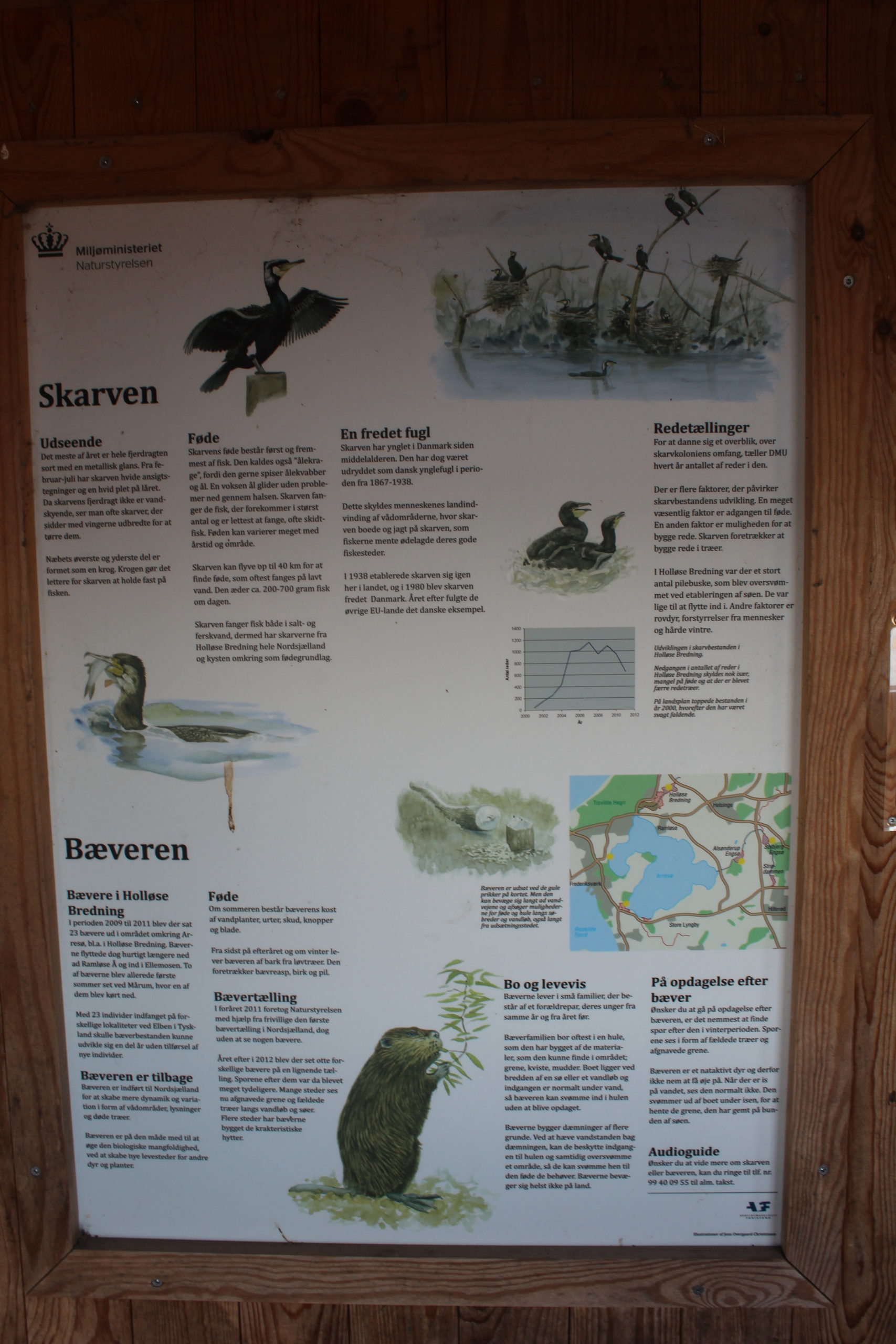
Click on photo and use your zoom control and you see them in full screen size.
Holløse Bredning Lake.
Plate inside viewpoint House:
Click on photo and use your zoom control and you see them in full screen size.
Holløse Bredning – view in direction south to Lake Holløse Bredning from Tibirke Church Area:
Click on photo and use your zoom control and you see them in full screen size.

Denmark is closed down – but nature is full open for visitors.
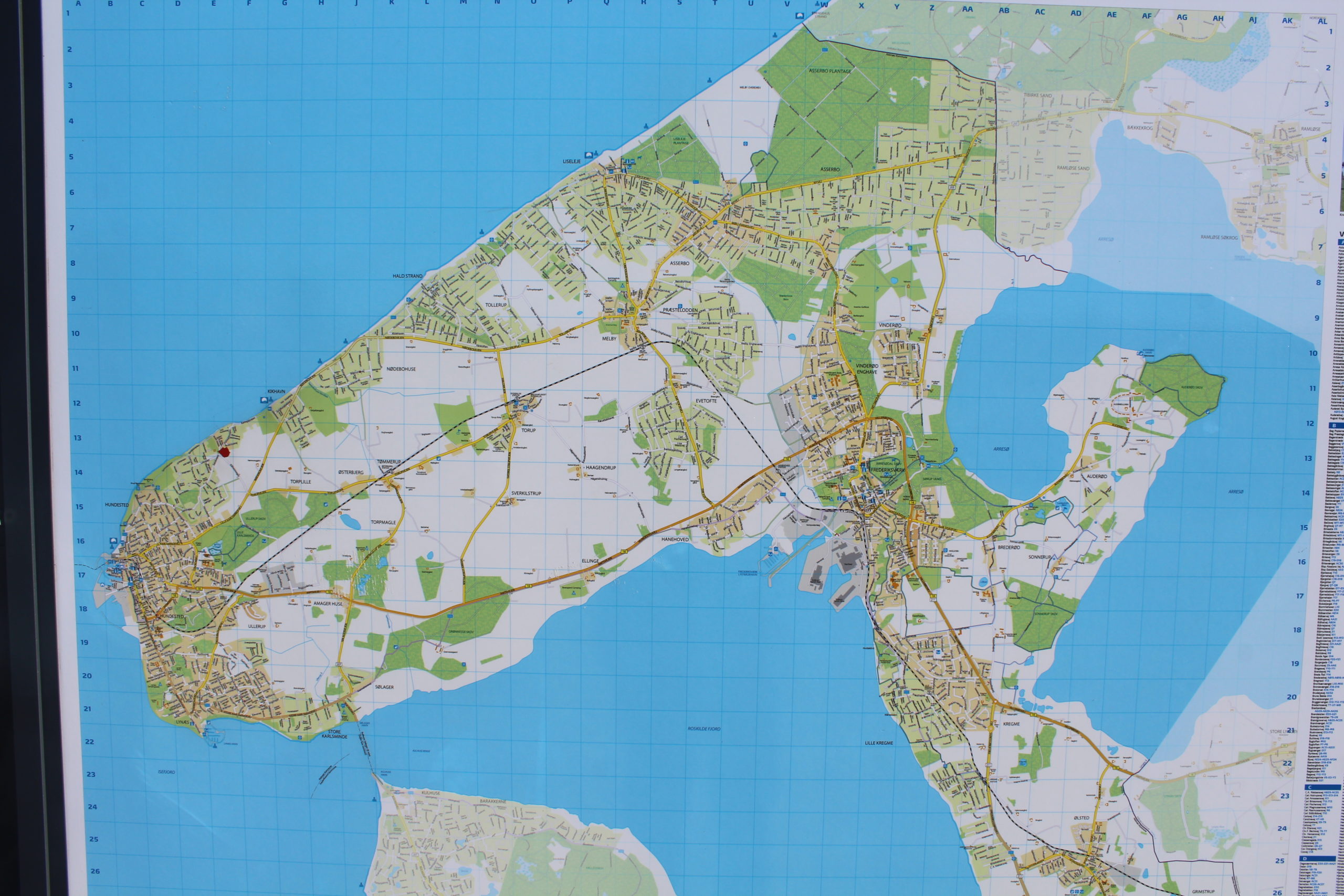
Halsnaes Commune – surrounded by sea, fjord and lake:
Kattegat Sea, Roskilde Fjord, Isefjiod and Arresø Lake.
Map of Halsnaes Commune, North Sealand:
Click on photo and use your zoom control and you see them in full screen size.
I recommend my article on my homepage danculture.dk (Clic on text):
Text and photos Copyright Erik K Abrahamsen 2020
All rights reserved
Enjoy life – be happy!
Melby, North Sealand the 23. march 2020
Best wishes
Erik