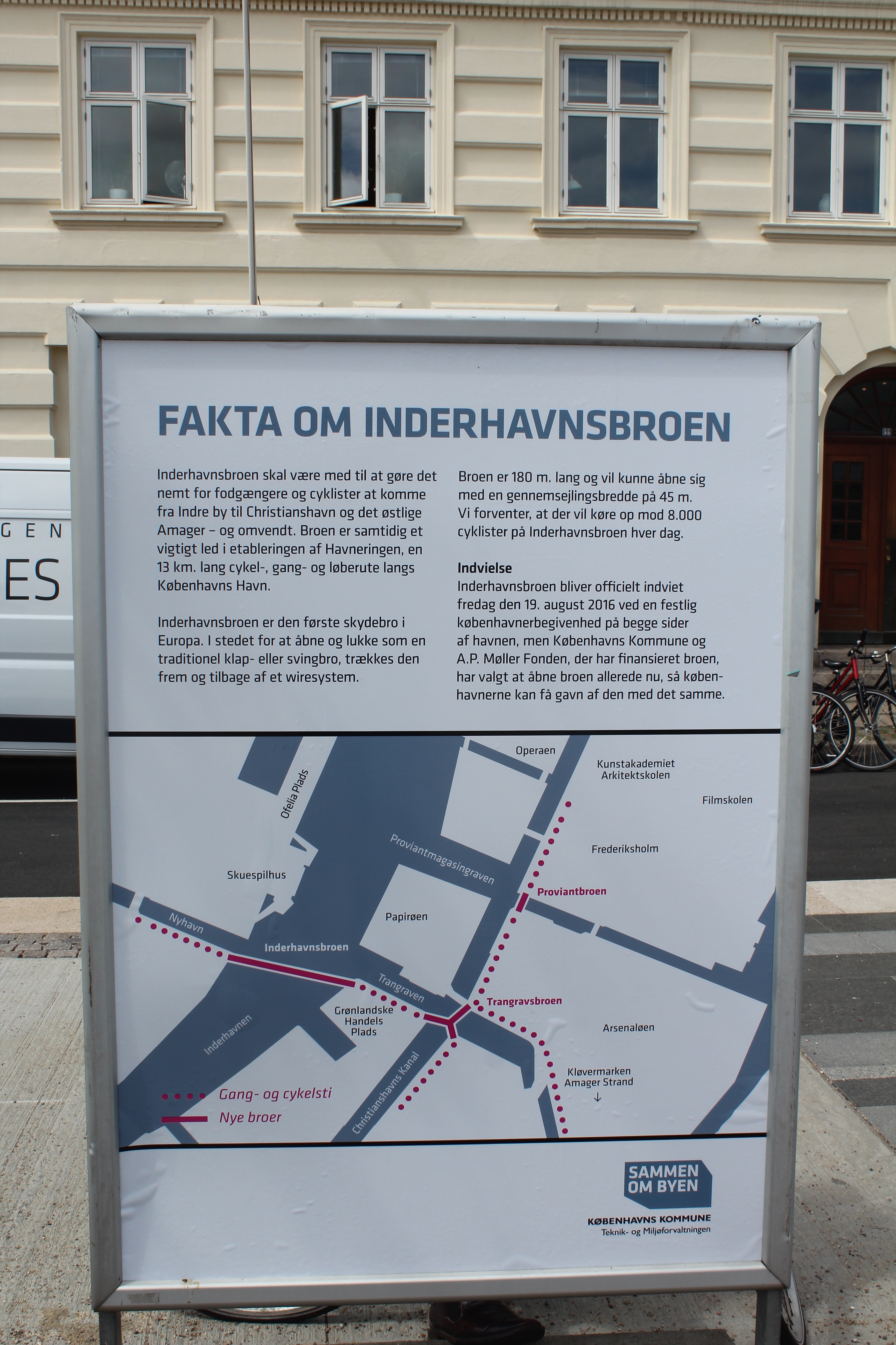
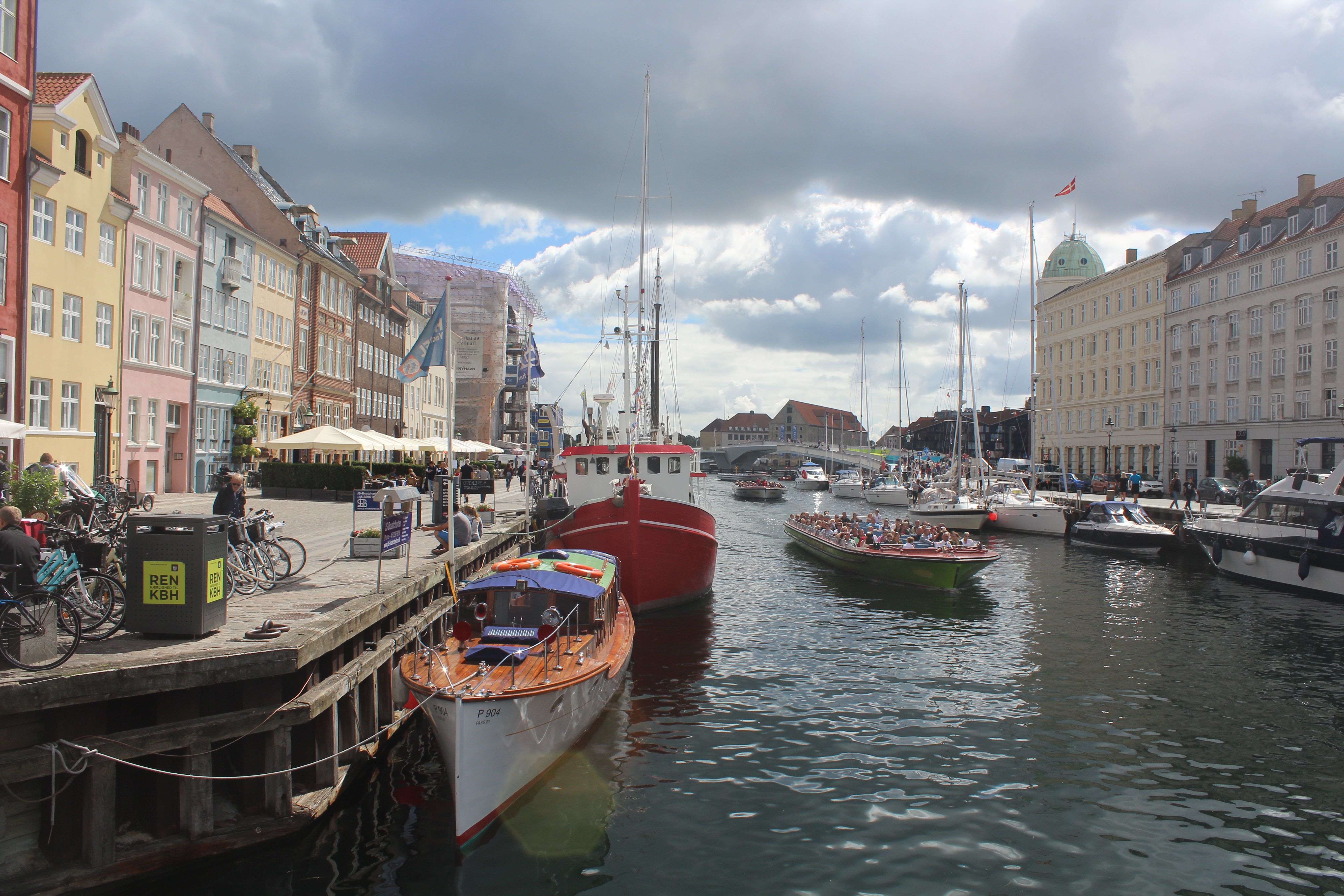
Ny gang- og cykelbro “Inderhavnsbroen” i Københavns Havn binder Nyhavn sammen med Christianshavn – blændende design af skønhed, stil og funktion.
Photos og text Erik K Abrahamsen.
After 3 years delay and after 5 years under construction walk- and bike bridge “Inderhavnsbroen” between Nyhavn and Christianshavn was opened thursday the 7. july 2016 at 6 PM to the public.
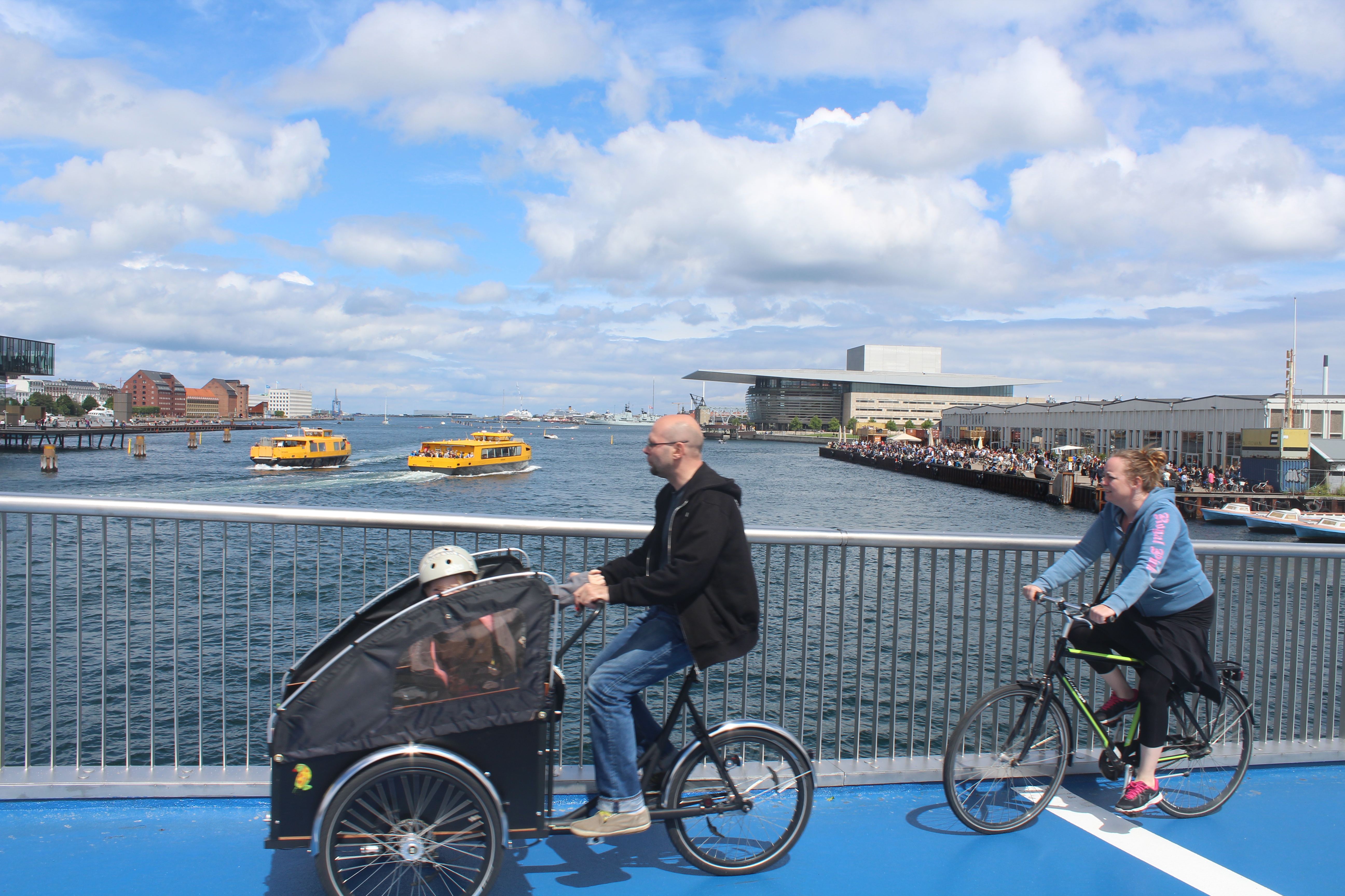
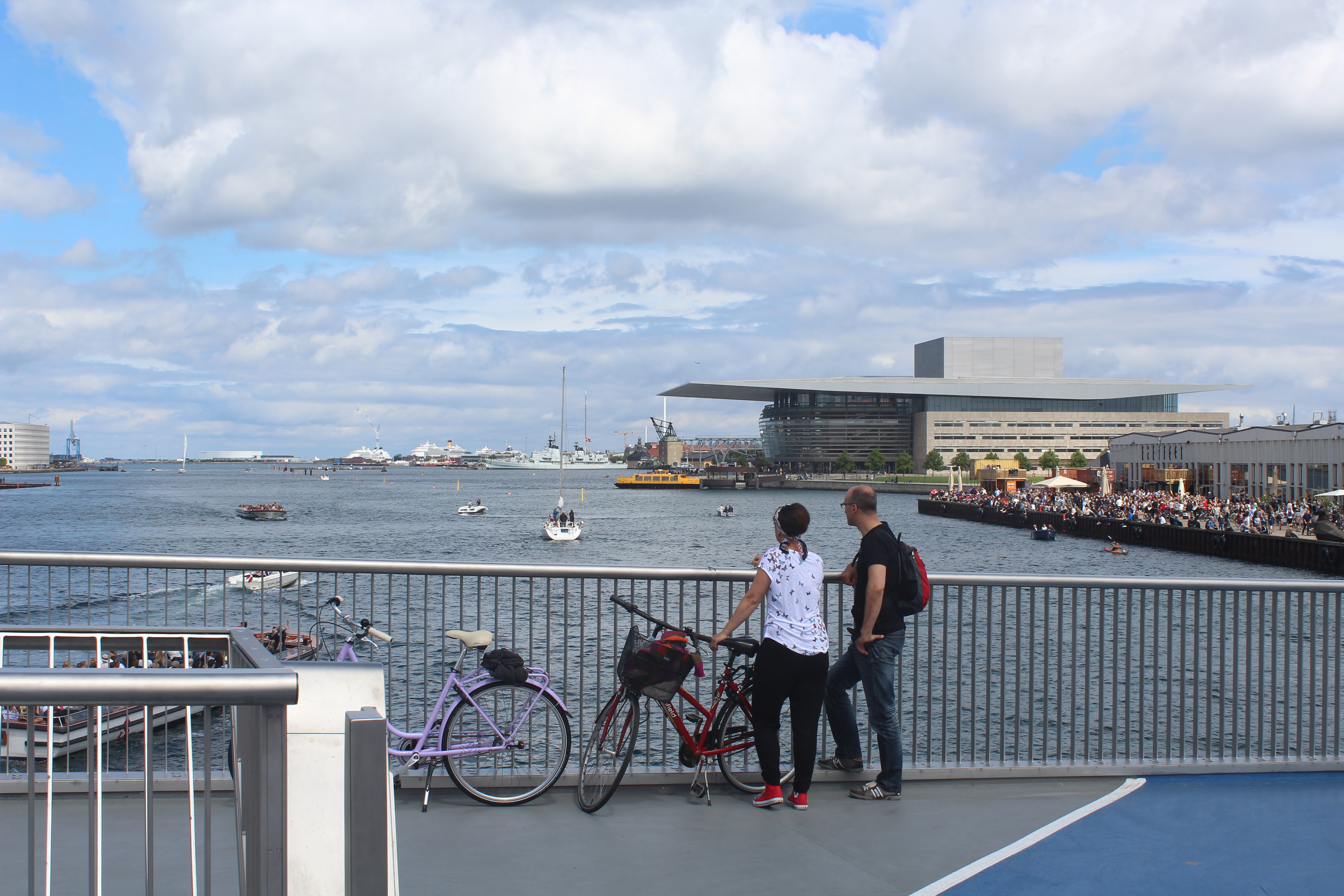
Thousands of danes and visitors have “invaded” the new walk- and bike bridge the last 3 days to enjoy its function and the splendid view from the bridge to the beauty of Copenhagen Inner Harbour.
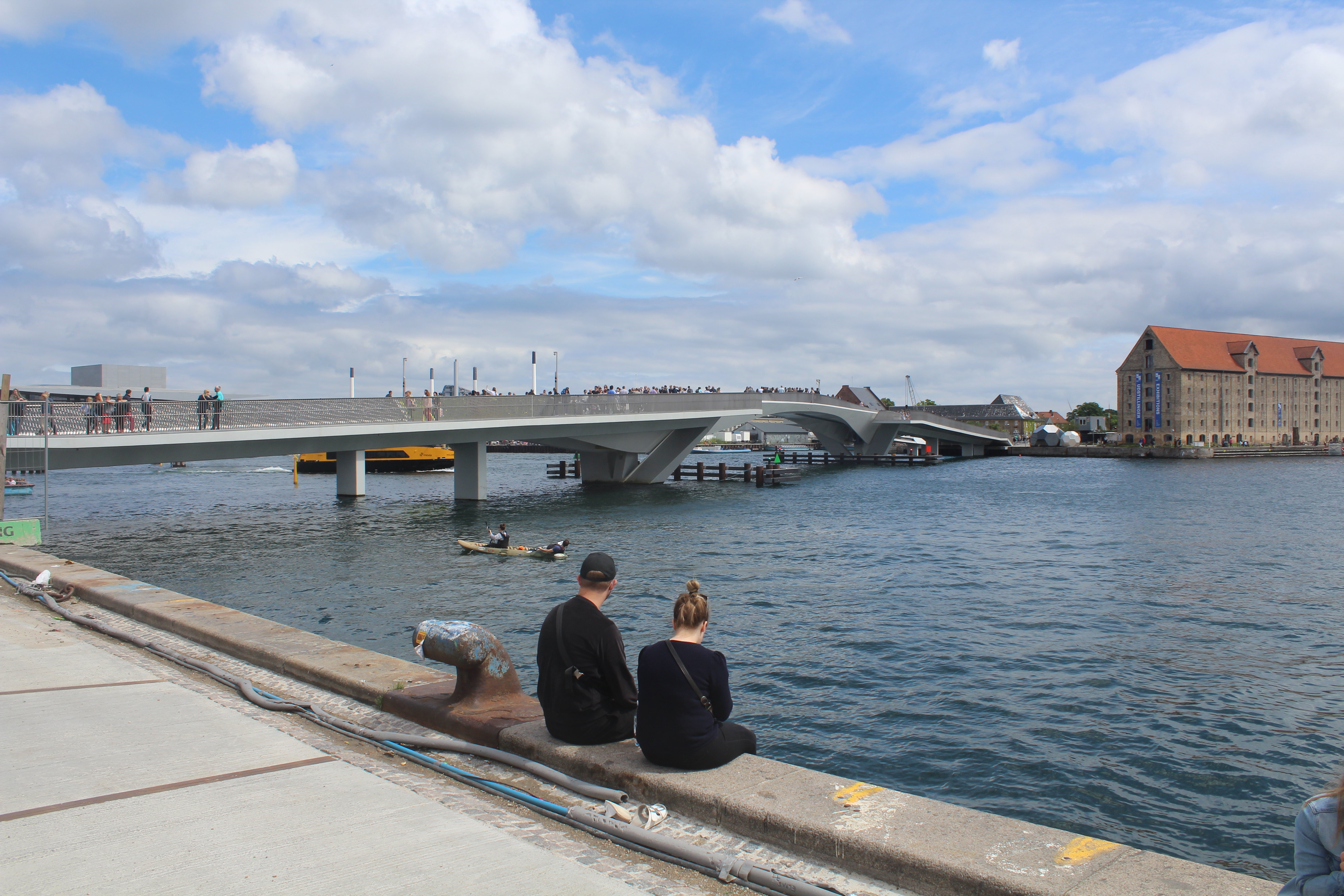
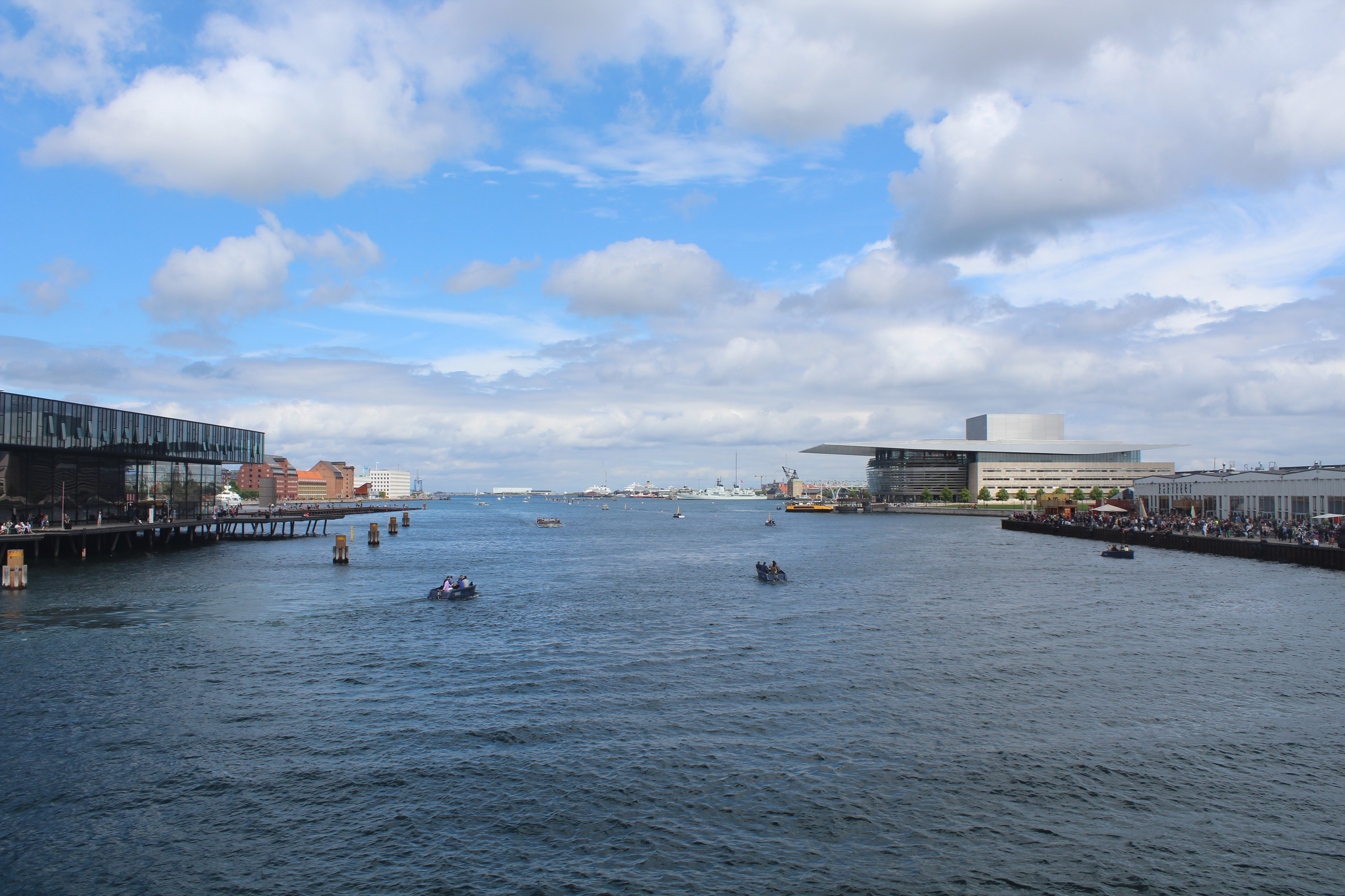
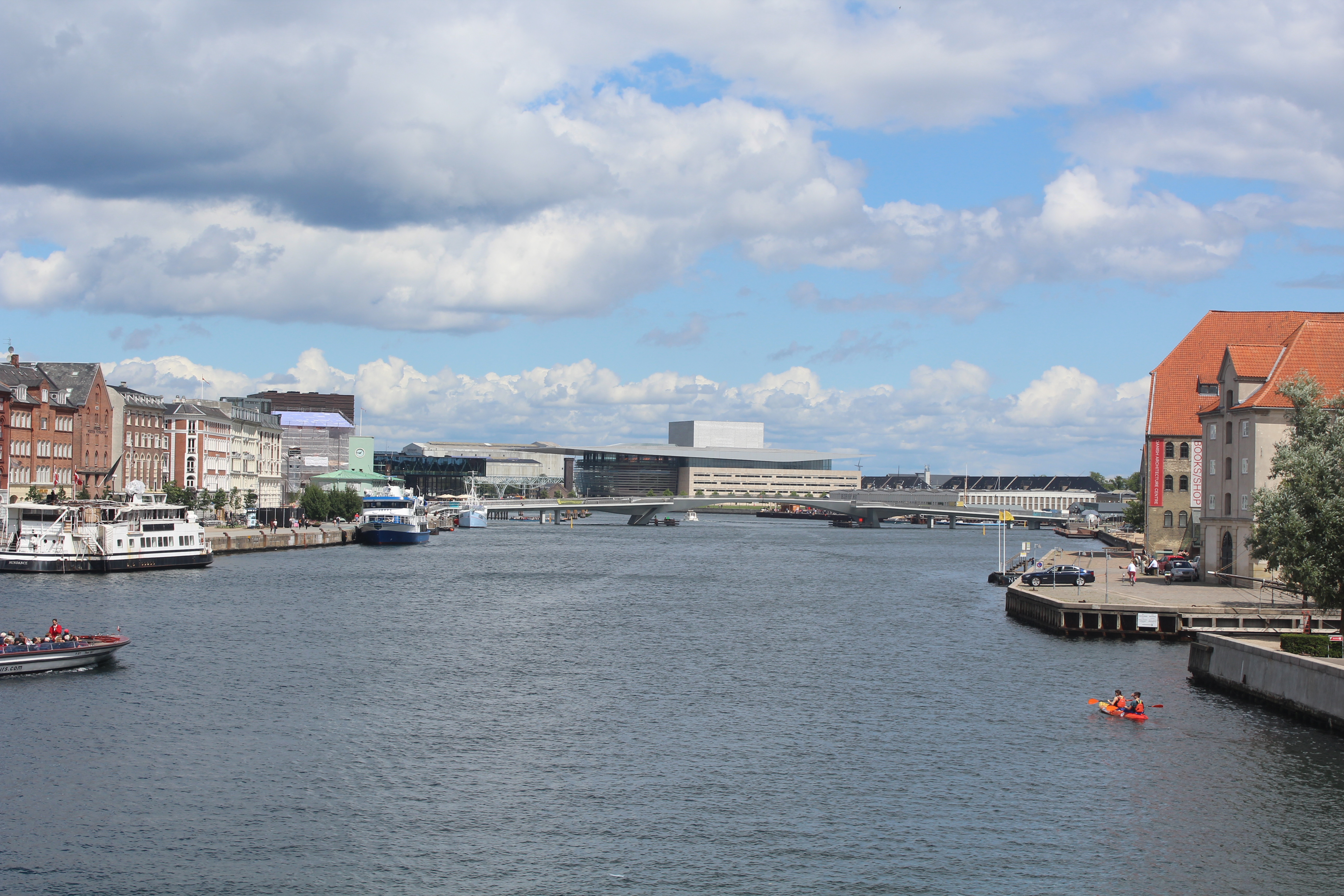
New 180 meter long bike- and walk bridge “Inderhavnsbroen” between Havnegade/Nyhavn and Christianshavn – view from Nyhavn to Grønlandske Handels Plads på Christianshavn:
Click on photos and use your zoom control and you see them in full screen size and text on right side of photo disappear.
On saturday 9. july 2016 I drove 60 km from my home in North Sealand to Copenhagen to visit and “invade” the new bridge.
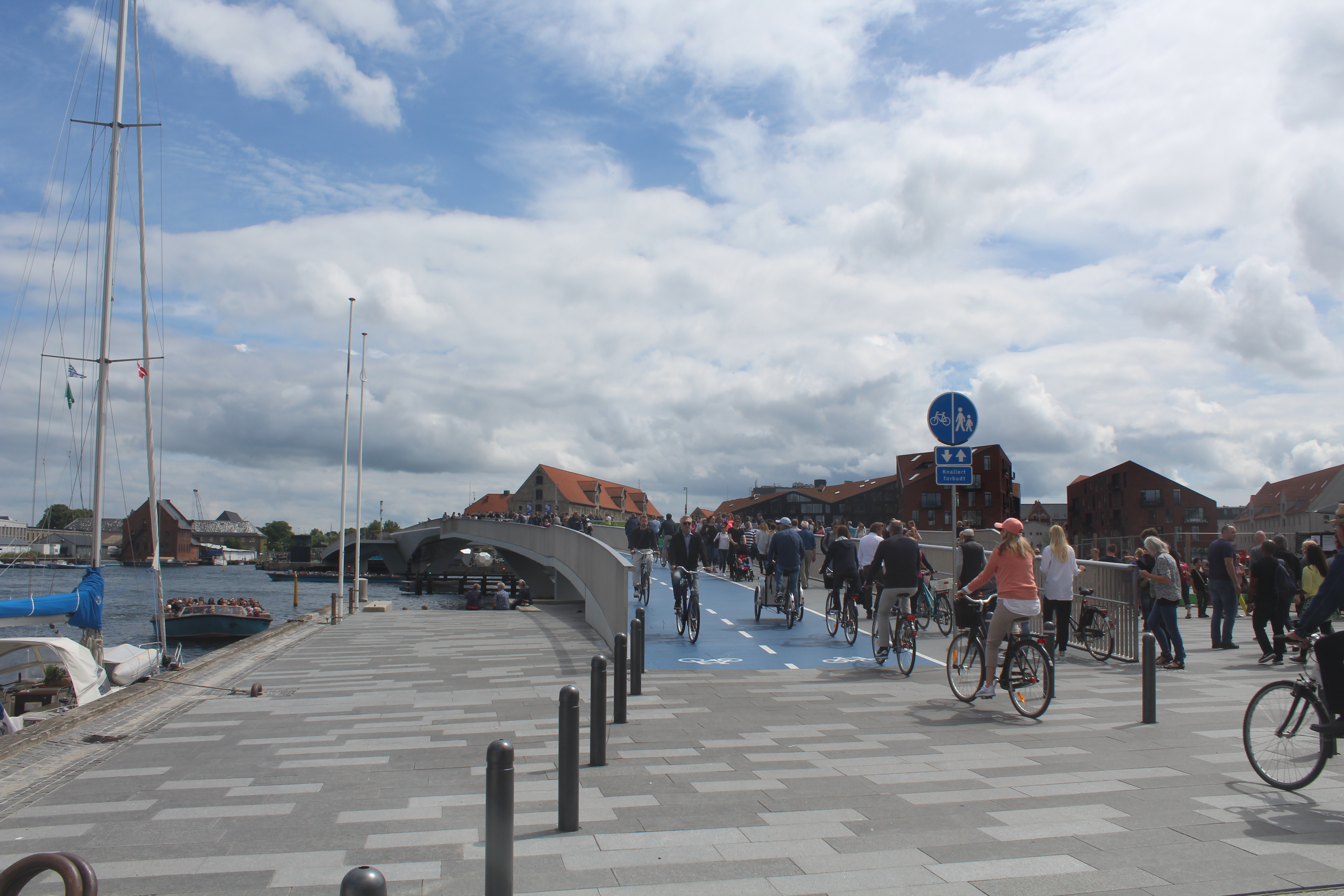
The 180 meter long “Inderhavnsbroen” is one of three new bike-and walk bridges, which connects Copenhagen City in Nyhavn with the quarters Christianshavn, Amager and Holmen on the opposite side of Copenhagen Inner Harbour.
The two other walk-and bike bridges are “Trangravsbroen” (between Christianshavn and Arsenaløen) and “Proviantbroen” (between Arsenaløen and Frederiksholm) and were opened for the public in 2014.
The 3 new walk-and bike bridges are a main crossing route of Copenhagen Inner Harbour of two major bike-, run- and walk routes:
Christianhavnsruten from Copenhagen City and quarters Vesterbro, Frederiksberg, Nørrebro and Østerbro via Nyhavn/Havnegade to Grønlandske Handels Plads på Christianshavn, Freetown Christiania, Kløvermarken, Island Amager and Amager Beach to Kastrup Airport (north/south route) and
Havneringen – 13 km long bike-, run- and walk route on north- and south side of Copenhagen Inner Harbour from east to west at “Sluseholmen” and back (See locations on map) and havneringen.dk .You can choose four “circle routes” – lengths 2, 4, 7 and 13 km passing 4 bridges: Cirkelbroen, Bryggebroen, Slusen and Inderhavnsbroen.
Kort over København City, Christianshavn og Holmen:
Click on map and use your zoom control and you see them in full screen size.

Photo 10. october 2012 by Erik K Abrahamsen.
Map of the 13 km long walk-, run- and bike route “Havneringen” in Copenhagen Inner Harbour:

Map of “Havneringen” in Copenhagen Inner Harbour. Thanks to Copenhagen Kommune, Teknik- og Miljøforvaltningen for using this map.
Table of the 3 new walk- and bikebridges connecting Nyhavn in Copenhagen City with Christianshavn, Holmen and Amager in Copenhagen Inner Harbour:
Click on photos and use your zoom control and you see them in full screen size.
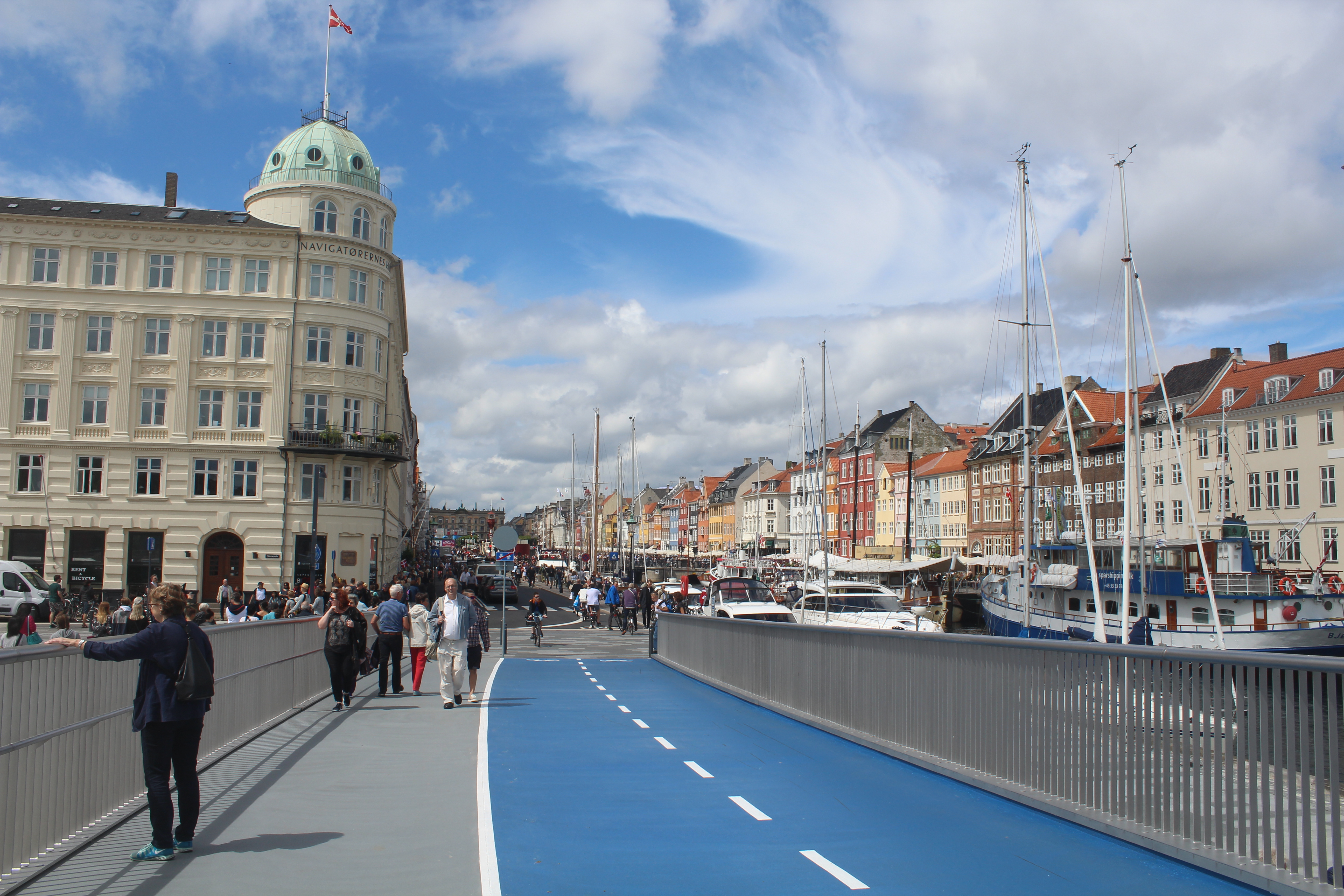
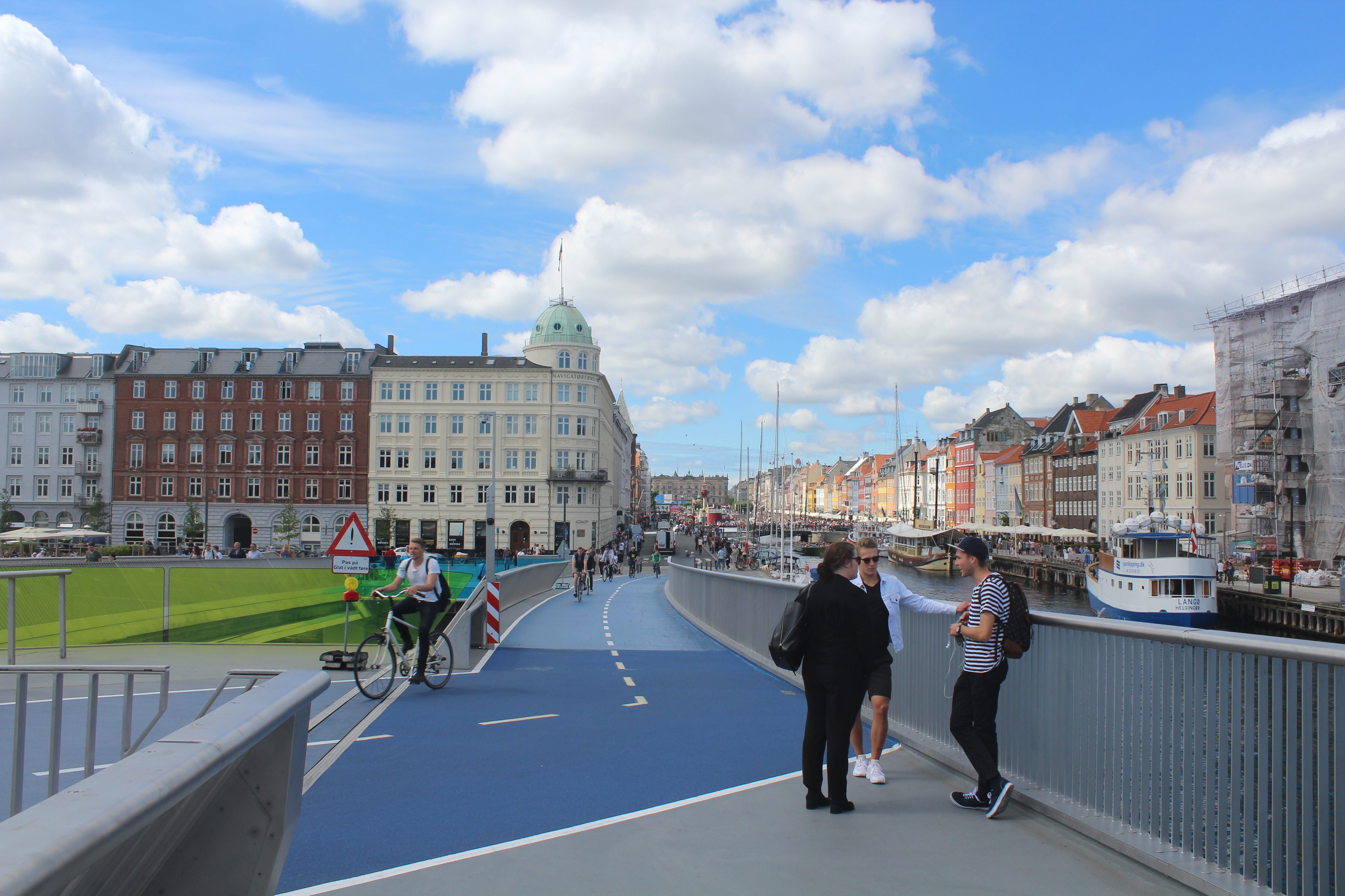
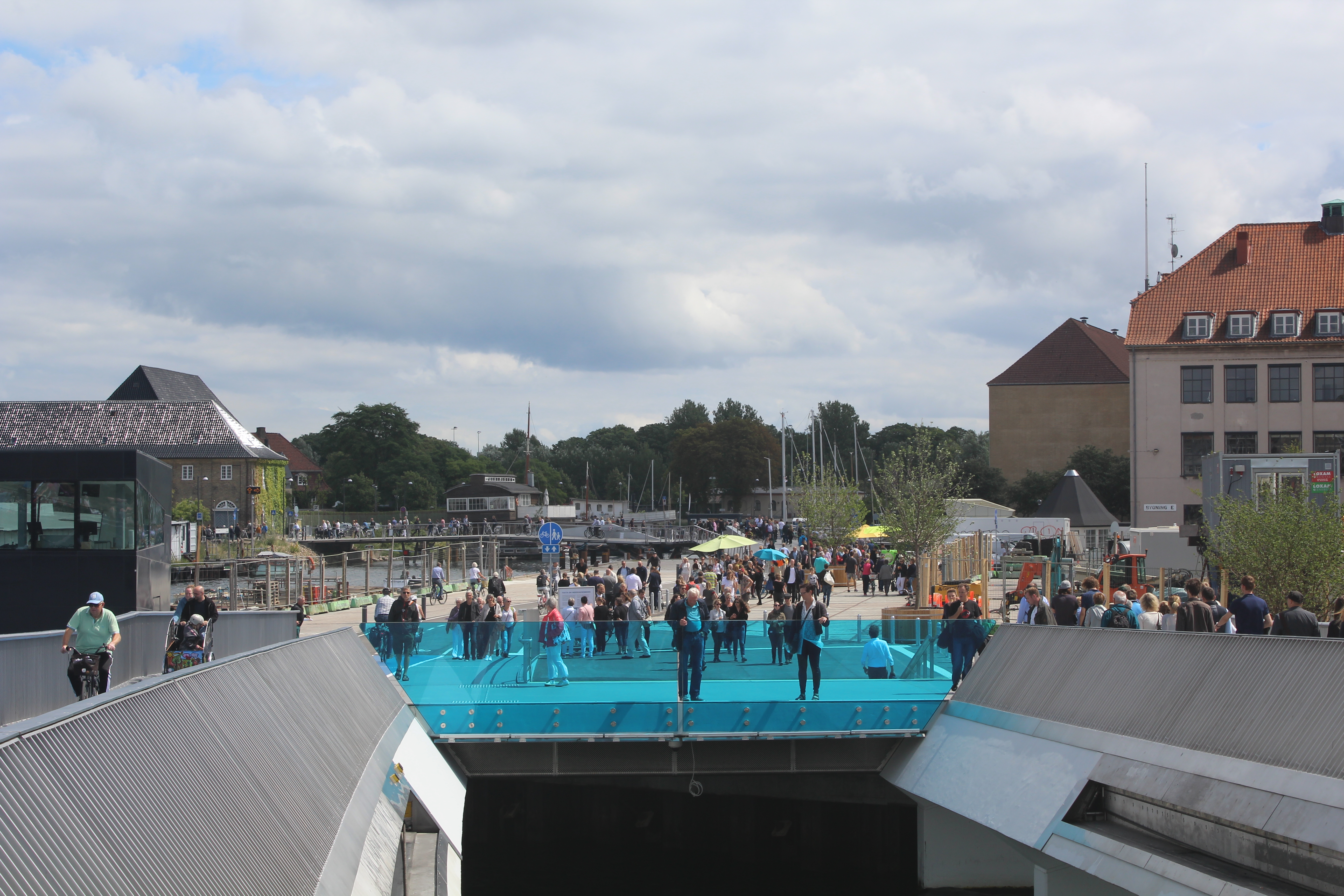
The 180 m long Inderhavnsbroen – view from its beginning on Havnegade and south part of Nyhavn:
Click on photos and use your zoom control and you see them in full screen size.
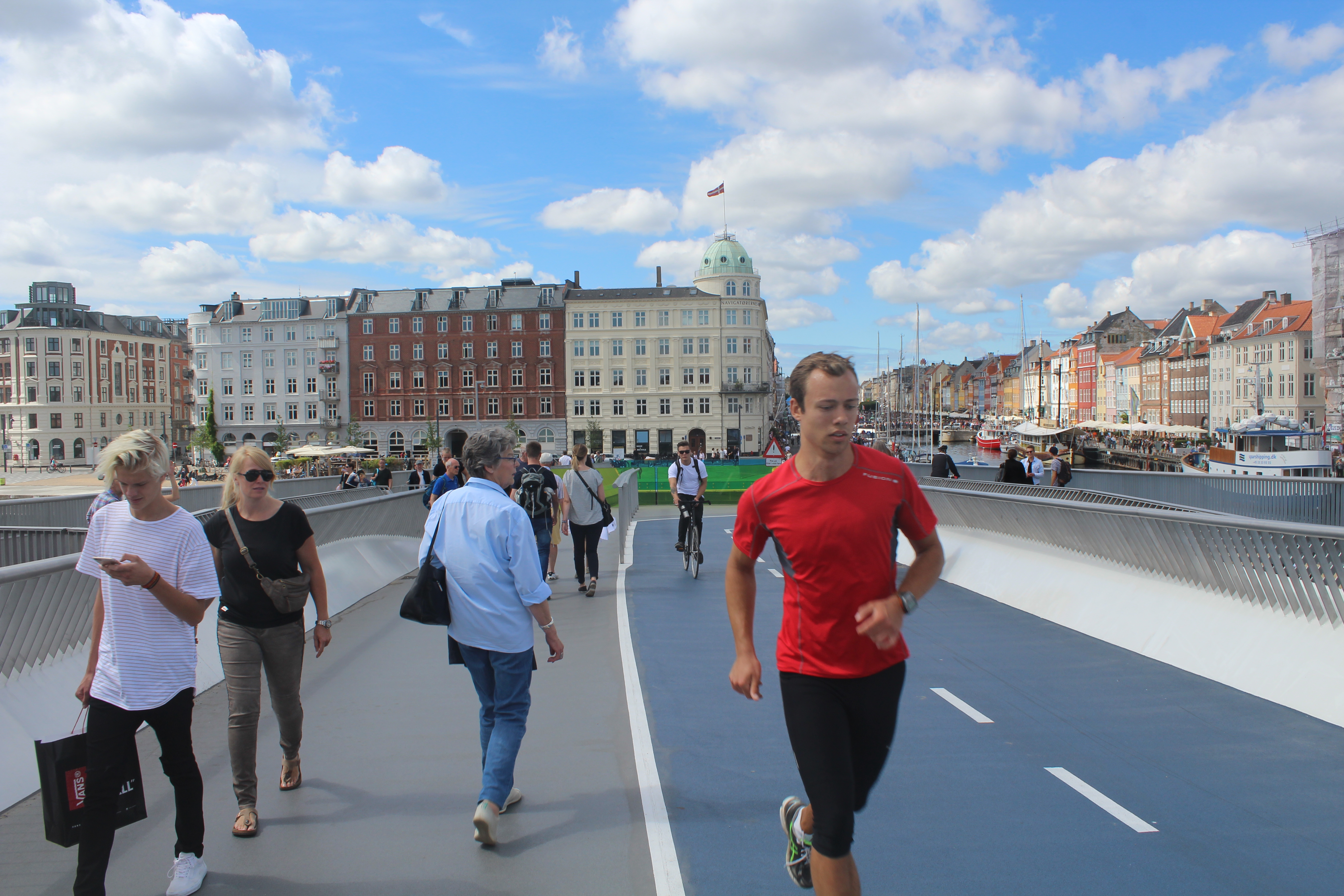
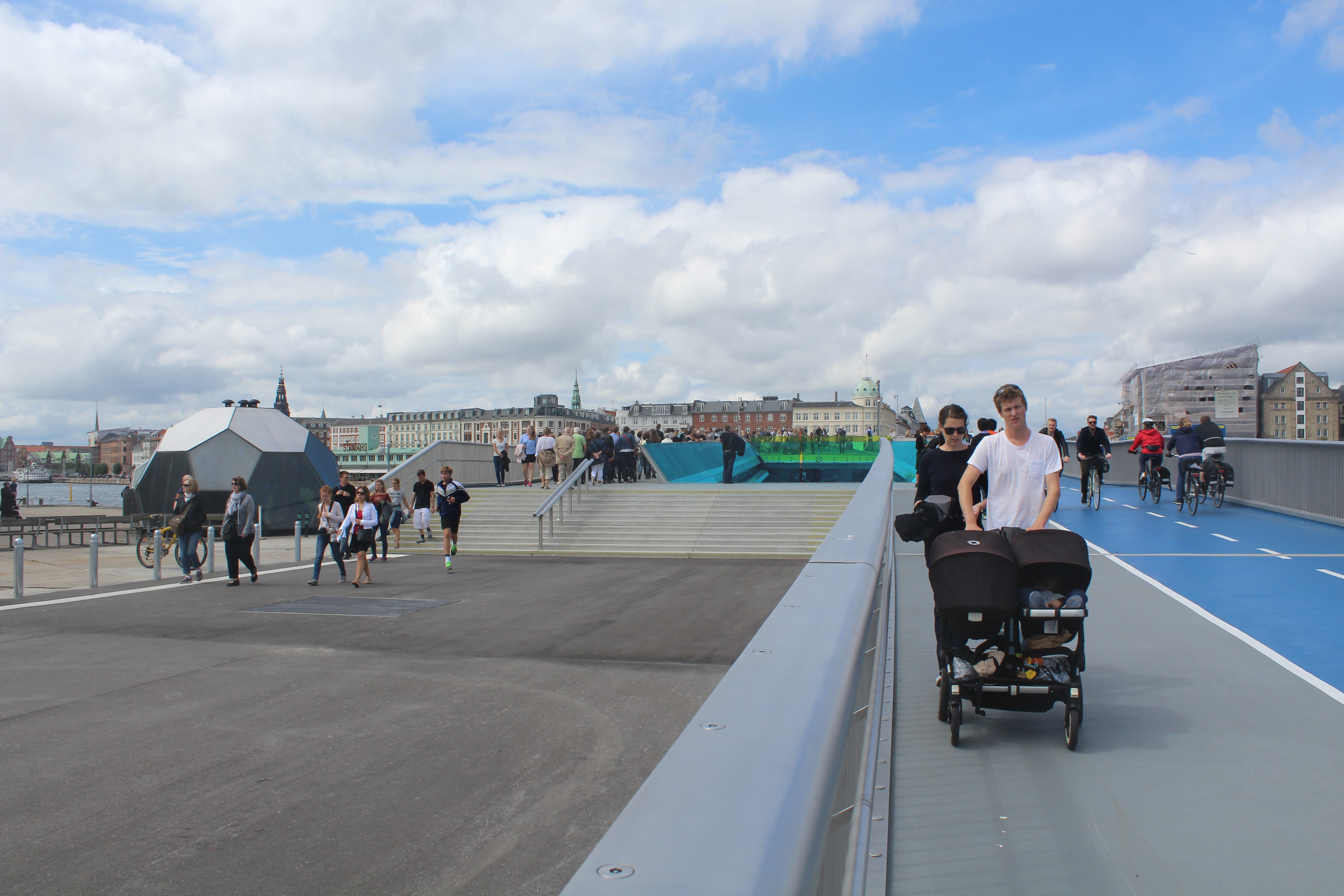
View from the new 180 m long “Inderhavnsbroen” in direction north to Havnegade and Nyhavn and Copenhagen City:
Click on photos and use your zoom control and you see them in full screen size.
Exstra photo on 19. july 2016:
Relaxed atmosphere on top of the bridge – view in direction north to Nyhavn:
Click on photos and use your zoom control and you see them in full screen size.
Exstra photo on 19. july 2016:
The new walk- and bike bridge is excellent for running:
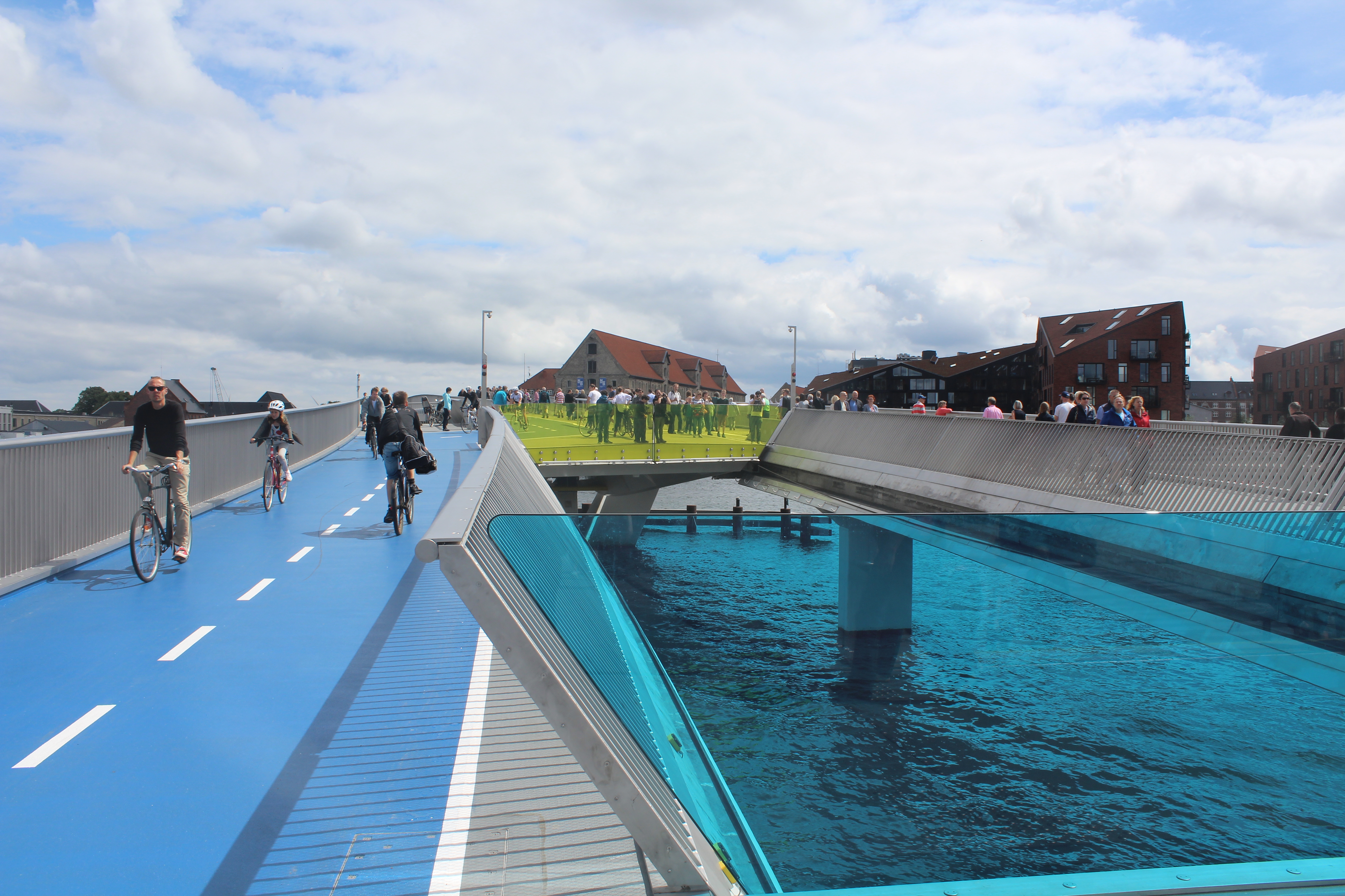
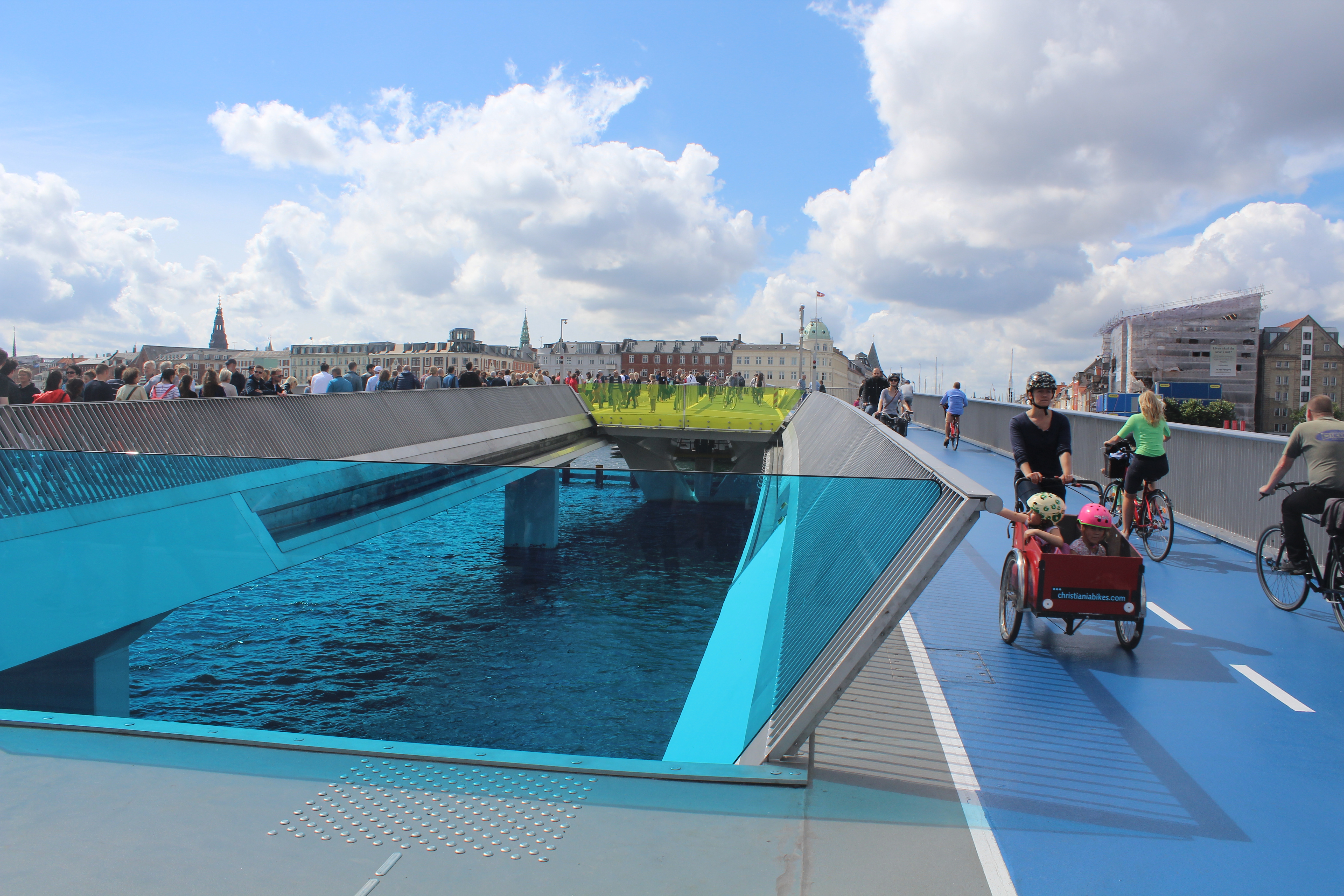
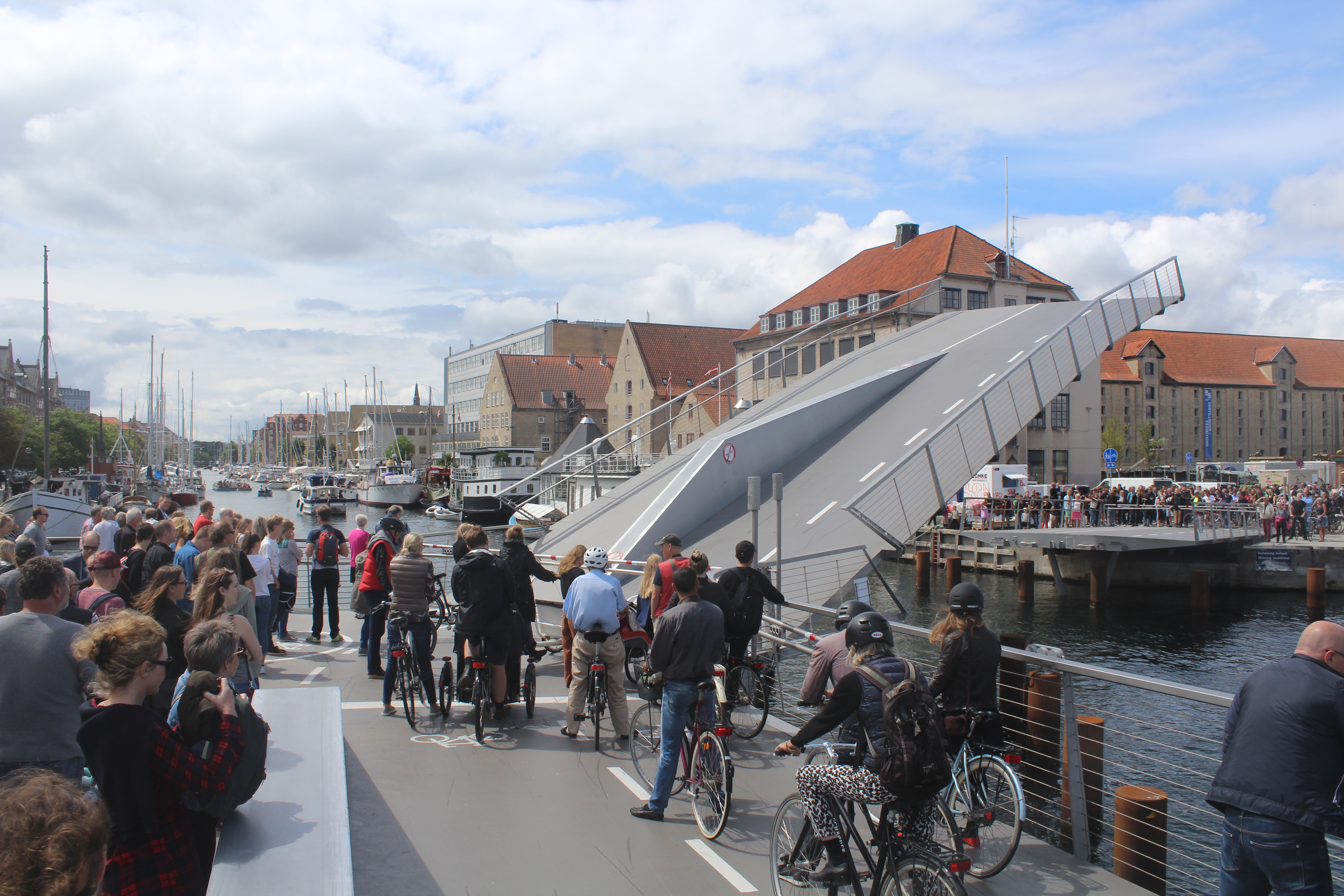
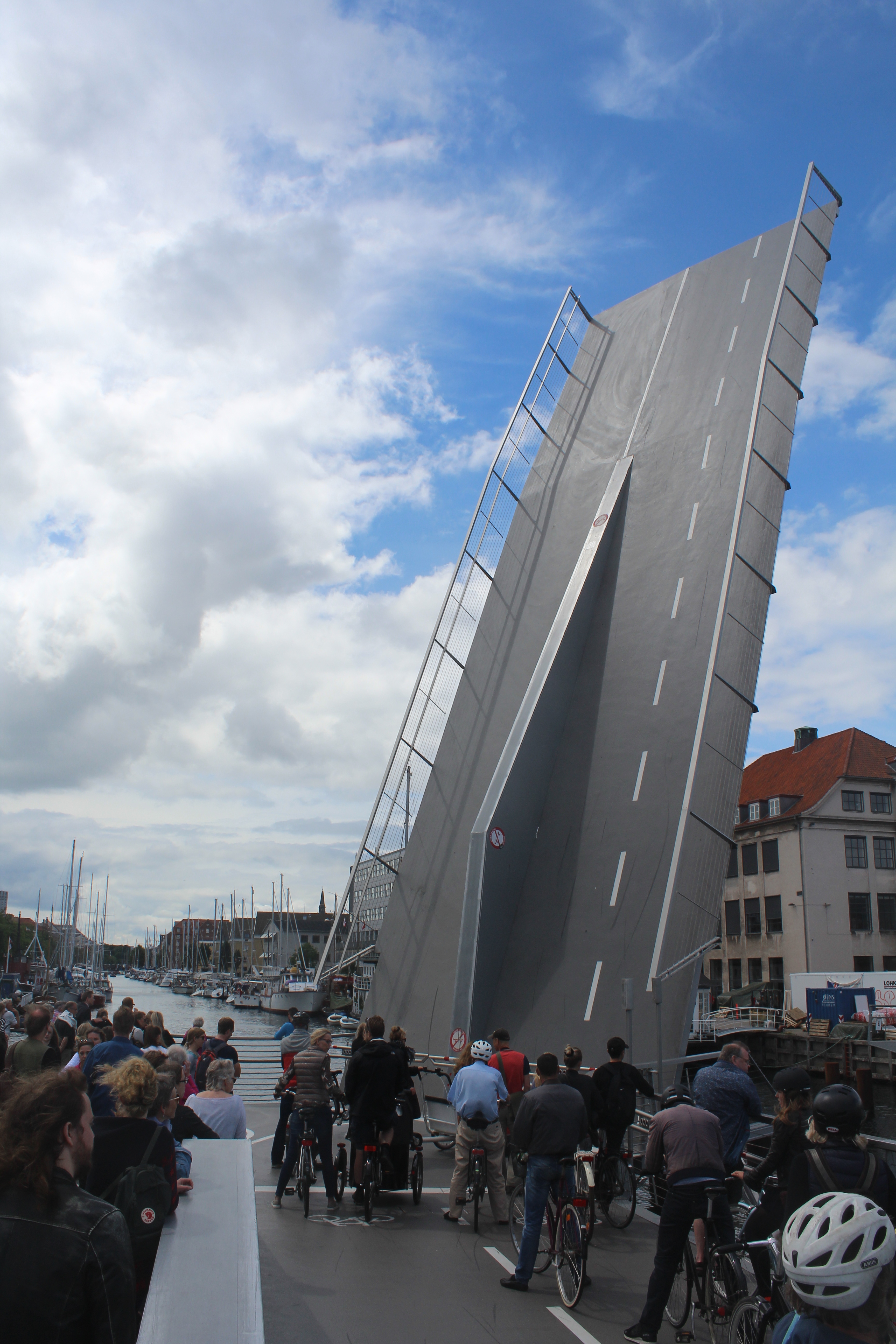
The new 180 m long walk- and bike bridge “Innerhavnsbroen” is constructed as a “glide bridge”: the two moving components each 24 m long slides to connect and disconnect from opposite of the foundations. It creates an open space of 15 meter width for passing of sailing- and motor boats.
This “Glide Bridge” is a new, unique and creative construction, which has been used here in Copenhagen for the first time in Europe:
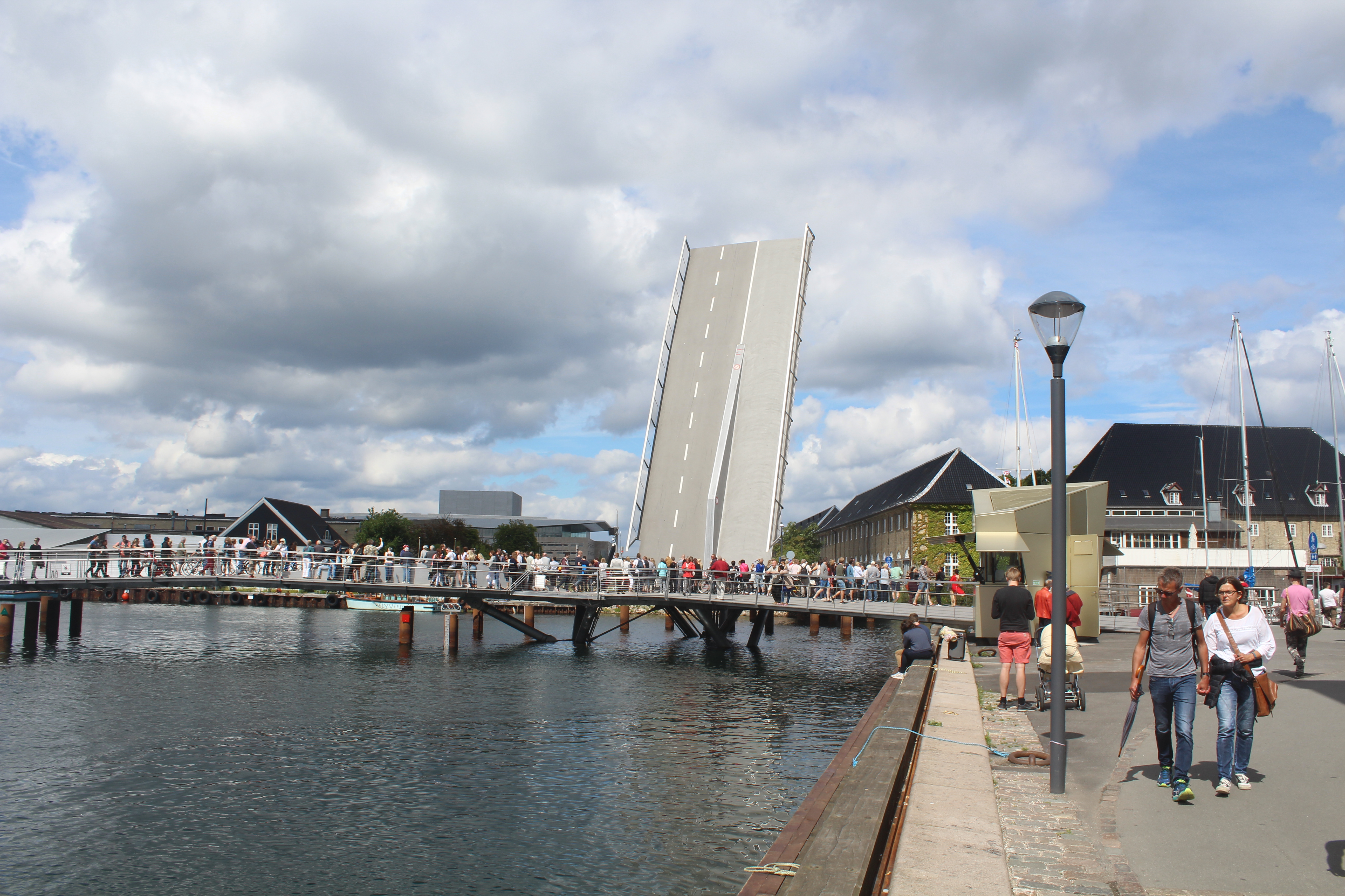
The 180 m long “glide bridge” Inderhavnsbroen” – seen in direction south to Christianshavn:
Click on photos and use your zoom control and you see them in full screen size.
ç
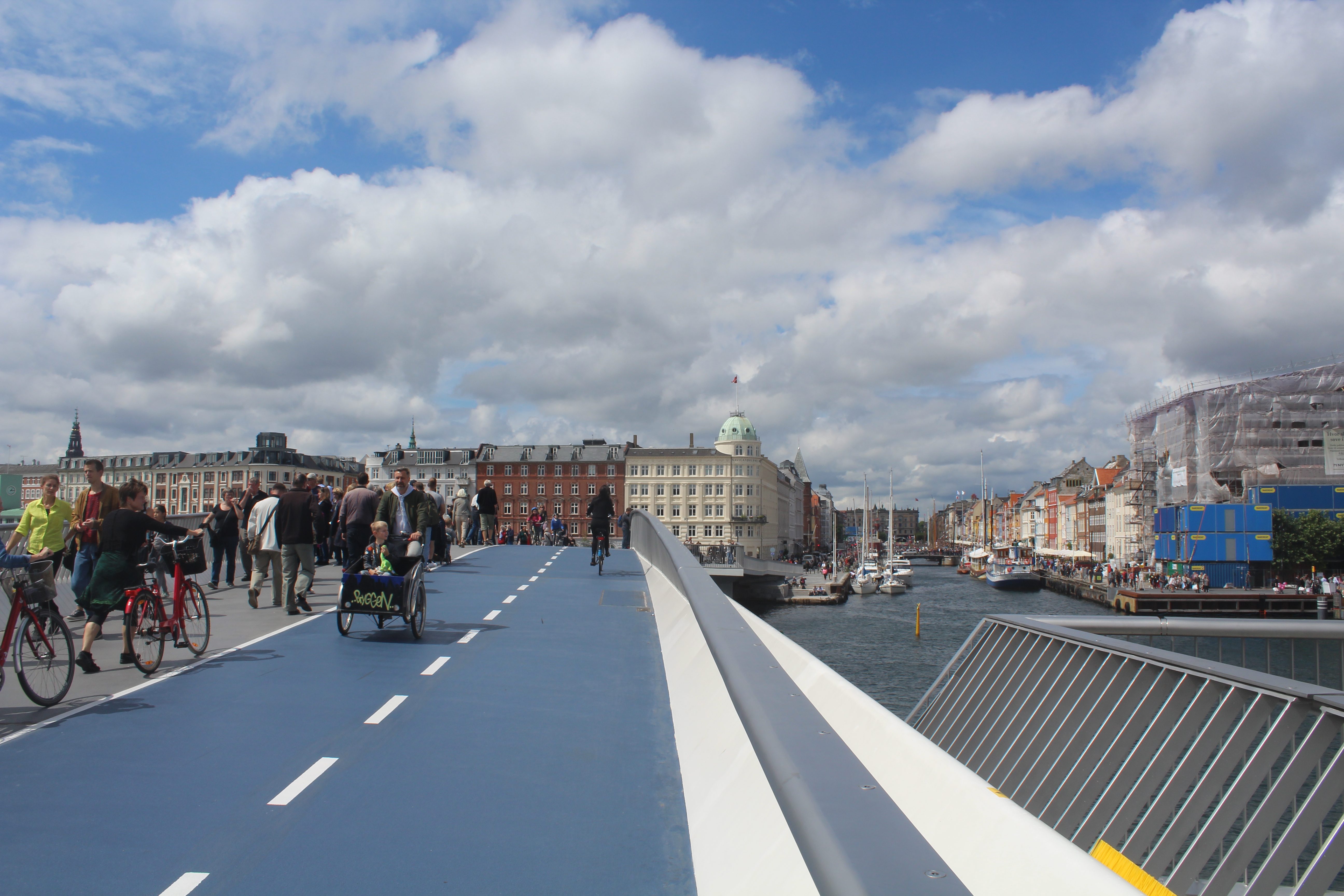
View from top of the 180 m long walk- and bike bridge “Inderhavnsbroen” in direction north to Nyhavn and Copenhagen City:
“Inderhavnsbroen” ´s nickname is KYSSEBROEN – The Kiss Bridge. (See explanation in text under photo).
Click on photos and use your zoom control and you see them in full screen size.
View from top of the 180 m long walk- and bike bridge “Inderhavnsbroen” in direction north to Nyhavn and Copenhagen City:
On photo below left you can see the two gliding constructions each 24 meter long fixed together in a kiss on top of Inderhavnsbroen.
The opening space for passing boats between the 2 stationary foundations on north- and south side of Copenhagen Inner Harbour is 15 meter width and the bridge is 5,40 meter above sea level (Frihøjde 5,40 m).
In middle of photo below you see the stationary foundations of Inderhavnsbroen on the Havnegade/Nyhavn side of Inner Copenhagen Harbour.
Click on photos and use your zoom control and you see them in full screen size.

View from top of the 180 m long walk- and bike bridge “Inderhavnsbroen” in direction east Copenhagen Inner Harbour :
View from top of walk-and bike bridge “Inderhavnsbroen” in direction east to Copenhagen Inner Harbour. At left New Copenhagen Theatre built 2005, Store houses built 1780 and A.P. Møller Maersk Domicile Building. At right island Papirøen with Experimentarium, Copenhagen Opera built 2002-2004, Naval Base Holmen built 1680-1935 with Gamle Dock built 1858 and Nyhavns Mastekran built by Philip de Lange 1749 and Museum Navy ship Peder Skram built 1965.
Click on photos and use your zoom control and you see them in full screen size.
View from top of the 180 m long walk- and bike bridge “Inderhavnsbroen” in direction east to north and south side of Copenhagen Inner Harbour and entrance of Copenhagen Harbour from Øresund:
(at right, south side) island Papirøen with Experimentarium, Copenhagen Opera built 2012-04 on island Dokøen, Naval Base Holmen built 1680-1935 on island Nyholm with museum navy ship Fregatten Peder Skram built 1965 and
at left (north side) Store Houses built 1780 and A. P. Møller Maersk Domicile Building:
Click on photos and use your zoom control and you see them in full screen size.
View from top of the 180 m long walk- and bike bridge “Inderhavnsbroen” in direction east Copenhagen Inner Harbour : Papirøen, Copenhagen Opera, Naval Base Holmen built 1680-1935 with museum navy ship Fregatten Peder Skram at right and at left Store Houses built 1780 and A. P. Møller Maersk Domicile Building:
Click on photos and use your zoom control and you see them in full screen size.
The same view from island Christiansholm on a sunny day 3. september 2014 (Copy from my article: ” Visit Copenhagen Inner Harbour, Christianshavn Canal and the places for construction of 3 walk- and bike bridges” on this home page Danculture.dk – Click on category HISTORIE and choose “Older Entries”):
View in direction east from island Christiansholm to The OPERA built 2002-04 by architect Henning Larsen (1925-2013) as a gift to the danish people from Maersk Mc-Kinney Moeller (1913-2012):

View in direction east from island Christiansholm to Royal Danish Opera on island “Dokøen”. Photo 3. september 2014 by Erik K Abrahamsen Copyright 2014 All rights reserved.
On top of walk-and bike bridge “Inderhavnsbroen”:
On left on photo the two gliding constructions each 24 meter long .
At right on photo the stationary foundation ends on top of bridge on platform to enjoy the magnificent views to Copenhagen Inner Harbour´s north and south side.
Click on photos and use your zoom control and you see them in full screen size.

On top of walk-and bike bridge “Inderhavnsbroen”:
Click on photos and use your zoom control and you see them in full screen size.

On top of walk-and bike bridge “Inderhavnsbroen”:
Click on photos and use your zoom control and you see them in full screen size.
View from top of the 180 m long walk- and bike bridge “Inderhavnsbroen” in direction south/west Copenhagen Inner Harbour:
Click on photos and use your zoom control and you see them in full screen size.

View from top of the 180 m long walk- and bike bridge “Inderhavnsbroen” in direction west Copenhagen Inner Harbour:
From left to right on photo below: South side of Copenhagen Inner Harbour, Christianshavn with resident- and storehouses (Eigtved Storehouse built 1750) and Ministery of Foreign affairs built 1980, Knippels Bridge built 1937, Exchange Building (Børsen) built 1618-22, The 106 meter high Tower (with a restaurant on top with a magnificent view all over Copenhagen) of the third Christiansborg Castle built 1906-28 with Danish Parliament (Folketinget), The Prime Minister´s Department and The Royal Apartments and north side: Havnegade of Copenhagen Inner Harbour.
Click on photos and use your zoom control and you see them in full screen size.

Exstra photo:
View from Knippels Bridge (Knippelsbro) in direction east to Copenhagen Inner Harbour with new walk-and bike bridge “Inderhavnsbroen” built 2011-16:
– a spectacular design of beauty, style and function:
My Photo from “Knippelsbro” in direction east to “Inderhavnsbroen” and Copenhagen Opera, monday 4. july 2016:
Click on photos and use your zoom and you see them in full screen size.
View from Knippels Bro in direction east to Inderhavnsbroen (The Inner Harbour Bridge in Copenhagen Harbour), Copenhagen Opera built 2002-04and at right Eigtved Store House built 1748-50. Photo the 4. july 2016 by Erik K Abrahamsen.
Exstra photo on 19. july 2016:
View from Nyhavn in direction south to new walk- and bike bridge “Inderhavnsbroen” passing Copenhagen Inner Harbour from Havnegade/Nyhavn to Christianshavn:
Click on photos and use your zoom control and you see them in full screen size.
Relaxed atmosphere on top of Inderhavnsbroen – view to new resident houses on Grønlandske Handels Plads:
Click on photos and use your zoom control and you see them in full screen size.
The 180 m long bike-and walk bridge “Inderhavnsbroen” at the Christianshavn side of the bridge. In middle of photo the moving “gliding area”and at right and left of photo the stationary foundations.
Photo in direction south to Christianshavn with walk- and bike bridge”Trangravsbroen” in background of photo:
Click on photos and use your zoom control and you see them in full screen size.
The 180 m long bike-and walk bridge “Inderhavnsbroen” at the Christianshavn side of the bridge to Grønlandske Handels Plads and the new walk-and bik bridge “Trangravsbroen”:
Click on photos and use your zoom control and you see them in full screen size.
The 180 m long bike-and walk bridge “Inderhavnsbroen” at the Christianshavn side of the bridge:
Click on photos and use your zoom control and you see them in full screen size.
View from Christianhavn side of new 180 m long bike- and walk bridge “Inderhavnsbroen”:
Click on photos and use your zoom control and you see them in full screen size.
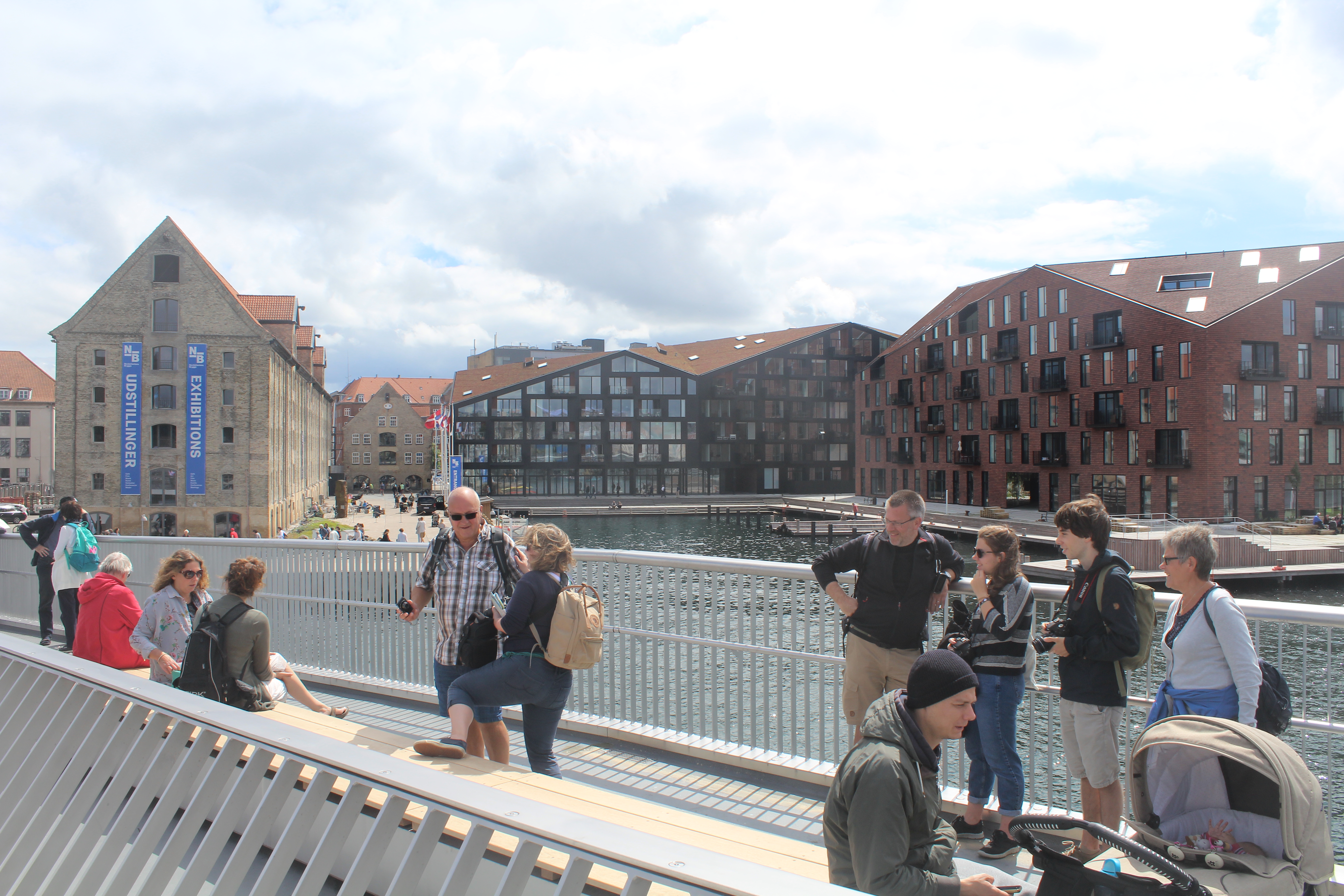
Model of Christianshavn, Holmen, Freetown Christiania and south side of a Copenhagen Inderhavn (Havneløbet):
Holmen was founded in open water area of Copenhagen Harbour by artificial constructions of 5 islands since 1680 until 1927 and served as Holmen Navy Base until 1989. Today Marine Station København on island Nyholm:
Nyholm, Frederiksholm, Arsenaløen, Dokøen and Christiansholm.
Model of Copenhagen Inner Harbour, Holmen, Christianshavn and Freetown Christiania with its 5 bastions, moats and ramparts constructed 1680 as Fortress Christianshavn as a integrated part of Fortress Copenhagen with its 24 bastions from 1642-80 and Kastellet built 1660-63:
In bottom of model: Christianshavn founded as a fortress 1616-20 with Grønlandske Handels Plads with Store House built 1765 (left), Christianshavn Canal and Resident buildings (middle) and at right Freetown Christiania founded 26. september 1971 with original 7 bastions of Copenhagen Fortress built 1680 with 24 bastions surrounding the old town of Copenhagen with main fortress “Kastellet” built 1660-63.
Middle of model: island Papirøen with Experimentarium and island Dokøen with Copenhagen Opera under construction 2002-04 and Old Dock with Pumphouse constructed 1858 with Holmen Shipyard built 1927 and in service until 1989 with original cranes from 1927 and 1935 (left), island Arsenaløen (middle) and island Frederiksholm,
Top of Model: Island Nyholm with Naval Base Holmen founded 1680 with Nyholm Mastekran built 1749 and museum navy ship Peder Skram built 1965:
Click on photos and use your zoom control and you see them in full screen size.

Model af Christianshavn, Holmen med Marinestation København ud til Københans Inderhavn og Fristaden Chrisiania. Foto: 28. september 2011 Erik K Abrahamsen. Model ca. 5 x 3 meter. Copyright 2012, All rights reserved.
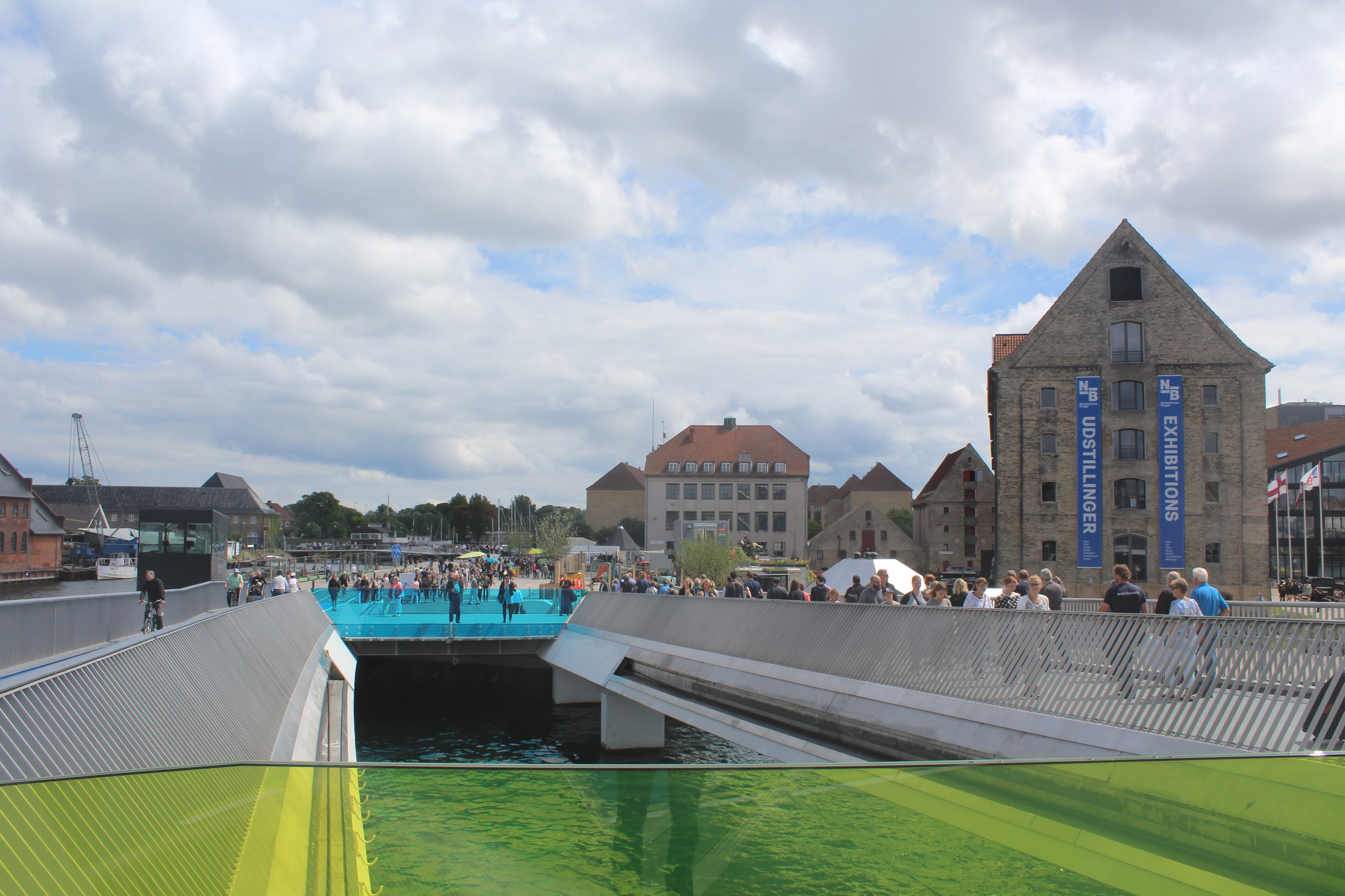
Grønlandske Handels Plads – Square of Greenland Trading – view to new walk- and bike bridge “Trangravsbroen” which connects Christianshavn and Island Arsenal øen:
Click on photos and use your zoom control and you see them in full screen size.

New walk- and bikebridge “Transgravsbroen” connects Grønlandske Handels Plads and Iceland Place on Christianshavn with Island Arsenaløen:
“Trangravsbroen” has 3 leafs:
one stationary from Iceland Place to center of bridge and the 2 other leafs can open up in the air and connects to Grønlandsk Handels Plads on Christianshavn and to Island Arsenaløen on Holmen.
Click on photos and use your zoom control and you see them in full screen size.
View from walk-and bike bridge “Trangravsbroen” in direction west to Christianshavns Canal:
Click on photos and use your zoom control and you see them in full screen size.
View from walk- and bike bridge “Trangravsbroen” to Grønlandske Handels Plads, Trangravs Kanal and new walk- and bike bridge “Inderhavnsbroen”:
Click on photos and use your zoom control and you see them in full screen size.

View in direction west to Christianshavn Canal from new walk- and bike brigade “Trangravsbroen”:
Click on photos and use your zoom control and you see them in full screen size.

View from walk-and bike bridge “Trangravsbroen” in direction north to new walk- and bike bridge “Inderhavnsbroen”, Nyhavn and Copenhagen City in background:
Click on photos and use your zoom control and you see them in full screen size.

Walk- and bike bridge Trangravsbroen – view in direction east to island Arsenaløen and Copenhagen Opera on island Dokøen:
Click on photos and use your zoom control and you see them in full screen size.

View from walk- and bike bridge “Trangravsbroen” to stationary leaf to island Iceland Place on Christianshavn:
Click on photos and use your zoom control and you see them in full screen size.

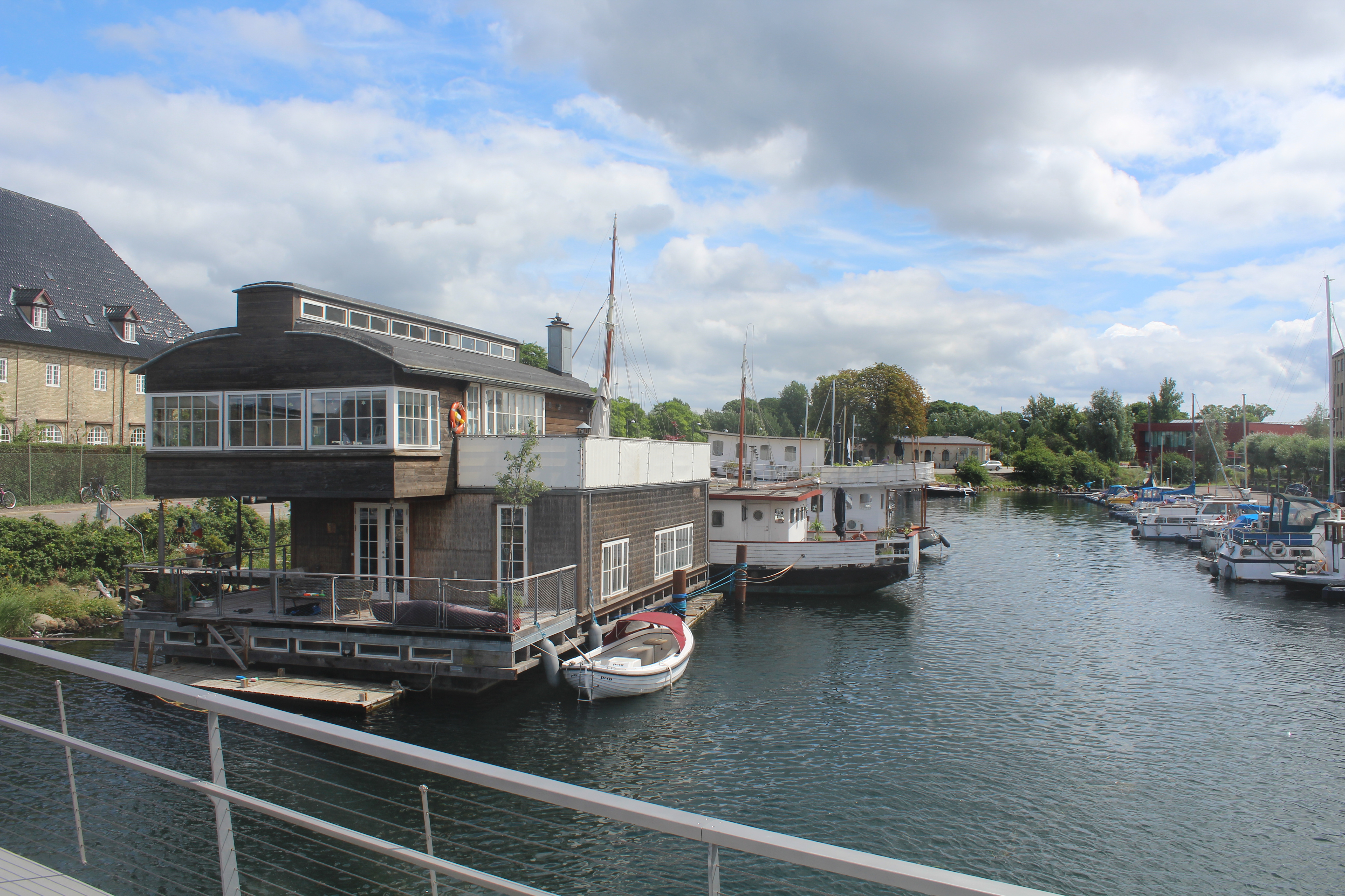
View from walk- and bike bridge “Trangravsbroen” to Trangravskanalen med house boats:
Houseboats in Trangravskanalen.
Click on photos and use your zoom control and you see them in full screen size.
“Proviantbroen”- walk-and bikebridge between the two islands Arsenaløen and Frederiksholm on Holmen.
View from island Arsenaløen in direction east to Copenhagen OPERA:
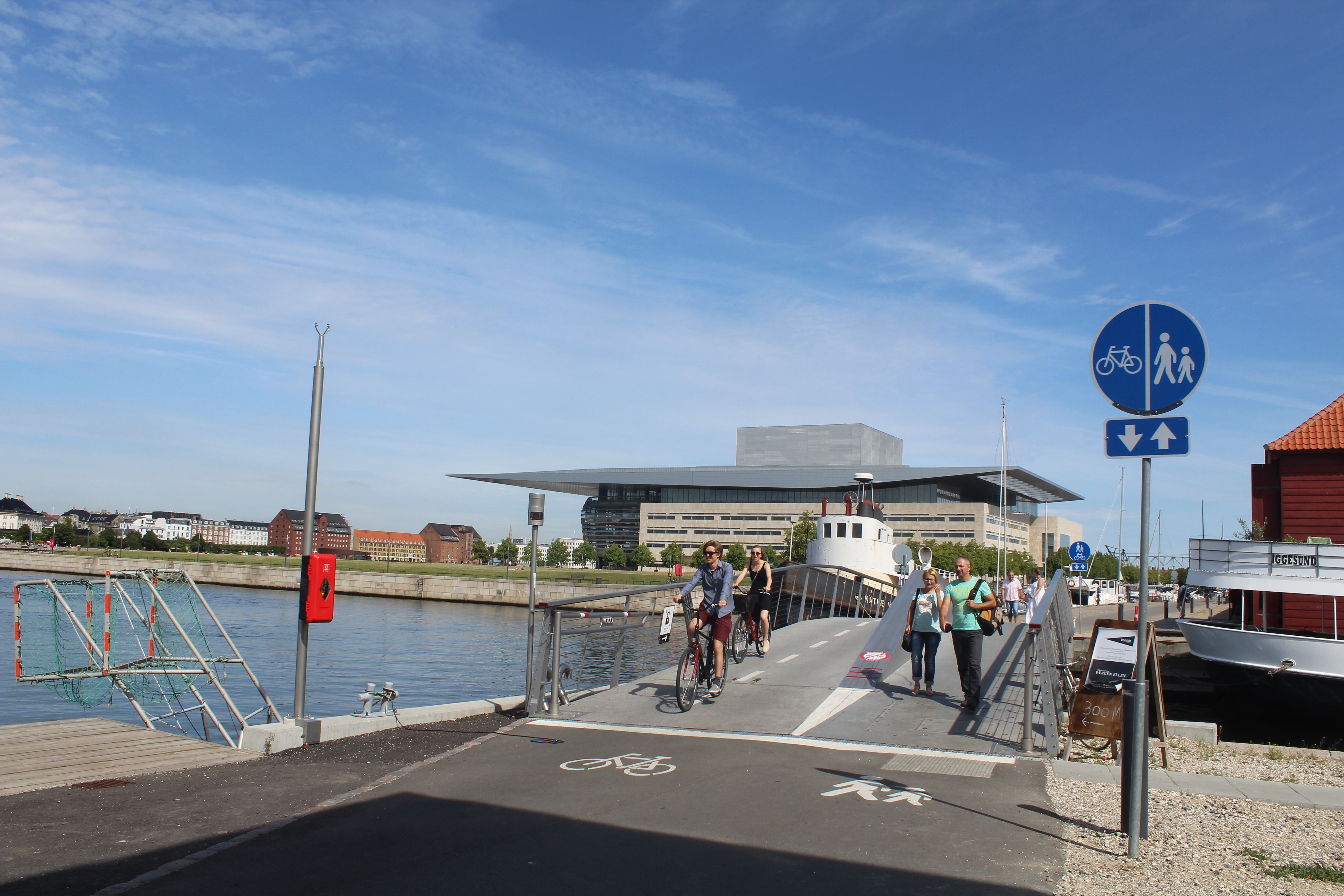
“Proviantbroen” between the islands Frederiksholm and Arsenaløen. Photo in direction to OPERA on island Dokøen. Photo september 2015 by Erik K Abrahamsen.
Walk- and bike bridge “Proviantbroen” with leaf open to air connects island Arsenaløen with island Frederiksholm on Holmen:
View to Amalienborg Castle built 1749-54 on north side of Copenhagen Inner Harbour.
Click on photos and use your zoom control and you see them in full screen size.
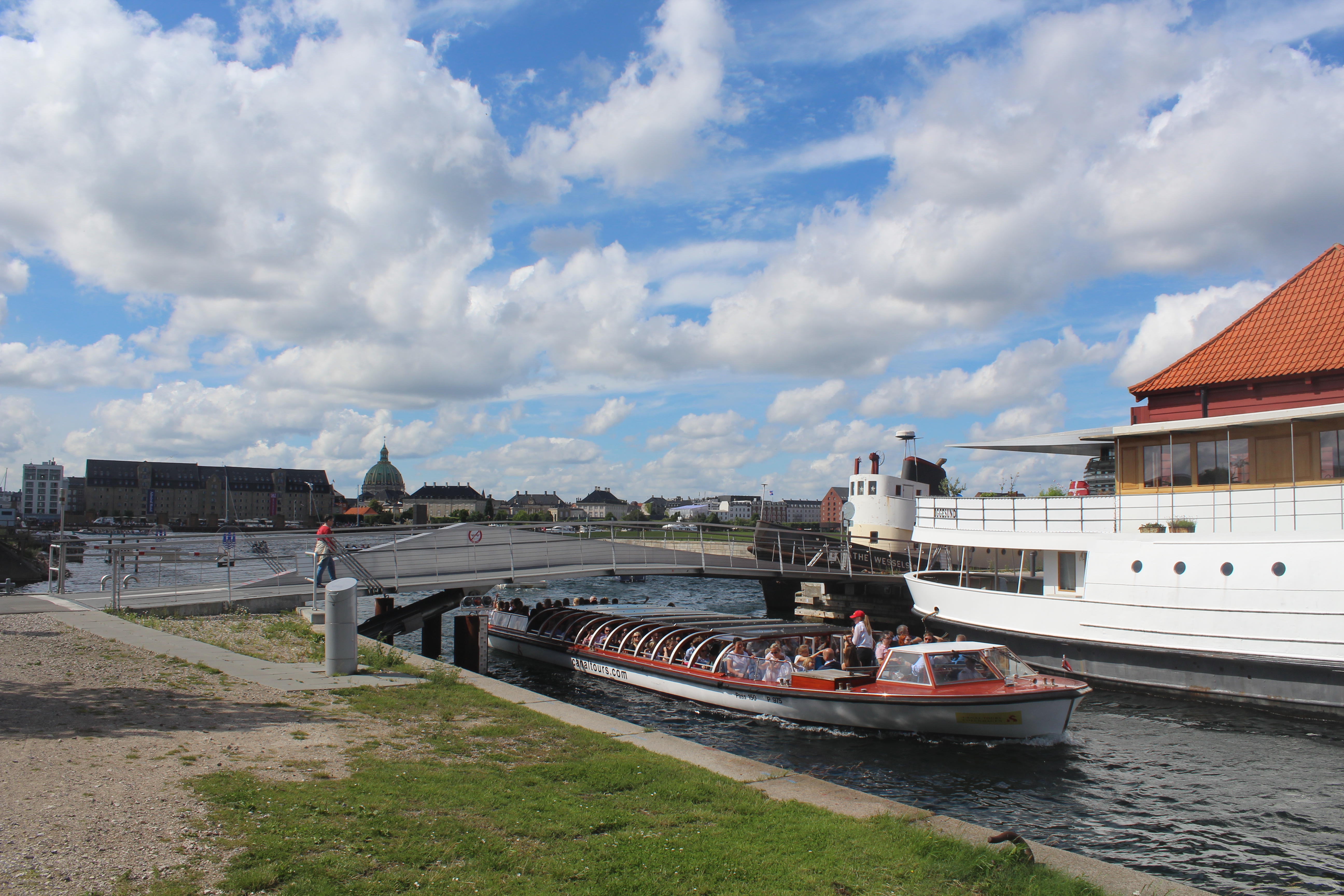
I finish my article with this photo – passage of a sailing boat through walk-and bike bridge “Trangravsbroen” from Christianshavn Canal to Trangraven Canal:
Click on photos and use your zoom control and you see them in full screen size.

“Trangravsbroen” ´s leaf is open for passage of sailing boat and people waits on both side of the bridge:
Click on photos and use your zoom control and you see them in full screen size.
So many happy people celebrated the opening of all 3 new walk-and bike bridges in Copenhagen Inner Harbour – today the 9. july 2016 the third opening day:
Click on photos and use your zoom control and you see them in full screen size.

What a gift to all danes and foreign visitors to Copenhagen!
Congratulations!
Thanks for all 3 new walk- and bike bridges: Inderhavnsbroen, Trangravsbroen and Proviantbroen.
It was worth waiting 3 delays years for a perfect finish of a VERY difficult and complex construction (Glide Bridge) of this splendid walk- and bike bridge – its beauty, its elegance and its sustainability!
Links: havneringen.dk , also in an english version.
On my homepage Danculture.dk I have written 2 articles about the above 3 walk-and bike bridges in Copenhagen Inner Harbour:
Copenhagen autumn 2015 – visit Nyhavn Canal and Inner Harbour with 3 new walk-and bike bridges
Visit Copenhagen Inner Harbour, Christianshavn Canal and the places for construction of 3 walk- and bike bridges
In 2015 three walk- and bike bridges will connect Copenhagen Inner Harbour, Nyhavn and Copenhagen City with Christianshavn, Holmen with its Opera, Film- Music-, Theatre- and Architecture Schools, Naval Base Copenhagen and residental and business areas.
I 2015 vil 3 gang- og cykelbroer forbinde Københavns Inderhavn, Nyhavn og København City med Christianshavn, Holmens Opera med Film-, Teater-, Musik- og Arkitektskolen, Marinestation København samt boliger og forretninger.
Text og photo’s Erik K Abrahamsen.
and
Bike lanes in Copenhagen Inner Harbour – The Bicycle Snake: safe, fast and clean
2 cykel baner i Københavns Inderhavn:
– cykel- og gangbro “Bryggebro” og cykelbro “Cykelslangen”: sikker, hurtig og ren forbindelse mellem Vesterbro og Islands Brygge på Amager.
In october 2012 I wrote this article on my second homepage Erik K Abrahamsen Blog tvndk.wordpress.com :
3 nye gang- og cykelbroer binder Christianshavn sammen med Nyhavn og Holmen
oktober 12, 2012
and this article on my homepage tvndk.wordpress.com from 22. october 2014:
3 new walk- and bikebridges in Copenhagen Inner Harbour connects Nyhavn, Holmen and Christianshavn.
3 broklapper monteret på 2 nye cykel- og gangbroer i Københavns Inderhavn mellem Nyhavn og Christianshavn
3 leafs of bridges assembled on 2 new bike- and walk bridges i Copenhagen Inner Harbour between Nyhavn and Christianshavn.
Lidt faktuelle oplysninger – copy from my article of 12. october 2012 on my homepage Erik K Abrahamsen Blog:
3 nye gang- og cykelbroer binder Christianshavn sammen med Nyhavn og Holmen
Inderhavnsbroen, længde 180 m fra Nyhavn til Nordatlantens Brygge (Grønlandske Handels Plads) på Christianshavn:
Arkitekt: Studio Bednarski Limited
Ingeniører: Flint & Neill Limited,
Hardesty & Hanover International LLC,
COWI
Trangravsbroen og Proviantbroen:
SIDSTE, marts 2014:
Entreprenøren E. Pihl & Søn gik konkurs august 2013. Det betyder, at færdiggørelsen af alle 3 broer er forsinket på ubestemt tid. Det er Københavns Kommune som har ansvaret for færdiggørelse af alle 3 broer og kommunen er pt i forhandlinger med entreprenører, som har nødvendig kompetence til at færdiggøre de 3 relativt komplicerede klap- og skydebroer.
Allersidste, september 2014:
København Kommune har indgået kontrakter med 2 entrepenørfimaer omkring færdiggørelse af Inderhavnsbroen, Trangravsbroen og Proviantbroen. Alle 3 gang- og cykelbroer er planlagt færdigbyggede i begyndelsen af 2015.
Copy finish.
Enjoy life- be happy!
Photo and text Copyright Erik K Abrahamsen 2016
All rights reserved
Melby, North Sealand, Denmark the 9. july 2016
Best greetings
Erik